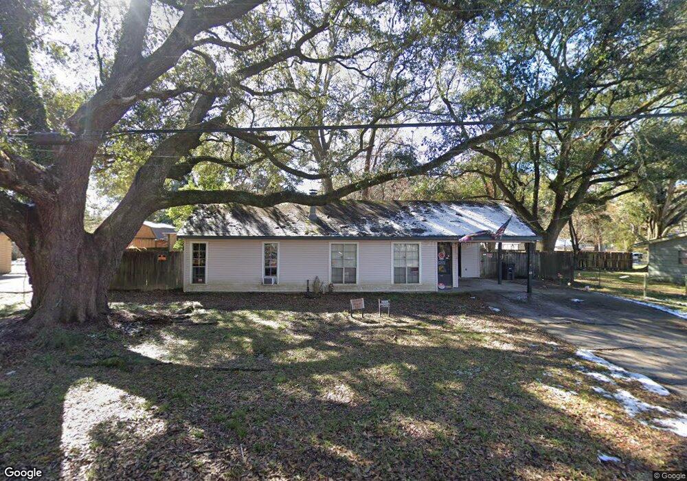
5344 Devore Dr Baton Rouge, LA 70811
Scotlandville NeighborhoodEstimated Value: $96,442 - $159,000
Studio
--
Bath
1,284
Sq Ft
$105/Sq Ft
Est. Value
About This Home
This home is located at 5344 Devore Dr, Baton Rouge, LA 70811 and is currently estimated at $135,111, approximately $105 per square foot. 5344 Devore Dr is a home located in East Baton Rouge Parish with nearby schools including Brownfields Elementary School, Scotlandville Magnet High School, and Impact Charter School.
Ownership History
Date
Name
Owned For
Owner Type
Purchase Details
Closed on
Nov 9, 2018
Sold by
Goudeau Taylor Darlene
Bought by
Goudeau Diane K
Current Estimated Value
Home Financials for this Owner
Home Financials are based on the most recent Mortgage that was taken out on this home.
Original Mortgage
$70,500
Outstanding Balance
$61,864
Interest Rate
4.7%
Mortgage Type
New Conventional
Estimated Equity
$73,247
Create a Home Valuation Report for This Property
The Home Valuation Report is an in-depth analysis detailing your home's value as well as a comparison with similar homes in the area
Home Values in the Area
Average Home Value in this Area
Purchase History
| Date | Buyer | Sale Price | Title Company |
|---|---|---|---|
| Goudeau Diane K | $7,500 | Leader Title Company |
Source: Public Records
Mortgage History
| Date | Status | Borrower | Loan Amount |
|---|---|---|---|
| Open | Goudeau Diane K | $70,500 |
Source: Public Records
Tax History
| Year | Tax Paid | Tax Assessment Tax Assessment Total Assessment is a certain percentage of the fair market value that is determined by local assessors to be the total taxable value of land and additions on the property. | Land | Improvement |
|---|---|---|---|---|
| 2024 | $32 | $4,790 | $660 | $4,130 |
| 2023 | $32 | $4,790 | $660 | $4,130 |
| 2022 | $669 | $4,790 | $660 | $4,130 |
| 2021 | $659 | $4,790 | $660 | $4,130 |
| 2020 | $666 | $4,790 | $660 | $4,130 |
| 2019 | $628 | $4,350 | $600 | $3,750 |
| 2018 | $622 | $4,350 | $600 | $3,750 |
| 2017 | $622 | $4,350 | $600 | $3,750 |
| 2016 | $32 | $4,350 | $600 | $3,750 |
Source: Public Records
Map
Nearby Homes
- 11747 Troy St
- 11685 Troy St
- 11502 Nimitz St
- 5029 Clark St
- 12265 Plank Rd
- 4633 Clark St
- 11225 Plank Rd
- 5715 Guice Dr
- 5656 Guice Dr
- 11544 Ellen Dr
- 11395 Granberry Dr
- 11444 Saint Lawrence Dr
- 6466 Celia Ave
- 5440 Gallantry Ct
- 12744 Middlewood Dr
- 6525 Brownfields Dr
- 11325 Cypress Dale Ave
- 13261 Plank Rd
- 11130 Cypress Dale Ave
- 13311 Plank Rd