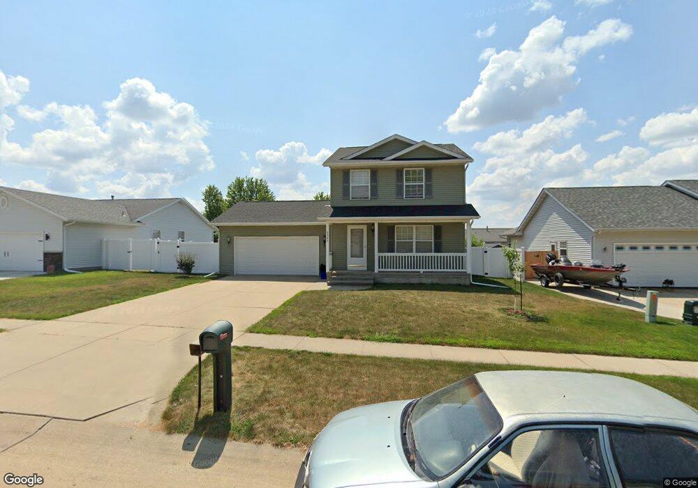
5345 21st Ave Marion, IA 52302
Estimated Value: $281,044 - $318,000
4
Beds
4
Baths
1,424
Sq Ft
$211/Sq Ft
Est. Value
About This Home
This home is located at 5345 21st Ave, Marion, IA 52302 and is currently estimated at $300,511, approximately $211 per square foot. 5345 21st Ave is a home located in Linn County with nearby schools including Linn Grove Elementary School, Excelsior Middle School, and Linn-Mar High School.
Ownership History
Date
Name
Owned For
Owner Type
Purchase Details
Closed on
Feb 28, 1999
Sold by
Mcguire Construction Inc
Bought by
Brodrecht James L and Brodrecht Christine A
Current Estimated Value
Home Financials for this Owner
Home Financials are based on the most recent Mortgage that was taken out on this home.
Original Mortgage
$64,430
Outstanding Balance
$15,700
Interest Rate
6.83%
Estimated Equity
$284,811
Create a Home Valuation Report for This Property
The Home Valuation Report is an in-depth analysis detailing your home's value as well as a comparison with similar homes in the area
Home Values in the Area
Average Home Value in this Area
Purchase History
| Date | Buyer | Sale Price | Title Company |
|---|---|---|---|
| Brodrecht James L | $130,500 | -- |
Source: Public Records
Mortgage History
| Date | Status | Borrower | Loan Amount |
|---|---|---|---|
| Open | Brodrecht James L | $64,430 |
Source: Public Records
Tax History Compared to Growth
Tax History
| Year | Tax Paid | Tax Assessment Tax Assessment Total Assessment is a certain percentage of the fair market value that is determined by local assessors to be the total taxable value of land and additions on the property. | Land | Improvement |
|---|---|---|---|---|
| 2025 | $4,608 | $228,200 | $27,300 | $200,900 |
| 2024 | $4,340 | $255,500 | $27,300 | $228,200 |
| 2023 | $4,340 | $255,500 | $27,300 | $228,200 |
| 2022 | $3,762 | $204,500 | $27,300 | $177,200 |
| 2021 | $3,890 | $186,800 | $27,300 | $159,500 |
| 2020 | $3,890 | $181,200 | $27,300 | $153,900 |
| 2019 | $3,660 | $170,800 | $30,700 | $140,100 |
| 2018 | $3,514 | $170,800 | $30,700 | $140,100 |
| 2017 | $3,414 | $163,300 | $30,700 | $132,600 |
| 2016 | $3,414 | $158,200 | $25,600 | $132,600 |
| 2015 | $3,401 | $158,200 | $25,600 | $132,600 |
| 2014 | $3,214 | $158,200 | $25,600 | $132,600 |
| 2013 | $3,066 | $158,200 | $25,600 | $132,600 |
Source: Public Records
Map
Nearby Homes
- 2200 50th St
- 2054 Shortgrass Place
- 2176 49th St Unit 2176
- 1935 48th Street Ct
- 4663 Pintail Ct Unit 4663
- 5865 Robinwood Ln
- 1570 50th St Unit 1570
- 4681 Vasey Ave
- 2605 Greenway Ct Unit 2605
- 1510 50th St Unit 1510
- 4903 Foxtail Ct
- 4390 Mcgowan Blvd
- 4315 Snowgoose Dr
- 0 Robinwood Ln
- 2370 Spoonbill Dr
- 6279 Glenwood Dr
- 6166 Cope Dr
- 6177 Glenwood Dr
- 6188 Cope Dr
- 4501 Surrey Ct