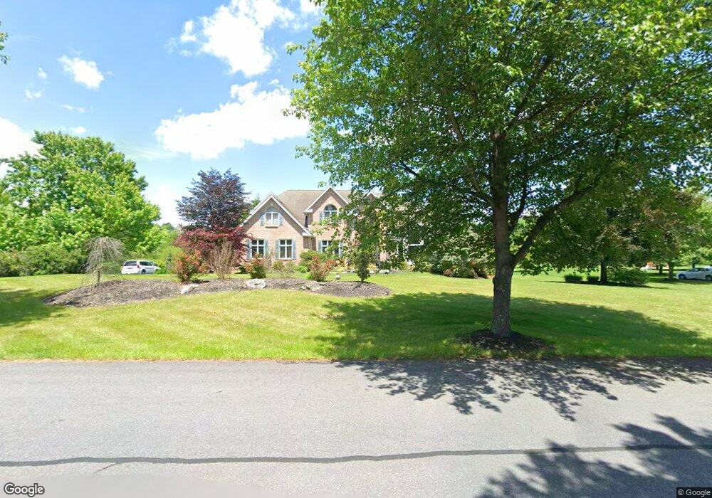
5349 Millstone Ct Orefield, PA 18069
Estimated Value: $806,000 - $1,036,000
4
Beds
4
Baths
4,367
Sq Ft
$207/Sq Ft
Est. Value
About This Home
This home is located at 5349 Millstone Ct, Orefield, PA 18069 and is currently estimated at $906,080, approximately $207 per square foot. 5349 Millstone Ct is a home located in Lehigh County with nearby schools including Parkland Kernsville Elementary School, Orefield Middle School, and Parkland High School.
Ownership History
Date
Name
Owned For
Owner Type
Purchase Details
Closed on
Nov 11, 1996
Sold by
Jaindl Fred J & Jaindl Land Co
Bought by
Gingras Steven R and Gingras Cynthia M
Current Estimated Value
Purchase Details
Closed on
Dec 7, 1984
Bought by
Jaindl Fred J & Jaindl Land Co
Create a Home Valuation Report for This Property
The Home Valuation Report is an in-depth analysis detailing your home's value as well as a comparison with similar homes in the area
Home Values in the Area
Average Home Value in this Area
Purchase History
| Date | Buyer | Sale Price | Title Company |
|---|---|---|---|
| Gingras Steven R | $65,000 | -- | |
| Jaindl Fred J & Jaindl Land Co | $548,600 | -- |
Source: Public Records
Tax History
| Year | Tax Paid | Tax Assessment Tax Assessment Total Assessment is a certain percentage of the fair market value that is determined by local assessors to be the total taxable value of land and additions on the property. | Land | Improvement |
|---|---|---|---|---|
| 2026 | $12,293 | $537,300 | $76,800 | $460,500 |
| 2025 | $11,928 | $537,300 | $76,800 | $460,500 |
| 2024 | $11,219 | $537,300 | $76,800 | $460,500 |
| 2023 | $10,896 | $537,300 | $76,800 | $460,500 |
| 2022 | $10,848 | $537,300 | $460,500 | $76,800 |
| 2021 | $10,848 | $537,300 | $76,800 | $460,500 |
| 2020 | $10,848 | $537,300 | $76,800 | $460,500 |
| 2019 | $10,563 | $537,300 | $76,800 | $460,500 |
| 2018 | $10,354 | $537,300 | $76,800 | $460,500 |
| 2017 | $10,203 | $537,300 | $76,800 | $460,500 |
| 2016 | -- | $537,300 | $76,800 | $460,500 |
| 2015 | -- | $537,300 | $76,800 | $460,500 |
| 2014 | -- | $537,300 | $76,800 | $460,500 |
Source: Public Records
Map
Nearby Homes
- 2695 Apple Valley Estates Dr
- 2739 Apple Valley Cir
- 5934 Kernsville Rd
- 4403 Wolfs Crossing Rd
- 3267 2nd Ave
- 4361 Wolfs Crossing Rd
- 2786 Stadium Dr
- 3465 Wolf Pack Dr Unit 162
- 3486 Lil Wolf Dr
- 3620 Lil Wolf Cir
- 4828 Huckleberry Rd
- 6688 Haasadahl Rd
- 4377 Astor Dr
- 6726 Ryan Ct
- 2010 Hickory Ln
- 2507 Rachael Ln
- 3955 Coplay Creek Rd
- 4131 Orefield Rd
- 1724 Park Ln
- 1834 Majestic Dr
- 5357 Millstone Ct
- 5341 Millstone Ct
- 3062 Jordan Rd
- 5348 Millstone Ct
- 3058 Jordan Rd
- 5365 Millstone Ct
- 5340 Millstone Ct
- 5356 Millstone Ct
- 5333 Millstone Ct
- 5336 Millstone Ct
- 5325 Millstone Ct
- 3059 Jordan Rd
- 5332 Millstone Ct
- 3067 Jordan Rd
- 5525 Kernsville Rd
- 5324 Millstone Ct
- 3075 Jordan Rd
- 5297 Creekview Dr
- 3045 Jordan Rd
- 3081 Jordan Rd
Your Personal Tour Guide
Ask me questions while you tour the home.