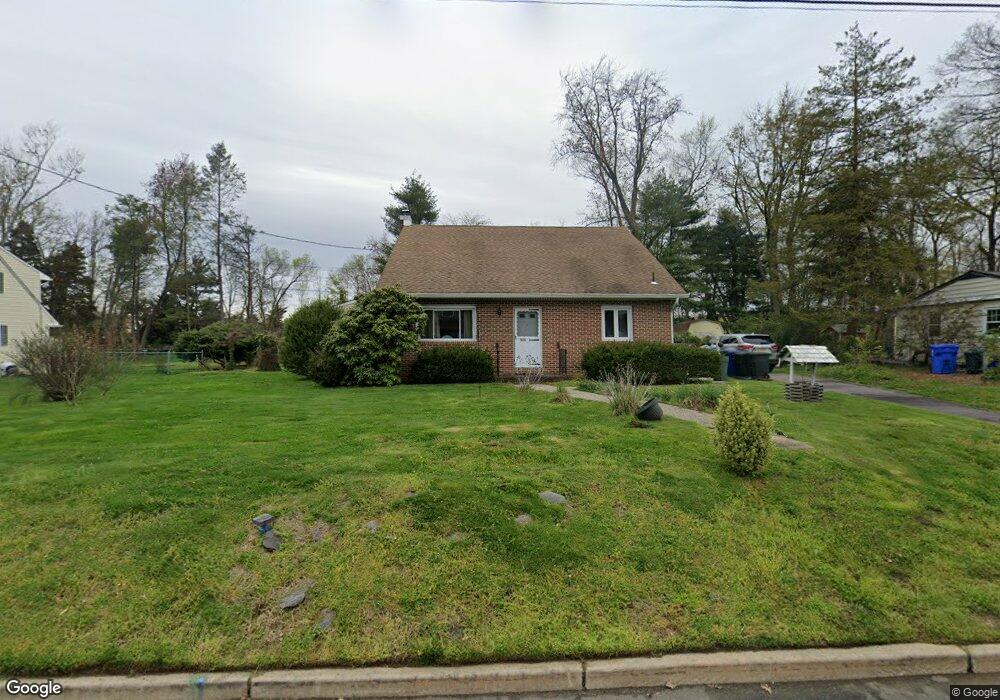
535 Devon Rd Moorestown, NJ 08057
Estimated Value: $572,789 - $621,000
Studio
--
Bath
2,108
Sq Ft
$280/Sq Ft
Est. Value
About This Home
This home is located at 535 Devon Rd, Moorestown, NJ 08057 and is currently estimated at $589,447, approximately $279 per square foot. 535 Devon Rd is a home located in Burlington County with nearby schools including George C. Baker Elementary School, Moorestown Upper Elementary School, and William Allen Middle School.
Ownership History
Date
Name
Owned For
Owner Type
Purchase Details
Closed on
Mar 31, 2006
Sold by
Duffner Frances R
Bought by
Norton Kenneth L and Norton Audrey
Current Estimated Value
Home Financials for this Owner
Home Financials are based on the most recent Mortgage that was taken out on this home.
Original Mortgage
$210,000
Outstanding Balance
$120,122
Interest Rate
6.28%
Mortgage Type
Fannie Mae Freddie Mac
Estimated Equity
$469,325
Purchase Details
Closed on
Sep 21, 1999
Sold by
Duffner William W and Duffner Frances R
Bought by
Duffner Frances R
Create a Home Valuation Report for This Property
The Home Valuation Report is an in-depth analysis detailing your home's value as well as a comparison with similar homes in the area
Home Values in the Area
Average Home Value in this Area
Purchase History
| Date | Buyer | Sale Price | Title Company |
|---|---|---|---|
| Norton Kenneth L | $350,000 | Infinity Title Agency Inc | |
| Duffner Frances R | -- | -- |
Source: Public Records
Mortgage History
| Date | Status | Borrower | Loan Amount |
|---|---|---|---|
| Open | Norton Kenneth L | $210,000 |
Source: Public Records
Tax History
| Year | Tax Paid | Tax Assessment Tax Assessment Total Assessment is a certain percentage of the fair market value that is determined by local assessors to be the total taxable value of land and additions on the property. | Land | Improvement |
|---|---|---|---|---|
| 2025 | $7,251 | $255,600 | $127,400 | $128,200 |
| 2024 | $7,032 | $255,600 | $127,400 | $128,200 |
| 2023 | $7,032 | $255,600 | $127,400 | $128,200 |
| 2022 | $6,960 | $255,600 | $127,400 | $128,200 |
| 2021 | $6,868 | $255,600 | $127,400 | $128,200 |
| 2020 | $6,825 | $255,600 | $127,400 | $128,200 |
| 2019 | $6,704 | $255,600 | $127,400 | $128,200 |
| 2018 | $6,523 | $255,600 | $127,400 | $128,200 |
| 2017 | $6,329 | $255,600 | $127,400 | $128,200 |
| 2016 | $6,306 | $255,600 | $127,400 | $128,200 |
| 2015 | $6,227 | $255,600 | $127,400 | $128,200 |
| 2014 | $5,900 | $255,600 | $127,400 | $128,200 |
Source: Public Records
Map
Nearby Homes
- 401 W 3rd St
- 307 Fairview Ave
- 206 E Camden Ave
- 543 Bethel Ave
- 601 Stratford Dr
- 444 Shady Ln
- 93 Westbrook Dr
- 705 Iron Post Rd
- 9 N Lenola Rd
- 21 N Lenola Rd
- 11 Errickson Ave
- 126 S Lenola Rd
- 242 Center St
- 15 W Close Unit 15
- 10 E Close Unit 10EAST
- 11 W Spruce Ave
- 129 S Church St
- 8 S Close Unit 8
- 106 Pine St
- 611 New Albany Rd
- 541 Devon Rd
- 519 Devon Rd
- 555 Devon Rd
- 518 Devon Rd
- 517 Devon Rd
- 311 N Colonial Ridge
- 516 Devon Rd
- 599 Devon Rd
- 310 N Colonial Ridge
- 515 Devon Rd
- 514 Devon Rd
- 601 Devon Rd
- 513 Devon Rd
- 535 Covington Terrace
- 301 N Colonial Ridge
- 512 Devon Rd
- 603 Devon Rd
- 602 Devon Rd
- 300 N Colonial Ridge
- 511 Devon Rd
Your Personal Tour Guide
Ask me questions while you tour the home.