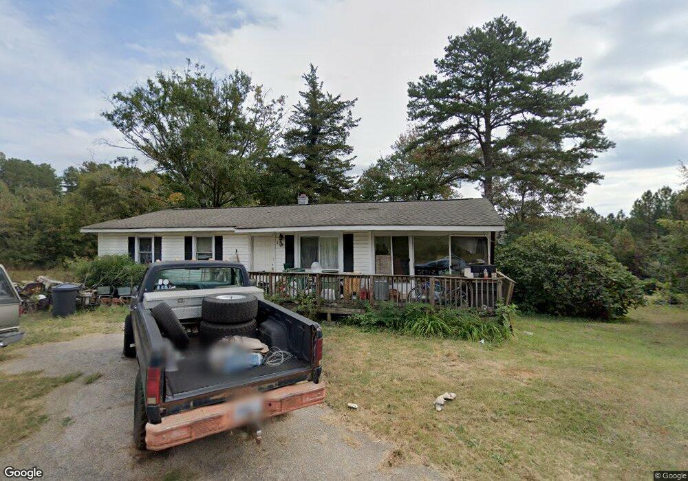
535 Earle St Unit PRICE REDUCED!!! West Union, SC 29696
Estimated Value: $134,000 - $276,000
3
Beds
1
Bath
1,000
Sq Ft
$201/Sq Ft
Est. Value
About This Home
This home is located at 535 Earle St Unit PRICE REDUCED!!!, West Union, SC 29696 and is currently estimated at $200,950, approximately $200 per square foot. 535 Earle St Unit PRICE REDUCED!!! is a home located in Oconee County with nearby schools including James M. Brown Elementary School, Walhalla Middle School, and Walhalla High School.
Ownership History
Date
Name
Owned For
Owner Type
Purchase Details
Closed on
Jan 4, 2010
Sold by
Price Billy and Price Suzanne
Bought by
Sanders Argus F and Sanders Catherine S
Current Estimated Value
Home Financials for this Owner
Home Financials are based on the most recent Mortgage that was taken out on this home.
Original Mortgage
$106,122
Outstanding Balance
$68,151
Interest Rate
4.68%
Mortgage Type
Unknown
Estimated Equity
$132,799
Create a Home Valuation Report for This Property
The Home Valuation Report is an in-depth analysis detailing your home's value as well as a comparison with similar homes in the area
Home Values in the Area
Average Home Value in this Area
Purchase History
| Date | Buyer | Sale Price | Title Company |
|---|---|---|---|
| Sanders Argus F | $104,000 | -- |
Source: Public Records
Mortgage History
| Date | Status | Borrower | Loan Amount |
|---|---|---|---|
| Open | Sanders Argus F | $106,122 |
Source: Public Records
Tax History Compared to Growth
Tax History
| Year | Tax Paid | Tax Assessment Tax Assessment Total Assessment is a certain percentage of the fair market value that is determined by local assessors to be the total taxable value of land and additions on the property. | Land | Improvement |
|---|---|---|---|---|
| 2025 | $85 | $2,808 | $709 | $2,099 |
| 2024 | $85 | $2,808 | $709 | $2,099 |
| 2023 | $86 | $2,808 | $709 | $2,099 |
| 2022 | $86 | $2,808 | $709 | $2,099 |
| 2021 | $91 | $2,585 | $598 | $1,987 |
| 2020 | $66 | $2,585 | $598 | $1,987 |
| 2019 | $66 | $0 | $0 | $0 |
| 2018 | $575 | $0 | $0 | $0 |
| 2017 | $91 | $0 | $0 | $0 |
| 2016 | $91 | $0 | $0 | $0 |
| 2015 | -- | $0 | $0 | $0 |
| 2014 | -- | $2,870 | $898 | $1,972 |
| 2013 | -- | $0 | $0 | $0 |
Source: Public Records
Map
Nearby Homes
- 117 Edney Dr
- 2539 Blue Ridge Blvd
- 00 Branch St
- 208 Branch St
- 000 Anderson St
- 00 Keowee St
- 320 Jaynes St
- 00 S Spring St
- 2423 Westminster Hwy
- 204 Friendship Dr
- 209 Moore Ave
- 1198 Anderson St
- 213 Castlebrook Dr
- 217 Castlebrook Dr
- 115 Burns Mill Rd
- 412 N Spring St
- 2054 Westminster Hwy
- 301 Shadybrook Dr Unit B
- 606 W South Broad St
- 711 Campbell Town Rd
- Lot Earle St
- 00 Earle St
- 615 Earle St
- 516 Earle St
- 614 Earle St
- 519 Earle St
- 527 Earle St
- 512 Earle St
- 712 E South Boundary St
- 621 Earle St
- 508 Earle St
- 632 Earle St
- 140 Davis Hill Rd
- 150 Sunflower Dr
- 705 E South Boundary St
- 701 E South Boundary St
- 702 E South Boundary St
- 630 Earle St
- 331 Thrasher Rd
- 134 Davis Hill Rd