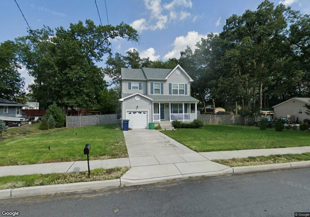
535 Route 50 Mays Landing, NJ 08330
Estimated Value: $240,258 - $371,000
--
Bed
--
Bath
--
Sq Ft
10,759
Sq Ft Lot
About This Home
This home is located at 535 Route 50, Mays Landing, NJ 08330 and is currently estimated at $310,419. 535 Route 50 is a home located in Atlantic County with nearby schools including Joseph Shaner School, George L. Hess Educational Complex, and William Davies Middle School.
Ownership History
Date
Name
Owned For
Owner Type
Purchase Details
Closed on
Jun 2, 2015
Sold by
Keefe David W
Bought by
Nicholson Roger
Current Estimated Value
Purchase Details
Closed on
Jun 29, 2004
Sold by
Wielandt Christina G and Benson Carol A
Bought by
Keefe David W
Home Financials for this Owner
Home Financials are based on the most recent Mortgage that was taken out on this home.
Original Mortgage
$142,500
Interest Rate
6.25%
Mortgage Type
Unknown
Purchase Details
Closed on
Nov 12, 2001
Sold by
Perri Vincent and Perri Jennie
Bought by
Perri Jennie
Create a Home Valuation Report for This Property
The Home Valuation Report is an in-depth analysis detailing your home's value as well as a comparison with similar homes in the area
Home Values in the Area
Average Home Value in this Area
Purchase History
| Date | Buyer | Sale Price | Title Company |
|---|---|---|---|
| Nicholson Roger | $63,100 | Attorney | |
| Keefe David W | $150,000 | The Title Company Of Jersey | |
| Perri Jennie | -- | -- |
Source: Public Records
Mortgage History
| Date | Status | Borrower | Loan Amount |
|---|---|---|---|
| Previous Owner | Keefe David W | $142,500 |
Source: Public Records
Tax History Compared to Growth
Tax History
| Year | Tax Paid | Tax Assessment Tax Assessment Total Assessment is a certain percentage of the fair market value that is determined by local assessors to be the total taxable value of land and additions on the property. | Land | Improvement |
|---|---|---|---|---|
| 2025 | $4,491 | $130,900 | $37,600 | $93,300 |
| 2024 | $4,491 | $130,900 | $37,600 | $93,300 |
| 2023 | $4,223 | $130,900 | $37,600 | $93,300 |
| 2022 | $4,223 | $130,900 | $37,600 | $93,300 |
| 2021 | $4,214 | $130,900 | $37,600 | $93,300 |
Source: Public Records
Map
Nearby Homes
- 717 Route 50
- 526 Bainbridge Ave
- 0 3rd St
- 535 Park Rd
- 565 Park Rd
- Rt 50 and Old Mays Landing Rd
- 5745 2nd St
- 0 Cape May Ave
- 1st First Ave
- 22 Ernst Ct
- Lot:11.02-12.02 Estelle Ave
- B:534 L:11.01 Estelle Ave
- B:534 L:12.02 Estelle Ave
- B:534 L:11.02 Estelle Ave
- 80 Mill St
- Bl 531 Lot 8&9 Adams Ave
- 42 Ernst Ct
- 225 Old River Rd
- 504 Meadowbrook Dr
- 246 Old River Rd
- 540 Decatur Ave
- 550 Decatur Ave
- 526 Decatur Ave
- 517 Route 50
- 527 Decatur Ave
- 560 Decatur Ave
- 502 Decatur Ave
- 565 Route 50
- 509 Decatur Ave
- 501 Route 50
- 501 Decatur Ave
- 0 7th St
- 526 Calhoun Ave
- 542 Calhoun Ave
- L:7 5th St
- 0 5th St Unit 6001153
- 0 5th St Unit 5860584
- 544 Calhoun Ave
- 500 Calhoun Ave
- 510 Route 50