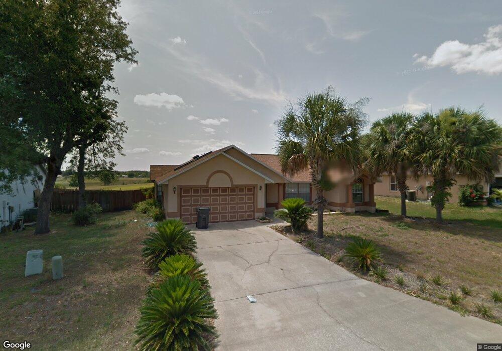
535 Wild Forrest Dr Davenport, FL 33837
Estimated Value: $325,000 - $366,431
3
Beds
2
Baths
1,774
Sq Ft
$197/Sq Ft
Est. Value
About This Home
This home is located at 535 Wild Forrest Dr, Davenport, FL 33837 and is currently estimated at $350,108, approximately $197 per square foot. 535 Wild Forrest Dr is a home located in Polk County with nearby schools including Davenport School Of The Arts, Loughman Oaks Elementary School, and Dundee Elementary Academy.
Ownership History
Date
Name
Owned For
Owner Type
Purchase Details
Closed on
Dec 1, 2021
Sold by
Lorenzo Derrick M
Bought by
Lorenzo Derrick M and Lorenzo Ursula
Current Estimated Value
Purchase Details
Closed on
Jun 19, 1996
Sold by
Schubert John D and Schubert Karen
Bought by
Barnes David S
Home Financials for this Owner
Home Financials are based on the most recent Mortgage that was taken out on this home.
Original Mortgage
$93,712
Interest Rate
8.21%
Create a Home Valuation Report for This Property
The Home Valuation Report is an in-depth analysis detailing your home's value as well as a comparison with similar homes in the area
Home Values in the Area
Average Home Value in this Area
Purchase History
| Date | Buyer | Sale Price | Title Company |
|---|---|---|---|
| Lorenzo Derrick M | -- | Law Office Of Mery Lopez Pa | |
| Barnes David S | $95,000 | -- |
Source: Public Records
Mortgage History
| Date | Status | Borrower | Loan Amount |
|---|---|---|---|
| Previous Owner | Barnes David S | $86,600 | |
| Previous Owner | Barnes David S | $66,500 | |
| Previous Owner | Barnes David S | $93,712 |
Source: Public Records
Tax History Compared to Growth
Tax History
| Year | Tax Paid | Tax Assessment Tax Assessment Total Assessment is a certain percentage of the fair market value that is determined by local assessors to be the total taxable value of land and additions on the property. | Land | Improvement |
|---|---|---|---|---|
| 2025 | $1,661 | $118,944 | -- | -- |
| 2024 | $1,499 | $115,592 | -- | -- |
| 2023 | $1,499 | $112,225 | $0 | $0 |
| 2022 | $1,424 | $108,956 | $0 | $0 |
| 2021 | $1,409 | $105,783 | $0 | $0 |
| 2020 | $1,376 | $104,322 | $0 | $0 |
| 2018 | $1,314 | $100,076 | $0 | $0 |
| 2017 | $1,278 | $98,018 | $0 | $0 |
| 2016 | $1,239 | $96,002 | $0 | $0 |
| 2015 | $866 | $95,335 | $0 | $0 |
| 2014 | $1,172 | $94,578 | $0 | $0 |
Source: Public Records
Map
Nearby Homes
- 426 Wild Forrest Dr
- 368 Sand Ridge Dr
- 319 Sand Ridge Dr
- 4111 Oaktree Dr
- 4103 Oak Tree Dr
- 4147 Oaktree Dr
- 178 Forest View Dr
- 245 Hollingshead Loop
- 235 Hollingshead Loop
- 143 Hollingshead Loop
- 341 Whittier St
- 157 Forest View Ct
- 4072 Oak Tree Dr
- 124 Sand Ridge Dr
- 424 Meadow Green Dr
- 100 Sunridge Woods Ct
- 5168 Oakbourne Ave
- 4204 Oakview Dr
- 0 Ronald Reagan Pkwy Unit MFRR4907141
- 5192 Oakbourne Ave
- 527 Wild Forrest Dr
- 543 Wild Forrest Dr
- 519 Wild Forrest Dr
- 534 Wild Forrest Dr
- 526 Wild Forrest Dr
- 511 Wild Forrest Dr
- 518 Wild Forrest Dr
- 510 Wild Forrest Dr
- 503 Wild Forrest Dr
- 502 Wild Forrest Dr
- 435 Wild Forrest Dr
- 434 Wild Forrest Dr
- 427 Wild Forrest Dr
- 100 Meadow Green Dr
- 419 Wild Forrest Dr
- 418 Wild Forrest Dr
- 108 Meadow Green Dr
- 411 Wild Forrest Dr
- 2517 Ronald Reagan Pkwy
- 109 Meadow Green Dr