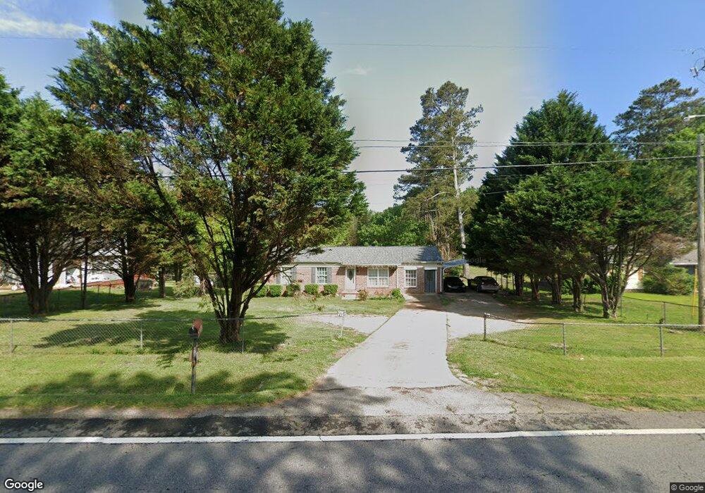
5352 Browns Bridge Rd Gainesville, GA 30504
Estimated Value: $268,000 - $361,000
3
Beds
2
Baths
1,224
Sq Ft
$253/Sq Ft
Est. Value
About This Home
This home is located at 5352 Browns Bridge Rd, Gainesville, GA 30504 and is currently estimated at $309,110, approximately $252 per square foot. 5352 Browns Bridge Rd is a home located in Hall County with nearby schools including McEver Elementary School, Chestatee Middle School, and Chestatee High School.
Ownership History
Date
Name
Owned For
Owner Type
Purchase Details
Closed on
Apr 20, 1999
Sold by
Trotter Evelyn and Trotter Grady
Bought by
Pantoja Nicolas M
Current Estimated Value
Home Financials for this Owner
Home Financials are based on the most recent Mortgage that was taken out on this home.
Original Mortgage
$71,900
Outstanding Balance
$17,399
Interest Rate
7%
Mortgage Type
New Conventional
Estimated Equity
$291,711
Create a Home Valuation Report for This Property
The Home Valuation Report is an in-depth analysis detailing your home's value as well as a comparison with similar homes in the area
Home Values in the Area
Average Home Value in this Area
Purchase History
| Date | Buyer | Sale Price | Title Company |
|---|---|---|---|
| Pantoja Nicolas M | $72,000 | -- |
Source: Public Records
Mortgage History
| Date | Status | Borrower | Loan Amount |
|---|---|---|---|
| Open | Pantoja Nicolas M | $71,900 |
Source: Public Records
Tax History Compared to Growth
Tax History
| Year | Tax Paid | Tax Assessment Tax Assessment Total Assessment is a certain percentage of the fair market value that is determined by local assessors to be the total taxable value of land and additions on the property. | Land | Improvement |
|---|---|---|---|---|
| 2025 | $2,075 | $92,560 | $14,520 | $78,040 |
| 2024 | $2,297 | $90,080 | $14,520 | $75,560 |
| 2023 | $2,187 | $85,600 | $14,520 | $71,080 |
| 2022 | $1,927 | $72,000 | $12,720 | $59,280 |
| 2021 | $1,474 | $53,360 | $9,120 | $44,240 |
| 2020 | $1,458 | $51,240 | $9,120 | $42,120 |
| 2019 | $1,271 | $43,920 | $9,120 | $34,800 |
| 2018 | $1,040 | $34,264 | $7,560 | $26,704 |
| 2017 | $1,029 | $34,264 | $7,560 | $26,704 |
| 2016 | $1,006 | $34,264 | $7,560 | $26,704 |
| 2015 | $1,013 | $34,264 | $7,560 | $26,704 |
| 2014 | $1,013 | $34,264 | $7,560 | $26,704 |
Source: Public Records
Map
Nearby Homes
- 5490 Hulsey Cir
- 5471 Dogwood Ln
- 5320 Sherri Dr
- 5119 Ash Cir
- 4510 Browns Bridge Rd
- 9340 Ann Harbor Dr
- 5659 Nags Head Cir
- 9155 Greenway Ct
- 4451 Flat Creek Dr
- 4469 Flat Creek Dr
- 9145 Greenway Ct
- 9135 Greenway Ct
- 9150 Greenway Ct
- Belville Plan at White Post on Lake Lanier
- Chatsworth Plan at White Post on Lake Lanier
- Milton II Plan at White Post on Lake Lanier
- Sawyer Plan at White Post on Lake Lanier
- Manchester Plan at White Post on Lake Lanier
- Tiburon Plan at White Post on Lake Lanier
- 9110 Greenway Ct
- 5348 Browns Bridge Rd
- 5356 Browns Bridge Rd
- 5439 Beach Haven Dr
- 5445 Beach Haven Dr
- 5433 Beach Haven Dr
- 5342 Browns Bridge Rd
- 5360 Browns Bridge Rd
- 5451 Beach Haven Dr
- 5427 Beach Haven Dr
- 5340 Browns Bridge Rd
- 5363 Browns Bridge Rd
- 5457 Beach Haven Dr
- 5469 Beach Haven Dr
- 5438 Beach Haven Dr
- 5438 Beach Haven Dr
- 5408 Dogwood Ln
- 5432 Beach Haven Dr
- 5419 Beach Haven Dr
- 5463 Beach Haven Dr
- 5414 Dogwood Ln Unit 76