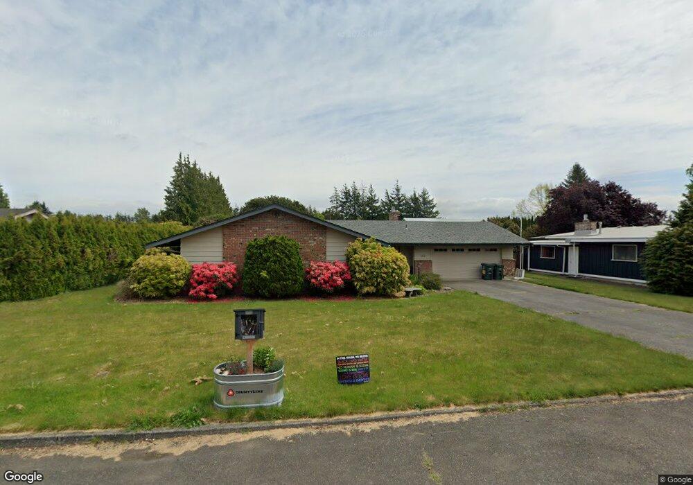
5356 Belfern Dr Bellingham, WA 98226
Estimated Value: $520,000 - $601,000
3
Beds
2
Baths
1,364
Sq Ft
$399/Sq Ft
Est. Value
About This Home
This home is located at 5356 Belfern Dr, Bellingham, WA 98226 and is currently estimated at $543,705, approximately $398 per square foot. 5356 Belfern Dr is a home located in Whatcom County with nearby schools including Central Elementary School, Vista Middle School, and Ferndale High School.
Ownership History
Date
Name
Owned For
Owner Type
Purchase Details
Closed on
Sep 14, 2021
Sold by
Beatrice Flaherty Ruby
Bought by
Flaherty Jeffrey W and Olsonjeffrey Keeley
Current Estimated Value
Purchase Details
Closed on
Sep 13, 2021
Sold by
Flaherty Jeffrey W
Bought by
Olson Caleb and Olson Keeley
Purchase Details
Closed on
Mar 12, 2003
Sold by
Flaherty Ruby B
Bought by
Flaherty Ruby B
Create a Home Valuation Report for This Property
The Home Valuation Report is an in-depth analysis detailing your home's value as well as a comparison with similar homes in the area
Home Values in the Area
Average Home Value in this Area
Purchase History
| Date | Buyer | Sale Price | Title Company |
|---|---|---|---|
| Flaherty Jeffrey W | -- | None Listed On Document | |
| Flaherty Jeffrey W | -- | None Listed On Document | |
| Olson Caleb | -- | None Available | |
| Flaherty Ruby B | -- | -- |
Source: Public Records
Tax History Compared to Growth
Tax History
| Year | Tax Paid | Tax Assessment Tax Assessment Total Assessment is a certain percentage of the fair market value that is determined by local assessors to be the total taxable value of land and additions on the property. | Land | Improvement |
|---|---|---|---|---|
| 2024 | $3,275 | $441,922 | $198,608 | $243,314 |
| 2023 | $3,275 | $458,956 | $225,000 | $233,956 |
| 2022 | $3,176 | $416,584 | $148,834 | $267,750 |
| 2021 | $3,206 | $344,283 | $123,003 | $221,280 |
| 2020 | $3,087 | $318,790 | $113,895 | $204,895 |
| 2019 | $2,464 | $277,656 | $99,199 | $178,457 |
| 2018 | $2,822 | $253,853 | $90,695 | $163,158 |
| 2017 | $2,350 | $222,463 | $79,480 | $142,983 |
| 2016 | $2,216 | $197,879 | $77,168 | $120,711 |
| 2015 | $2,230 | $186,344 | $73,059 | $113,285 |
| 2014 | -- | $182,465 | $71,400 | $111,065 |
| 2013 | -- | $179,857 | $70,000 | $109,857 |
Source: Public Records
Map
Nearby Homes
- 5502 Northwest Dr
- 1396 Woods Point Loop
- 1378 W Smith Rd
- 5324 Shields Rd
- 1371 W Axton Rd
- 1245 W Axton Rd
- 1300 W Axton Rd
- 0 W Axton Rd
- 5162 Spoonbill Ln
- 5545 La Bounty Dr
- 5094 Labounty Rd
- 4958 Pacific Hwy
- 5391 La Bounty Dr
- 5400 Barrett Rd
- 5330 Barret Rd S
- 794 W Smith Rd
- 1474 Sunset Ave
- 0 Labounty Unit 1968051
- 1625 Main St Unit 11
- 1655 Main St