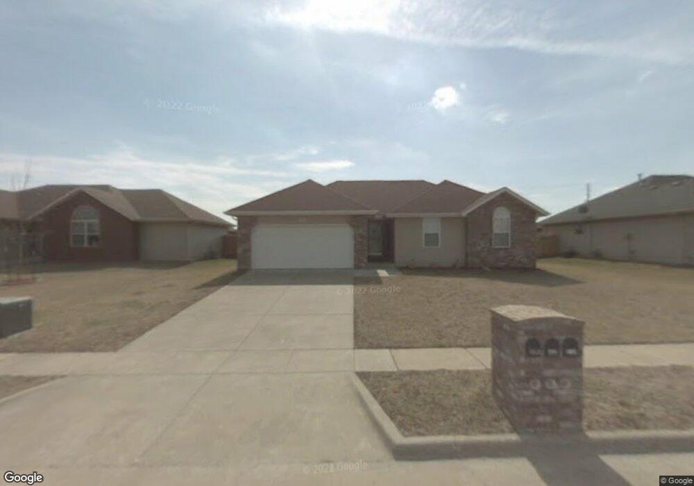
5356 W Josh St Springfield, MO 65802
Estimated Value: $246,000 - $253,000
3
Beds
2
Baths
1,451
Sq Ft
$173/Sq Ft
Est. Value
About This Home
This home is located at 5356 W Josh St, Springfield, MO 65802 and is currently estimated at $250,909, approximately $172 per square foot. 5356 W Josh St is a home located in Greene County with nearby schools including Willard Orchard Hills Elementary School, Willard Intermediate-South, and Willard High School.
Ownership History
Date
Name
Owned For
Owner Type
Purchase Details
Closed on
Dec 1, 2009
Sold by
Dennis James Robert and Dennis Scarlett
Bought by
Dennis James Robert and Dennis Scarlett
Current Estimated Value
Purchase Details
Closed on
Jun 12, 2009
Sold by
Bank Of Englend
Bought by
Dennis James Robert and Dennis Scarlett
Purchase Details
Closed on
May 9, 2008
Sold by
Hall Jeffery A and Hall Kathy A
Bought by
Bank Of England and Eng Lending
Purchase Details
Closed on
Feb 12, 2007
Sold by
Barnes Residential Inc
Bought by
Hall Jeffrey A and Hall Kathy A
Create a Home Valuation Report for This Property
The Home Valuation Report is an in-depth analysis detailing your home's value as well as a comparison with similar homes in the area
Home Values in the Area
Average Home Value in this Area
Purchase History
| Date | Buyer | Sale Price | Title Company |
|---|---|---|---|
| Dennis James Robert | -- | None Available | |
| Dennis James Robert | -- | None Available | |
| Bank Of England | $100,000 | None Available | |
| Hall Jeffrey A | -- | Lincoln Evans Land Title Com |
Source: Public Records
Tax History Compared to Growth
Tax History
| Year | Tax Paid | Tax Assessment Tax Assessment Total Assessment is a certain percentage of the fair market value that is determined by local assessors to be the total taxable value of land and additions on the property. | Land | Improvement |
|---|---|---|---|---|
| 2025 | $1,652 | $36,230 | $8,550 | $27,680 |
| 2024 | $1,652 | $29,470 | $3,800 | $25,670 |
| 2023 | $1,645 | $29,470 | $3,800 | $25,670 |
| 2022 | $1,441 | $25,590 | $3,800 | $21,790 |
| 2021 | $1,442 | $25,590 | $3,800 | $21,790 |
| 2020 | $1,207 | $23,260 | $3,800 | $19,460 |
| 2019 | $1,202 | $23,260 | $3,800 | $19,460 |
| 2018 | $1,033 | $19,870 | $3,800 | $16,070 |
| 2017 | $1,024 | $19,870 | $3,800 | $16,070 |
| 2016 | $1,019 | $19,870 | $3,800 | $16,070 |
| 2015 | $1,011 | $19,870 | $3,800 | $16,070 |
| 2014 | $1,010 | $19,700 | $3,800 | $15,900 |
Source: Public Records
Map
Nearby Homes
- 5353 Butternut Dr
- 5441 Basswood Ct W
- 834 S Lester Rd
- 1128 S Brecklyn Rd
- 1069 S Red Cedar Ave
- 5134 W Sunstruck St
- 5163 W Sunstruck St
- 5131 W Sunstruck St
- 5175 W Sunstruck St
- 5590 W Sunflower Dr
- 995 S Natalie Ave
- 5610 W Sugar Pine Dr
- 5640 W Sunflower Dr
- 5721 W Alexa Ln
- 5147 W Sunstruck St
- 5033 W Skyler Dr
- 768 S Long Dr
- 1161 S Broadview Ave
- 5170 W Sunstruck St
- 5182 W Sunstruck St
- 5344 W Josh St
- 5368 W Josh St
- 5332 W Josh St
- 5380 W Josh St
- 5367 W Josh St
- 5392 W Josh St
- 5367 Soapberry Ct
- 5359 Soapberry Ct
- 5379 W Josh St
- 5375 Soapberry Ct
- 5351 Soapberry Ct
- 5383 Soapberry Ct
- 5343 Soapberry Ct
- 5391 Soapberry Ct
- 5403 W Josh St
- 5416 W Josh St
- 5366 W Lombard St
- 5335 Soapberry Ct
- 5378 W Lombard St
- 5360 Soapberry Ct