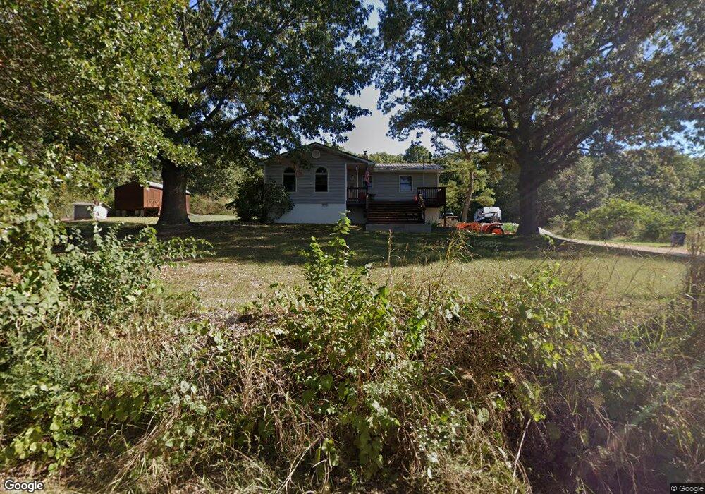
536 Brittain Cemetery Rd N Harrison, AR 72601
Estimated Value: $138,677 - $163,000
2
Beds
1
Bath
1,137
Sq Ft
$136/Sq Ft
Est. Value
About This Home
This home is located at 536 Brittain Cemetery Rd N, Harrison, AR 72601 and is currently estimated at $154,669, approximately $136 per square foot. 536 Brittain Cemetery Rd N is a home located in Boone County with nearby schools including Woodland Heights Elementary School and Harrison Jr. High School.
Ownership History
Date
Name
Owned For
Owner Type
Purchase Details
Closed on
Aug 10, 2007
Sold by
Hayes Buck
Bought by
Jaro Edward F and Jaro Joanna
Current Estimated Value
Home Financials for this Owner
Home Financials are based on the most recent Mortgage that was taken out on this home.
Original Mortgage
$87,700
Outstanding Balance
$55,612
Interest Rate
6.69%
Mortgage Type
New Conventional
Estimated Equity
$99,057
Purchase Details
Closed on
Sep 14, 1999
Bought by
Smothers
Create a Home Valuation Report for This Property
The Home Valuation Report is an in-depth analysis detailing your home's value as well as a comparison with similar homes in the area
Home Values in the Area
Average Home Value in this Area
Purchase History
| Date | Buyer | Sale Price | Title Company |
|---|---|---|---|
| Jaro Edward F | $88,000 | None Available | |
| Smothers | $60,000 | -- |
Source: Public Records
Mortgage History
| Date | Status | Borrower | Loan Amount |
|---|---|---|---|
| Open | Jaro Edward F | $87,700 |
Source: Public Records
Tax History Compared to Growth
Tax History
| Year | Tax Paid | Tax Assessment Tax Assessment Total Assessment is a certain percentage of the fair market value that is determined by local assessors to be the total taxable value of land and additions on the property. | Land | Improvement |
|---|---|---|---|---|
| 2025 | $788 | $17,580 | $1,200 | $16,380 |
| 2024 | $775 | $17,580 | $1,200 | $16,380 |
| 2023 | $743 | $17,580 | $1,200 | $16,380 |
| 2022 | $336 | $17,580 | $1,200 | $16,380 |
| 2021 | $303 | $17,580 | $1,200 | $16,380 |
| 2020 | $271 | $14,420 | $1,400 | $13,020 |
| 2019 | $289 | $14,420 | $1,400 | $13,020 |
| 2018 | $314 | $14,420 | $1,400 | $13,020 |
| 2017 | $296 | $14,420 | $1,400 | $13,020 |
| 2016 | $296 | $14,420 | $1,400 | $13,020 |
| 2015 | $701 | $15,650 | $2,000 | $13,650 |
| 2014 | $351 | $15,650 | $2,000 | $13,650 |
Source: Public Records
Map
Nearby Homes
- 7288 Highway 62 E
- 95 Lavista Cir
- 47 Lavista Cir
- 3618 Sharp Ln
- 12380 A Highway 62 E
- 12380 Highway 62 E
- 875 Meadow Lane Dr
- 4828 McDonald Rd
- 1565 Brazell Rd
- 3544 A Mulberry Rd
- 1350 Hawkins St
- 2662 Meeks Creek Rd
- 13003 E Hwy 62
- 0 Crawford Rd E Unit 1324761
- 4816 U S 65
- 0 Wilson Springs Rd
- 5946 U S 65
- 3917 Sansing Hollow Rd
- 0 Rally Hill Rd
- 2811 Harmon Rd N
- 536 Brittain Cemetery Rd
- 626 Brittain Cemetery Rd N
- 362 Brittain Cemetery Rd
- 0 Brittain Cemetery Rd N
- 0 Brittan Cemetary Rd
- 765 Brittain Cemetery Rd
- 793 Brittain Cemetery Rd N
- 793 Brittain Cemetery Rd
- 863 Brittain Cemetery Rd
- 6113 Floyd Lee Rd
- 266 Wild Rose Ln
- 6053 Floyd Lee Rd
- 1392 Brittain Cemetery Rd Unit A
- 1392a Brittain Cemetery Rd N
- 1392a Brittain Cemetery Rd
- 9079 Highway 62 E
- 0 Wild Rose Ln
- 8882 Highway 62 E
- 5997 Floyd Lee Rd
- 8519 Highway 62 E