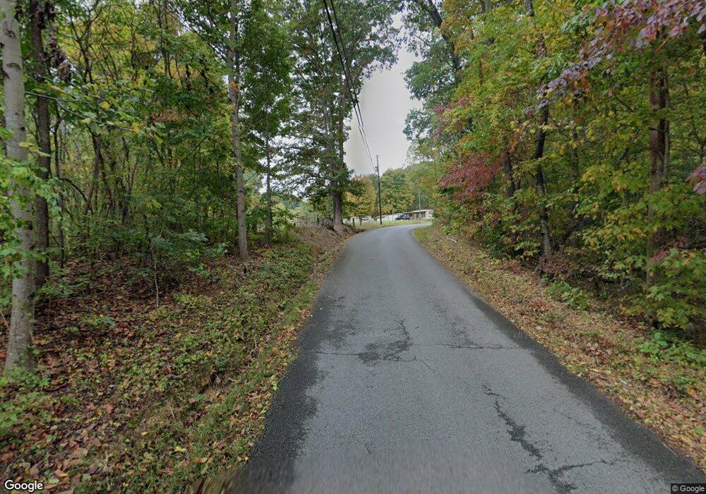
536 Daniels Rd Knoxville, TN 37938
North Knoxville NeighborhoodEstimated Value: $332,000
--
Bed
--
Bath
2,472
Sq Ft
$134/Sq Ft
Est. Value
About This Home
This home is located at 536 Daniels Rd, Knoxville, TN 37938 and is currently estimated at $332,000, approximately $134 per square foot. 536 Daniels Rd is a home located in Knox County with nearby schools including Beaumont Magnet Academy, Vine Middle/Magnet, and Fulton High School.
Ownership History
Date
Name
Owned For
Owner Type
Purchase Details
Closed on
Jan 9, 2012
Sold by
City Of Knoxville
Bought by
Schmidt Joakim
Current Estimated Value
Purchase Details
Closed on
Jan 25, 2011
Sold by
Delcampo Jorge Gomez and Oesterling Brigid
Bought by
Schmidt Joakim
Purchase Details
Closed on
Jul 27, 2007
Sold by
Reeder Equity Corp
Bought by
Delcampo Jorge Gomez and Oesterling Brigid
Purchase Details
Closed on
Nov 15, 1993
Sold by
Monday William Eugene and Monday James Stephenson
Bought by
Rainbow Adult Homes Inc
Create a Home Valuation Report for This Property
The Home Valuation Report is an in-depth analysis detailing your home's value as well as a comparison with similar homes in the area
Home Values in the Area
Average Home Value in this Area
Purchase History
| Date | Buyer | Sale Price | Title Company |
|---|---|---|---|
| Schmidt Joakim | -- | None Available | |
| Schmidt Joakim | $12,500 | None Available | |
| Delcampo Jorge Gomez | $2,578 | None Available | |
| Rainbow Adult Homes Inc | $10,680 | -- |
Source: Public Records
Tax History Compared to Growth
Tax History
| Year | Tax Paid | Tax Assessment Tax Assessment Total Assessment is a certain percentage of the fair market value that is determined by local assessors to be the total taxable value of land and additions on the property. | Land | Improvement |
|---|---|---|---|---|
| 2024 | $413 | $13,360 | $0 | $0 |
| 2023 | $496 | $13,360 | $0 | $0 |
| 2022 | $496 | $13,360 | $0 | $0 |
| 2021 | $537 | $11,720 | $0 | $0 |
| 2020 | $537 | $11,720 | $0 | $0 |
| 2019 | $537 | $11,720 | $0 | $0 |
| 2018 | $537 | $11,720 | $0 | $0 |
| 2017 | $537 | $0 | $0 | $0 |
| 2016 | $572 | $0 | $0 | $0 |
| 2015 | $572 | $0 | $0 | $0 |
| 2014 | $572 | $0 | $0 | $0 |
Source: Public Records
Map
Nearby Homes
- 201 W 5th Ave Unit 11
- 333 W Depot Ave Unit 219
- 333 W Depot Ave Unit 305
- 333 W Depot Ave Unit 617
- 333 W Depot Ave Unit 208
- 333 W Depot Ave Unit 310
- 353 Ogden St Unit 303
- 203 Mews Way
- 222 N Central St Unit 306
- 222 N Central St Unit 208
- 222 N Central St Unit B08
- 222 N Central St Unit 304
- 222 N Central St Unit 107
- 222 N Central St Unit B6
- 100 S Gay St Unit 202
- 100 S Gay St Unit 305
- 100 S Gay St Unit 204
- 240 W Jackson Ave Unit B05
- 240 W Jackson Ave Unit B05
- 200 W Jackson Ave Unit 607
- 534 W Fifth Ave
- 508 Daniels Rd
- 511 Cooper St
- 505 Cooper St
- 406 Fifth Ave
- 509 Cooper St
- 513 Cooper St
- 401 W Fifth Ave
- 400 W Magnolia Ave Unit 102
- 400 W Magnolia Ave Unit 203
- 400 W Magnolia Ave
- 209 W Fifth Ave Unit 304
- 209 W Fifth Ave Unit 302
- 209 W Fifth Ave Unit 301
- 209 W Fifth Ave Unit 202
- 209 W Fifth Ave Unit 102
- 209 W Fifth Ave Unit 101
- 415 W Depot Ave
- 605 King St Unit 8
- 605 King St Unit 6
