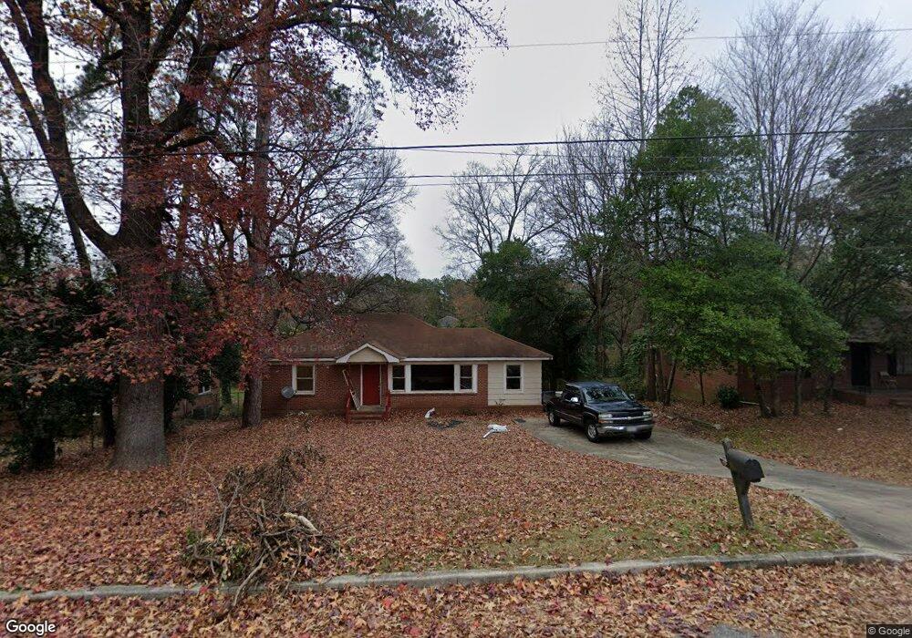
5364 Rodgers Dr Columbus, GA 31909
Northern Columbus NeighborhoodEstimated Value: $151,531 - $174,000
3
Beds
2
Baths
1,344
Sq Ft
$121/Sq Ft
Est. Value
About This Home
This home is located at 5364 Rodgers Dr, Columbus, GA 31909 and is currently estimated at $162,133, approximately $120 per square foot. 5364 Rodgers Dr is a home located in Muscogee County with nearby schools including Gentian Elementary School, Midland Middle School, and Hardaway High School.
Ownership History
Date
Name
Owned For
Owner Type
Purchase Details
Closed on
Aug 25, 2016
Bought by
Philips Constance S
Current Estimated Value
Purchase Details
Closed on
Dec 1, 2015
Sold by
Wells Fargo Bank
Bought by
Sec Of Housing & Urban
Purchase Details
Closed on
Apr 10, 2009
Sold by
Rp Investment Group Llc
Bought by
Mckinnon Patricia L
Home Financials for this Owner
Home Financials are based on the most recent Mortgage that was taken out on this home.
Original Mortgage
$106,735
Interest Rate
5.18%
Mortgage Type
FHA
Create a Home Valuation Report for This Property
The Home Valuation Report is an in-depth analysis detailing your home's value as well as a comparison with similar homes in the area
Home Values in the Area
Average Home Value in this Area
Purchase History
| Date | Buyer | Sale Price | Title Company |
|---|---|---|---|
| Philips Constance S | -- | -- | |
| Csp Investments Llc | -- | -- | |
| Sec Of Housing & Urban | $75,460 | -- | |
| Wells Fargo Bank | $75,460 | -- | |
| Mckinnon Patricia L | $109,900 | None Available |
Source: Public Records
Mortgage History
| Date | Status | Borrower | Loan Amount |
|---|---|---|---|
| Previous Owner | Mckinnon Patricia L | $106,735 |
Source: Public Records
Tax History Compared to Growth
Tax History
| Year | Tax Paid | Tax Assessment Tax Assessment Total Assessment is a certain percentage of the fair market value that is determined by local assessors to be the total taxable value of land and additions on the property. | Land | Improvement |
|---|---|---|---|---|
| 2025 | $1,105 | $28,240 | $7,988 | $20,252 |
| 2024 | $893 | $48,248 | $7,988 | $40,260 |
| 2023 | $899 | $22,810 | $7,988 | $14,822 |
| 2022 | $931 | $22,810 | $7,988 | $14,822 |
| 2021 | $931 | $26,232 | $7,988 | $18,244 |
| 2020 | $874 | $21,400 | $4,120 | $17,280 |
| 2019 | $877 | $21,400 | $4,120 | $17,280 |
| 2018 | $754 | $38,148 | $7,988 | $30,160 |
| 2017 | $756 | $18,400 | $4,120 | $14,280 |
| 2016 | $1,790 | $43,387 | $2,678 | $40,709 |
| 2015 | $1,244 | $43,387 | $2,678 | $40,709 |
| 2014 | $1,246 | $43,387 | $2,678 | $40,709 |
| 2013 | -- | $43,387 | $2,678 | $40,709 |
Source: Public Records
Map
Nearby Homes
- 5517 Rodgers Dr
- 5540 Rodgers Dr
- 5216 Moon Rd
- 4832 Rowland Ave
- 3872 E Britt David Rd
- 4813 Rowland Ct
- 5224 Miller Rd
- 4709 Rowland Ave
- 5636 Webb Ave
- 4807 Fairview Dr
- 3618 Grier Ave
- 3710 Winkfield Place
- 3504 Vernon Dr
- 4017 River Rock Way
- 4520 Marci Ct
- 4565 Prim Dr
- 5435 Wayne Dr
- 5829 Moon Rd
- 5921 Lawson St
- 5866 Morningside Dr
- 5360 Rodgers Dr
- 5368 Rodgers Dr
- 0 Rodgers Dr Unit 7605901
- 0 Rodgers Dr
- 5356 Rodgers Dr
- 5408 Rodgers Dr
- 6057 N Pointe Dr
- 3967 Austin Dr
- 3958 Austin Dr
- 6053 N Pointe Dr
- 5350 Rodgers Dr
- 5418 Rodgers Dr
- 3959 Austin Dr
- 3950 Austin Dr
- 6049 N Pointe Dr
- 5348 Rodgers Dr
- 6068 N Pointe Dr
- 5426 Rodgers Dr
- 5303 Emily Dr
- 3951 Austin Dr