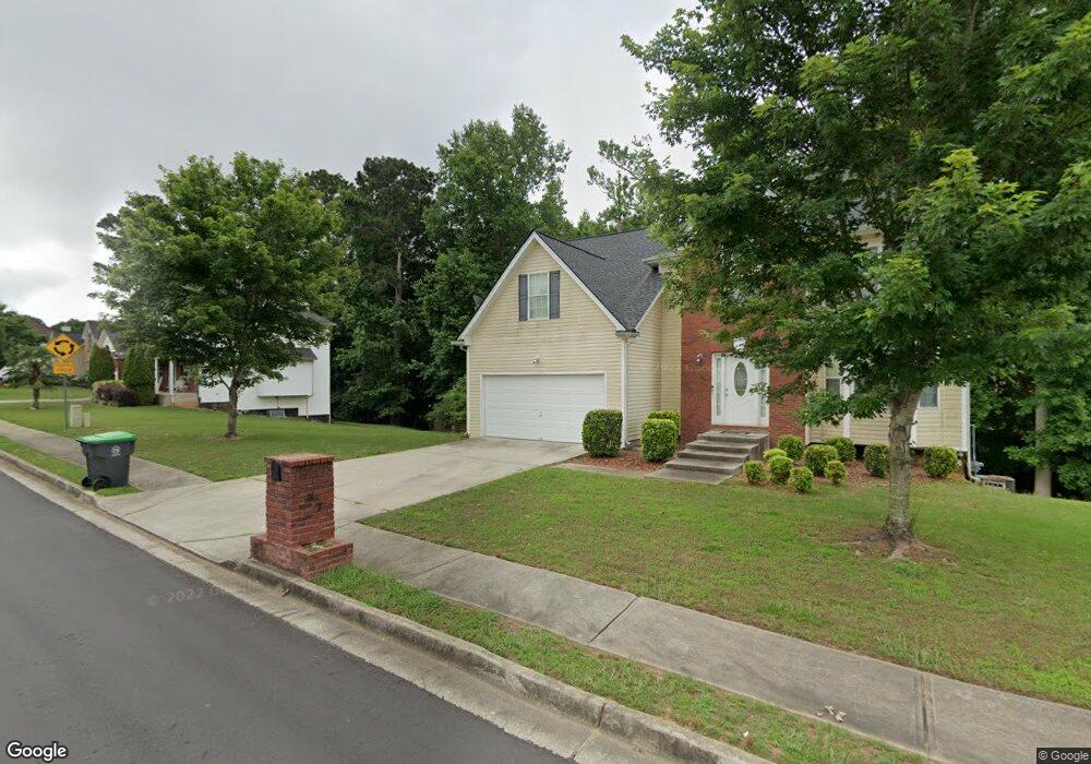
537 Andrews Dr Hampton, GA 30228
Estimated Value: $318,000 - $330,000
4
Beds
3
Baths
2,754
Sq Ft
$118/Sq Ft
Est. Value
About This Home
This home is located at 537 Andrews Dr, Hampton, GA 30228 and is currently estimated at $324,814, approximately $117 per square foot. 537 Andrews Dr is a home located in Clayton County with nearby schools including River's Edge Elementary School, Eddie White Academy, and Lovejoy High School.
Ownership History
Date
Name
Owned For
Owner Type
Purchase Details
Closed on
Apr 30, 2018
Sold by
Sec Of Veterans Affa
Bought by
Smith Stacey
Current Estimated Value
Home Financials for this Owner
Home Financials are based on the most recent Mortgage that was taken out on this home.
Original Mortgage
$174,479
Outstanding Balance
$151,739
Interest Rate
5.12%
Mortgage Type
FHA
Estimated Equity
$173,075
Purchase Details
Closed on
Nov 21, 2017
Sold by
Planet Home Lending Llc
Bought by
Secretary Of Veterans Affairs
Purchase Details
Closed on
Nov 7, 2017
Sold by
Dubose Gregory C
Bought by
Planet Home Lending Llc
Purchase Details
Closed on
Jul 8, 2005
Sold by
Northbridge Homes Llc
Bought by
Dubose Gregory C
Home Financials for this Owner
Home Financials are based on the most recent Mortgage that was taken out on this home.
Original Mortgage
$206,251
Interest Rate
5.46%
Mortgage Type
VA
Create a Home Valuation Report for This Property
The Home Valuation Report is an in-depth analysis detailing your home's value as well as a comparison with similar homes in the area
Home Values in the Area
Average Home Value in this Area
Purchase History
| Date | Buyer | Sale Price | Title Company |
|---|---|---|---|
| Smith Stacey | $168,900 | -- | |
| Secretary Of Veterans Affairs | $145,407 | -- | |
| Planet Home Lending Llc | $145,407 | -- | |
| Dubose Gregory C | $202,000 | -- |
Source: Public Records
Mortgage History
| Date | Status | Borrower | Loan Amount |
|---|---|---|---|
| Open | Smith Stacey | $174,479 | |
| Previous Owner | Dubose Gregory C | $206,251 |
Source: Public Records
Tax History
| Year | Tax Paid | Tax Assessment Tax Assessment Total Assessment is a certain percentage of the fair market value that is determined by local assessors to be the total taxable value of land and additions on the property. | Land | Improvement |
|---|---|---|---|---|
| 2025 | $5,270 | $146,480 | $10,400 | $136,080 |
| 2024 | $5,325 | $145,400 | $10,400 | $135,000 |
| 2023 | $5,302 | $146,840 | $10,400 | $136,440 |
| 2022 | $4,131 | $114,160 | $10,400 | $103,760 |
| 2021 | $3,071 | $86,680 | $10,400 | $76,280 |
| 2020 | $2,971 | $83,216 | $10,400 | $72,816 |
| 2019 | $2,379 | $67,560 | $9,600 | $57,960 |
| 2018 | $3,217 | $78,182 | $9,600 | $68,582 |
| 2017 | $3,195 | $77,471 | $9,600 | $67,871 |
| 2016 | $3,100 | $75,130 | $9,600 | $65,530 |
| 2015 | $1,951 | $0 | $0 | $0 |
| 2014 | $1,560 | $38,140 | $9,600 | $28,540 |
Source: Public Records
Map
Nearby Homes
- 12140 Dominion Dr
- 12237 Dickson Rd Unit 1
- 526 Canady Ct
- 11961 Markham Way
- 609 Vaughan Dr
- 12095 Panhandle Rd
- 11800 Guelph Cir
- 12148 Flannery Ln
- 12283 Coldstream Ct
- 12090 Centerra Dr
- 424 Toronto Cir
- 536 Caledon Way
- 12275 Styron Dr
- 609 Caledon Way
- 411 Toronto Cir
- 490 Caledon Way
- 0 Haley Ln Unit 10708324
- 12149 Centerra Dr
- 12155 Centerra Dr
- 12359 Hillcrest Dr
- 549 Andrews Dr Unit 4
- 523 Andrews Dr
- 523 Andrews Dr
- 536 Kimberwick Dr Unit 2
- 544 Kimberwick Dr
- 524 Kimberwick Dr Unit 2
- 536 Andrews Dr
- 548 Andrews Dr Unit 4
- 561 Andrews Dr Unit 147
- 561 Andrews Dr Unit 4
- 511 Andrews Dr Unit 4
- 524 Andrews Dr Unit 4
- 560 Andrews Dr
- 556 Kimberwick Dr Unit 2
- 512 Kimberwick Dr Unit 2
- 512 Andrews Dr Unit 4
- 533 Kimberwick Dr
- 573 Andrews Dr
- 545 Kimberwick Dr Unit 2
- 499 Andrews Dr Unit 4
Your Personal Tour Guide
Ask me questions while you tour the home.