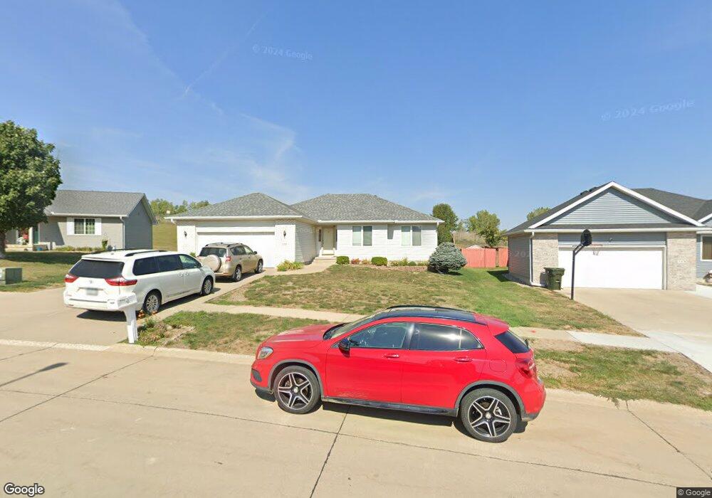
537 Forest View Ave Sioux City, IA 51103
West Side Sioux City NeighborhoodEstimated Value: $328,572 - $376,000
3
Beds
3
Baths
1,499
Sq Ft
$234/Sq Ft
Est. Value
About This Home
This home is located at 537 Forest View Ave, Sioux City, IA 51103 and is currently estimated at $350,643, approximately $233 per square foot. 537 Forest View Ave is a home located in Woodbury County with nearby schools including Loess Hills Elementary School, West Middle School, and West High School.
Ownership History
Date
Name
Owned For
Owner Type
Purchase Details
Closed on
Jul 6, 2005
Sold by
Nelson Dennis L and Nelson Sharon J
Bought by
Ton Huan G and Ton Chanda Keo
Current Estimated Value
Home Financials for this Owner
Home Financials are based on the most recent Mortgage that was taken out on this home.
Original Mortgage
$137,750
Outstanding Balance
$72,325
Interest Rate
5.75%
Mortgage Type
New Conventional
Estimated Equity
$278,318
Create a Home Valuation Report for This Property
The Home Valuation Report is an in-depth analysis detailing your home's value as well as a comparison with similar homes in the area
Home Values in the Area
Average Home Value in this Area
Purchase History
| Date | Buyer | Sale Price | Title Company |
|---|---|---|---|
| Ton Huan G | $145,000 | None Available |
Source: Public Records
Mortgage History
| Date | Status | Borrower | Loan Amount |
|---|---|---|---|
| Open | Ton Huan G | $137,750 |
Source: Public Records
Tax History Compared to Growth
Tax History
| Year | Tax Paid | Tax Assessment Tax Assessment Total Assessment is a certain percentage of the fair market value that is determined by local assessors to be the total taxable value of land and additions on the property. | Land | Improvement |
|---|---|---|---|---|
| 2025 | $4,516 | $298,800 | $37,900 | $260,900 |
| 2024 | $4,516 | $270,500 | $37,900 | $232,600 |
| 2023 | $4,202 | $270,500 | $37,900 | $232,600 |
| 2022 | $4,128 | $218,400 | $34,700 | $183,700 |
| 2021 | $4,128 | $218,400 | $34,700 | $183,700 |
| 2020 | $4,350 | $209,800 | $28,500 | $181,300 |
| 2019 | $4,216 | $195,200 | $0 | $0 |
| 2018 | $4,158 | $195,200 | $0 | $0 |
| 2017 | $4,158 | $179,100 | $0 | $0 |
| 2016 | $3,820 | $179,100 | $0 | $0 |
| 2015 | $3,787 | $179,100 | $22,800 | $156,300 |
| 2014 | $3,588 | $166,400 | $31,800 | $134,600 |
Source: Public Records
Map
Nearby Homes
- 612 Lancaster Cir
- 4210 Fieldcrest Dr
- 4266 Fieldcrest Dr
- 519 Ascot St
- 514 Ascot St
- 3827 Forest View Ave
- 1440 Burton St
- 2120 S Jermyn St
- 2917 W 5th St
- 612 Colon St
- 2824 W 14th St
- 2802 W 5th St
- 1919 Riverside Blvd
- 728 Prairie Blvd
- 218 S Davidson St
- 800 Paul Ave
- 707 Prairie Blvd
- 1016 Paul Ave
- 2411 Villa Ave
- 2543 W 20th St
- 543 Forest View Ave
- 531 Forest View Ave
- 549 Forest View Ave
- 525 Forest View Ave
- 4063 Manchester St
- 555 Forest View Ave
- 530 Forest View Ave
- 519 Forest View Ave
- 536 Forest View Ave
- 4059 Manchester St
- 4018 Fieldcrest Dr
- 542 Forest View Ave
- 4101 Fieldcrest Dr
- 4053 Manchester St
- 506 Forest View Ave
- 4070 Manchester St
- 4041 Fieldcrest Dr
- 4047 Manchester St
- 4024 Fieldcrest Dr
- 4107 Fieldcrest Dr