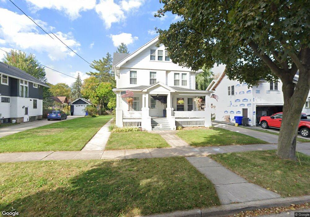
537 N Union St Appleton, WI 54911
Lawrence-City Park NeighborhoodEstimated Value: $333,000 - $406,000
5
Beds
1
Bath
2,657
Sq Ft
$139/Sq Ft
Est. Value
About This Home
This home is located at 537 N Union St, Appleton, WI 54911 and is currently estimated at $369,411, approximately $139 per square foot. 537 N Union St is a home located in Outagamie County with nearby schools including Edison Elementary School, Appleton North High School, and Appleton Bilingual School.
Ownership History
Date
Name
Owned For
Owner Type
Purchase Details
Closed on
Apr 10, 2020
Sold by
Kcoc Llc
Bought by
Milis Sean P and Milis Judy C
Current Estimated Value
Purchase Details
Closed on
Jul 11, 2019
Sold by
Oconnell Kurt and Oconnell Cindy
Bought by
Kcoc Llc
Purchase Details
Closed on
Apr 24, 2019
Sold by
Suvivors Lois E Reichardt
Bought by
Oconnell Kurt and Oconnell Cindy
Purchase Details
Closed on
Dec 27, 2007
Sold by
Reichardt Rodger C and Reichardt Lois E
Bought by
Reichardt Rodger C and Reichardt Lois E
Create a Home Valuation Report for This Property
The Home Valuation Report is an in-depth analysis detailing your home's value as well as a comparison with similar homes in the area
Home Values in the Area
Average Home Value in this Area
Purchase History
| Date | Buyer | Sale Price | Title Company |
|---|---|---|---|
| Milis Sean P | $90,000 | -- | |
| Kcoc Llc | $211,000 | -- | |
| Oconnell Kurt | $211,000 | -- | |
| Reichardt Rodger C | $160,000 | -- |
Source: Public Records
Tax History
| Year | Tax Paid | Tax Assessment Tax Assessment Total Assessment is a certain percentage of the fair market value that is determined by local assessors to be the total taxable value of land and additions on the property. | Land | Improvement |
|---|---|---|---|---|
| 2023 | $4,945 | $321,400 | $43,700 | $277,700 |
| 2022 | $4,230 | $205,200 | $36,500 | $168,700 |
| 2021 | $4,035 | $205,200 | $36,500 | $168,700 |
| 2020 | $4,016 | $205,200 | $36,500 | $168,700 |
| 2019 | $3,899 | $205,200 | $36,500 | $168,700 |
| 2018 | $3,419 | $158,500 | $30,200 | $128,300 |
| 2017 | $3,397 | $158,500 | $30,200 | $128,300 |
| 2016 | $3,338 | $158,500 | $30,200 | $128,300 |
| 2015 | $3,392 | $158,500 | $30,200 | $128,300 |
| 2014 | $3,362 | $158,500 | $30,200 | $128,300 |
| 2013 | $3,560 | $167,000 | $30,200 | $136,800 |
Source: Public Records
Map
Nearby Homes
- 526 N Ida St
- 827 E Washington St
- 221 E Winnebago St
- 324 E Commercial St
- 425 E Summer St
- 431 E Summer St
- 835 E John St
- 1426 N Meade St
- 501 W Winnebago St
- 913 N Harriman St
- 507 E Roosevelt St
- 400 N Richmond St Unit 328
- 400 N Richmond St Unit 417
- 1430 N Graceland Ave
- 1223 N Harriman St
- 1314 N Harriman St
- 1525 N Clark St
- 731 W Elsie St
- 730 W Oklahoma St
- 1606 S Carver Ln
- 521 N Union St
- 525 N Union St
- 531 N Union St
- 543 N Union St
- 524 E North St
- 502 N Union St
- 508 N Union St
- 515 N Union St
- 519 N Union St
- 514 N Union St
- 522 N Union St
- 530 N Union St
- 536 N Union St
- 540 N Union St
- 524 N Bateman St
- 530 N Bateman St
- 536 N Bateman St
- 504 E North St
- 520 E North St
- 516 E North St
Your Personal Tour Guide
Ask me questions while you tour the home.