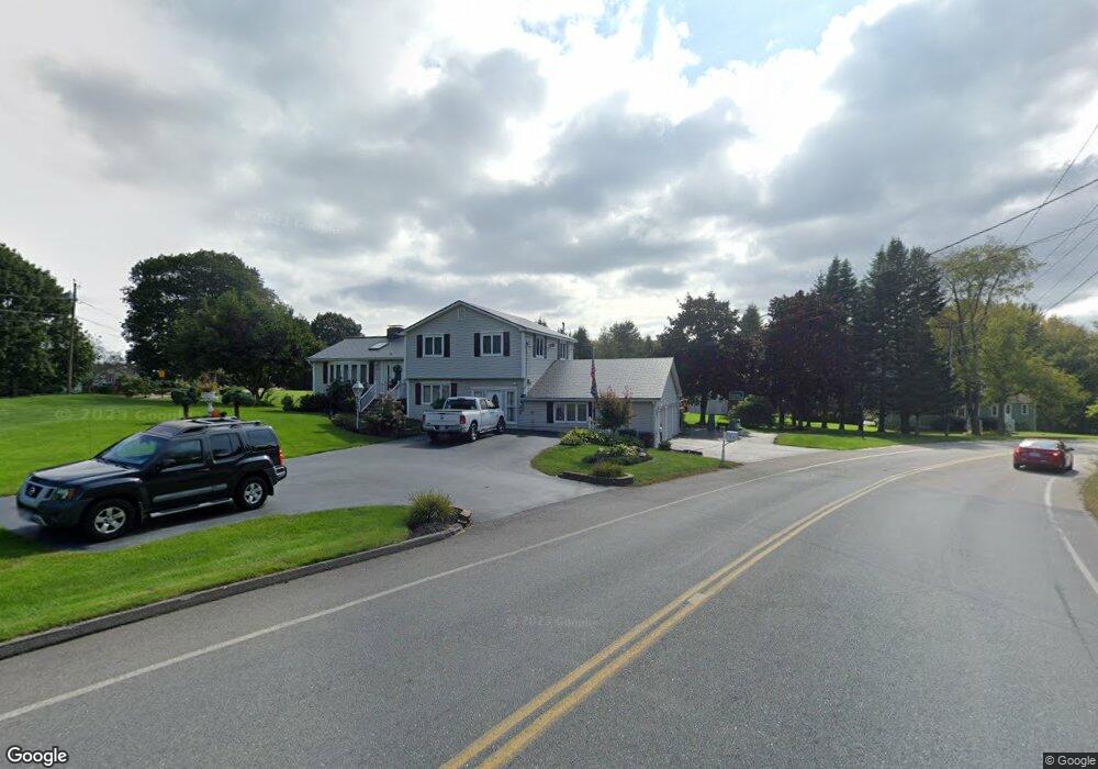
537 Rochdale St Auburn, MA 01501
West Auburn NeighborhoodEstimated Value: $414,478 - $530,000
3
Beds
3
Baths
1,320
Sq Ft
$345/Sq Ft
Est. Value
About This Home
This home is located at 537 Rochdale St, Auburn, MA 01501 and is currently estimated at $455,870, approximately $345 per square foot. 537 Rochdale St is a home located in Worcester County with nearby schools including Auburn Senior High School and Shrewsbury Montessori School - Auburn Campus.
Ownership History
Date
Name
Owned For
Owner Type
Purchase Details
Closed on
Dec 30, 1985
Bought by
Lemanski Peter J
Current Estimated Value
Create a Home Valuation Report for This Property
The Home Valuation Report is an in-depth analysis detailing your home's value as well as a comparison with similar homes in the area
Home Values in the Area
Average Home Value in this Area
Purchase History
| Date | Buyer | Sale Price | Title Company |
|---|---|---|---|
| Lemanski Peter J | $117,500 | -- |
Source: Public Records
Mortgage History
| Date | Status | Borrower | Loan Amount |
|---|---|---|---|
| Open | Lemanski Peter J | $242,400 | |
| Closed | Lemanski Peter J | $174,000 | |
| Closed | Lemanski Peter J | $20,376 |
Source: Public Records
Tax History Compared to Growth
Tax History
| Year | Tax Paid | Tax Assessment Tax Assessment Total Assessment is a certain percentage of the fair market value that is determined by local assessors to be the total taxable value of land and additions on the property. | Land | Improvement |
|---|---|---|---|---|
| 2025 | $45 | $313,700 | $82,100 | $231,600 |
| 2024 | $3,435 | $230,100 | $101,600 | $128,500 |
| 2023 | $3,287 | $207,000 | $92,400 | $114,600 |
| 2022 | $3,144 | $186,900 | $92,400 | $94,500 |
| 2021 | $34 | $156,200 | $81,600 | $74,600 |
| 2020 | $13,283 | $157,000 | $81,600 | $75,400 |
| 2019 | $2,737 | $148,600 | $80,900 | $67,700 |
| 2018 | $0 | $142,700 | $75,600 | $67,100 |
| 2017 | $2,489 | $135,700 | $68,600 | $67,100 |
| 2016 | $2,453 | $135,600 | $70,800 | $64,800 |
| 2015 | $4,822 | $279,400 | $78,600 | $200,800 |
| 2014 | $4,751 | $274,800 | $74,900 | $199,900 |
Source: Public Records
Map
Nearby Homes
- 620 Henshaw St
- 19 Virginia Dr Unit 19
- 6 Ryans Way Unit 6
- 23 Thayer Pond Dr Unit 1
- 24 Thayer Pond Dr Unit 16
- 28 Thayer Pond Dr Unit 12
- 1098 Stafford St Unit 9
- 34 Thayer Pond Dr Unit 8
- 748-A Stafford St
- 48 Appleton Rd
- 808 Washington St
- 45 Leicester St
- 0 Athens St
- 31-37 Leicester St
- 217 Prospect St
- 2 Sherman Ave
- 20 Leicester St
- 4 Linden Ln
- 27 W Applewood Dr
- 39 Hycrest Rd