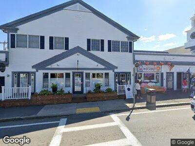
537 Route 28 Harwich Port, MA 02646
Harwich Port NeighborhoodEstimated Value: $2,915,489
--
Bed
--
Bath
20,486
Sq Ft
$142/Sq Ft
Est. Value
About This Home
This home is located at 537 Route 28, Harwich Port, MA 02646 and is currently estimated at $2,915,489, approximately $142 per square foot. 537 Route 28 is a home located in Barnstable County with nearby schools including Harwich Elementary School, Chatham Elementary School, and Monomoy Regional Middle School.
Ownership History
Date
Name
Owned For
Owner Type
Purchase Details
Closed on
Dec 11, 2002
Sold by
Port Centre Assoc Rt and Feuer Curt R
Bought by
Route 28 Nominee Rt and Lo York
Current Estimated Value
Home Financials for this Owner
Home Financials are based on the most recent Mortgage that was taken out on this home.
Original Mortgage
$900,000
Outstanding Balance
$401,962
Interest Rate
6.17%
Mortgage Type
Commercial
Estimated Equity
$2,513,527
Create a Home Valuation Report for This Property
The Home Valuation Report is an in-depth analysis detailing your home's value as well as a comparison with similar homes in the area
Home Values in the Area
Average Home Value in this Area
Purchase History
| Date | Buyer | Sale Price | Title Company |
|---|---|---|---|
| Route 28 Nominee Rt | $1,190,000 | -- |
Source: Public Records
Mortgage History
| Date | Status | Borrower | Loan Amount |
|---|---|---|---|
| Open | Route 28 Nominee Rt | $900,000 |
Source: Public Records
Tax History Compared to Growth
Tax History
| Year | Tax Paid | Tax Assessment Tax Assessment Total Assessment is a certain percentage of the fair market value that is determined by local assessors to be the total taxable value of land and additions on the property. | Land | Improvement |
|---|---|---|---|---|
| 2025 | $10,404 | $1,760,400 | $416,000 | $1,344,400 |
| 2024 | $10,354 | $1,717,100 | $399,900 | $1,317,200 |
| 2023 | $11,014 | $1,658,800 | $380,800 | $1,278,000 |
| 2022 | $13,012 | $1,604,500 | $359,300 | $1,245,200 |
| 2021 | $13,948 | $1,621,900 | $356,000 | $1,265,900 |
| 2020 | $10,824 | $1,239,900 | $311,500 | $928,400 |
| 2019 | $10,626 | $1,225,600 | $299,400 | $926,200 |
| 2018 | $11,159 | $1,231,100 | $299,400 | $931,700 |
| 2017 | $10,992 | $1,225,400 | $285,000 | $940,400 |
| 2016 | $11,125 | $1,226,600 | $279,500 | $947,100 |
| 2015 | $11,008 | $1,227,200 | $274,000 | $953,200 |
| 2014 | $10,731 | $1,223,600 | $266,100 | $957,500 |
Source: Public Records
Map
Nearby Homes
- 515 Massachusetts 28
- 515 Route 28
- 580 Route 28 Unit 9
- 77 Bank St Unit 13
- 601 Route 28 Unit 104
- 14 Park Place
- 9 Jason Ln
- 29 Hiawatha Rd
- 8 Kildee Rd
- 23 Snow Inn Rd Unit 8
- 98 Forest St
- 17 Harbor Rd
- 8 Mill Rd
- 14 Harold St Unit 2B
- 14 Harold St Unit 6D
- 14 Harold St Unit 12E
- 14 Harold St Unit 2F
- 10 Colonial Way
- 27 Saquatucket Bluffs Rd
- 537 Route 28
- 537 Route 28 Unit 2B
- 537 Route 28 Unit 1E
- 537 Route 28 Unit 2H
- 537 Route 28 Unit 1C
- 537 Route 28 Unit 2F, 2G
- 537 Route 28 Unit 2F
- 537 Route 28 Unit 2G
- 537 Route 28 Unit 1F
- 537 Route 28 Port Center Bldg
- 527 Massachusetts 28
- 541 Route 28 Unit 4
- 541 Route 28 Unit 1
- 541 Route 28 Unit 2
- 541 Route 28 Unit 3
- 527 Route 28
- 540 Route 28
- 530 Route 28
- 530 Route 28
- 545 Route 28