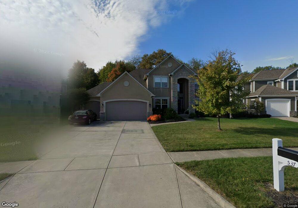
537 Trace Dr Delaware, OH 43015
Estimated Value: $675,958 - $799,000
4
Beds
5
Baths
3,698
Sq Ft
$200/Sq Ft
Est. Value
About This Home
This home is located at 537 Trace Dr, Delaware, OH 43015 and is currently estimated at $738,240, approximately $199 per square foot. 537 Trace Dr is a home located in Delaware County with nearby schools including Heritage Elementary School, Olentangy Shanahan Middle School, and Olentangy High School.
Ownership History
Date
Name
Owned For
Owner Type
Purchase Details
Closed on
Oct 7, 2005
Sold by
Silvestri Homes Ltd
Bought by
Rosales Israel and Rosales Julie S
Current Estimated Value
Home Financials for this Owner
Home Financials are based on the most recent Mortgage that was taken out on this home.
Original Mortgage
$50,000
Outstanding Balance
$37,929
Interest Rate
5.82%
Mortgage Type
Credit Line Revolving
Estimated Equity
$700,311
Purchase Details
Closed on
Jun 29, 2004
Sold by
Planned Communities Llc
Bought by
Silvestri Homes Ltd
Create a Home Valuation Report for This Property
The Home Valuation Report is an in-depth analysis detailing your home's value as well as a comparison with similar homes in the area
Home Values in the Area
Average Home Value in this Area
Purchase History
| Date | Buyer | Sale Price | Title Company |
|---|---|---|---|
| Rosales Israel | $475,100 | -- | |
| Silvestri Homes Ltd | $83,000 | Ohio Title |
Source: Public Records
Mortgage History
| Date | Status | Borrower | Loan Amount |
|---|---|---|---|
| Open | Rosales Israel | $50,000 | |
| Open | Rosales Israel | $377,590 |
Source: Public Records
Tax History
| Year | Tax Paid | Tax Assessment Tax Assessment Total Assessment is a certain percentage of the fair market value that is determined by local assessors to be the total taxable value of land and additions on the property. | Land | Improvement |
|---|---|---|---|---|
| 2024 | $10,392 | $187,610 | $45,260 | $142,350 |
| 2023 | $10,430 | $187,610 | $45,260 | $142,350 |
| 2022 | $11,599 | $169,760 | $32,730 | $137,030 |
| 2021 | $11,664 | $169,760 | $32,730 | $137,030 |
| 2020 | $11,720 | $169,760 | $32,730 | $137,030 |
| 2019 | $10,863 | $163,110 | $32,730 | $130,380 |
| 2018 | $10,912 | $163,110 | $32,730 | $130,380 |
| 2017 | $10,791 | $153,580 | $27,720 | $125,860 |
| 2016 | $10,935 | $153,580 | $27,720 | $125,860 |
| 2015 | $9,980 | $153,580 | $27,720 | $125,860 |
| 2014 | $10,121 | $153,580 | $27,720 | $125,860 |
| 2013 | $10,030 | $148,750 | $27,720 | $121,030 |
Source: Public Records
Map
Nearby Homes
- 7428 Cody Ln
- 7601 Overland Trail
- 7336 Falls View Cir
- 254 Harness Way
- 298 Waterside Dr Unit 12298
- 210 Tinley Park Cir Unit 210
- 306 Waterside Dr Unit 11306
- 7424 Gooding Blvd
- 7055 Falls View Cir Unit 77055
- 0 Gooding Blvd Unit LOT D 222032731
- 0 Gooding Blvd Unit LOT C 222032727
- 0 Gooding Blvd Unit LOT A 222032706
- 0 Gooding Blvd Unit LOT B 222032713
- 0 N Parkway Dr Unit 225026764
- 5143 and 0 Columbus Pike
- 5700 Columbus Pike
- 170 Daymark Dr
- 328 Restoration Dr
- 270 W Orange Rd
- 780 Home Rd
Your Personal Tour Guide
Ask me questions while you tour the home.