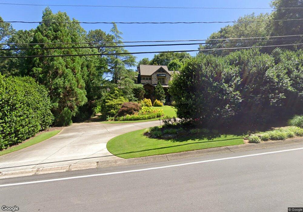
5372 Timber Ridge Rd Unit 3 Marietta, GA 30068
East Cobb NeighborhoodEstimated Value: $967,000 - $1,151,000
4
Beds
6
Baths
3,352
Sq Ft
$315/Sq Ft
Est. Value
About This Home
This home is located at 5372 Timber Ridge Rd Unit 3, Marietta, GA 30068 and is currently estimated at $1,057,203, approximately $315 per square foot. 5372 Timber Ridge Rd Unit 3 is a home located in Cobb County with nearby schools including Timber Ridge Elementary School, Dickerson Middle School, and Walton High School.
Ownership History
Date
Name
Owned For
Owner Type
Purchase Details
Closed on
Dec 2, 2005
Sold by
Twenty Twenty Ents Inc
Bought by
Jones Brenda B
Current Estimated Value
Purchase Details
Closed on
Apr 8, 2004
Sold by
Pittman David
Bought by
Twenty-Twenty Ents Inc
Home Financials for this Owner
Home Financials are based on the most recent Mortgage that was taken out on this home.
Original Mortgage
$72,775
Interest Rate
5.55%
Create a Home Valuation Report for This Property
The Home Valuation Report is an in-depth analysis detailing your home's value as well as a comparison with similar homes in the area
Home Values in the Area
Average Home Value in this Area
Purchase History
| Date | Buyer | Sale Price | Title Company |
|---|---|---|---|
| Jones Brenda B | -- | -- | |
| Jones Brenda B | $850,700 | -- | |
| Twenty-Twenty Ents Inc | $95,000 | -- |
Source: Public Records
Mortgage History
| Date | Status | Borrower | Loan Amount |
|---|---|---|---|
| Previous Owner | Twenty-Twenty Ents Inc | $72,775 |
Source: Public Records
Tax History Compared to Growth
Tax History
| Year | Tax Paid | Tax Assessment Tax Assessment Total Assessment is a certain percentage of the fair market value that is determined by local assessors to be the total taxable value of land and additions on the property. | Land | Improvement |
|---|---|---|---|---|
| 2025 | $2,920 | $460,756 | $68,400 | $392,356 |
| 2024 | $2,889 | $447,268 | $68,400 | $378,868 |
| 2023 | $2,343 | $333,528 | $54,000 | $279,528 |
| 2022 | $2,438 | $296,568 | $50,000 | $246,568 |
| 2021 | $2,438 | $296,568 | $50,000 | $246,568 |
| 2020 | $3,126 | $280,440 | $46,000 | $234,440 |
| 2019 | $2,739 | $248,524 | $38,000 | $210,524 |
| 2018 | $2,739 | $248,524 | $38,000 | $210,524 |
| 2017 | $2,355 | $245,972 | $40,000 | $205,972 |
| 2016 | $2,356 | $245,972 | $40,000 | $205,972 |
| 2015 | $2,738 | $266,056 | $54,400 | $211,656 |
| 2014 | $2,803 | $266,056 | $0 | $0 |
Source: Public Records
Map
Nearby Homes
- 1731 E Bank Dr
- 220 High Branch Way
- 5617 Asheforde Ln
- 5150 Timber Ridge Rd
- 1720 Little Willeo Rd
- 5140 Timber Ridge Rd
- 2039 Old Forge Way
- 1525 Huntingford Dr
- 3245 Bywater Trail Unit 6B
- 5122 Timber Ridge Rd
- 5184 Deering Trail Unit 2
- 1804 Shelburne Ridge
- 2066 Old Forge Way
- 889 Waterford Green
- 1382 Huntingford Dr Unit 2
- 1281 Riversound Dr
- 2255 Rushmore Dr
- 5408 W Bank Dr
- 5402 W Bank Dr Unit 3
- 970 W Point Dr
- 980 W Point Dr Unit 3
- 1804 Jacksons Creek Bluff
- 960 W Point Dr Unit 3
- 1809 Jacksons Creek Bluff
- 0 W Bank Dr Unit 7287665
- 0 W Bank Dr
- 5385 Timber Ridge Rd
- 1817 Jacksons Creek Bluff
- 1814 Jacksons Creek Bluff
- 950 W Point Dr
- 5403 W Bank Dr
- 5395 W Bank Dr
- 5409 W Bank Dr
- 5389 W Bank Dr
- 981 W Point Dr
- 971 W Point Dr
- 1824 Jacksons Creek Bluff