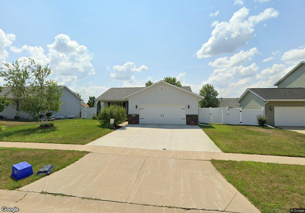
5375 21st Ave Marion, IA 52302
Estimated Value: $275,000 - $308,000
4
Beds
3
Baths
2,232
Sq Ft
$131/Sq Ft
Est. Value
About This Home
This home is located at 5375 21st Ave, Marion, IA 52302 and is currently estimated at $293,273, approximately $131 per square foot. 5375 21st Ave is a home located in Linn County with nearby schools including Linn Grove Elementary School, Excelsior Middle School, and Linn-Mar High School.
Ownership History
Date
Name
Owned For
Owner Type
Purchase Details
Closed on
Jul 21, 2010
Sold by
Crockett Kent A and Crockett Jennifer A
Bought by
Deck Steve and Lawrence Cami
Current Estimated Value
Home Financials for this Owner
Home Financials are based on the most recent Mortgage that was taken out on this home.
Original Mortgage
$147,240
Outstanding Balance
$97,990
Interest Rate
4.75%
Mortgage Type
FHA
Estimated Equity
$195,283
Purchase Details
Closed on
May 11, 1999
Sold by
Mcguire Construction Inc
Bought by
Crockett Kent A and Crockett Jennifer A
Home Financials for this Owner
Home Financials are based on the most recent Mortgage that was taken out on this home.
Original Mortgage
$112,560
Interest Rate
6.99%
Create a Home Valuation Report for This Property
The Home Valuation Report is an in-depth analysis detailing your home's value as well as a comparison with similar homes in the area
Home Values in the Area
Average Home Value in this Area
Purchase History
| Date | Buyer | Sale Price | Title Company |
|---|---|---|---|
| Deck Steve | $160,500 | None Available | |
| Crockett Kent A | $123,500 | -- |
Source: Public Records
Mortgage History
| Date | Status | Borrower | Loan Amount |
|---|---|---|---|
| Open | Deck Steve | $147,240 | |
| Previous Owner | Crockett Kent A | $112,560 |
Source: Public Records
Tax History Compared to Growth
Tax History
| Year | Tax Paid | Tax Assessment Tax Assessment Total Assessment is a certain percentage of the fair market value that is determined by local assessors to be the total taxable value of land and additions on the property. | Land | Improvement |
|---|---|---|---|---|
| 2025 | $4,456 | $255,200 | $27,300 | $227,900 |
| 2024 | $4,314 | $247,400 | $27,300 | $220,100 |
| 2023 | $4,314 | $247,400 | $27,300 | $220,100 |
| 2022 | $4,110 | $203,300 | $27,300 | $176,000 |
| 2021 | $3,878 | $203,300 | $27,300 | $176,000 |
| 2020 | $3,878 | $180,700 | $27,300 | $153,400 |
| 2019 | $3,652 | $170,400 | $30,700 | $139,700 |
| 2018 | $3,506 | $170,400 | $30,700 | $139,700 |
| 2017 | $3,418 | $162,400 | $30,700 | $131,700 |
| 2016 | $3,404 | $157,700 | $25,600 | $132,100 |
| 2015 | $3,391 | $157,700 | $25,600 | $132,100 |
| 2014 | $3,204 | $157,700 | $25,600 | $132,100 |
| 2013 | $3,056 | $157,700 | $25,600 | $132,100 |
Source: Public Records
Map
Nearby Homes
- 2200 50th St
- 2054 Shortgrass Place
- 2176 49th St Unit 2176
- 1935 48th Street Ct
- 4663 Pintail Ct Unit 4663
- 5865 Robinwood Ln
- 1570 50th St Unit 1570
- 4681 Vasey Ave
- 2605 Greenway Ct Unit 2605
- 1510 50th St Unit 1510
- 4903 Foxtail Ct
- 4390 Mcgowan Blvd
- 4315 Snowgoose Dr
- 0 Robinwood Ln
- 2370 Spoonbill Dr
- 6279 Glenwood Dr
- 6166 Cope Dr
- 6177 Glenwood Dr
- 6188 Cope Dr
- 4501 Surrey Ct