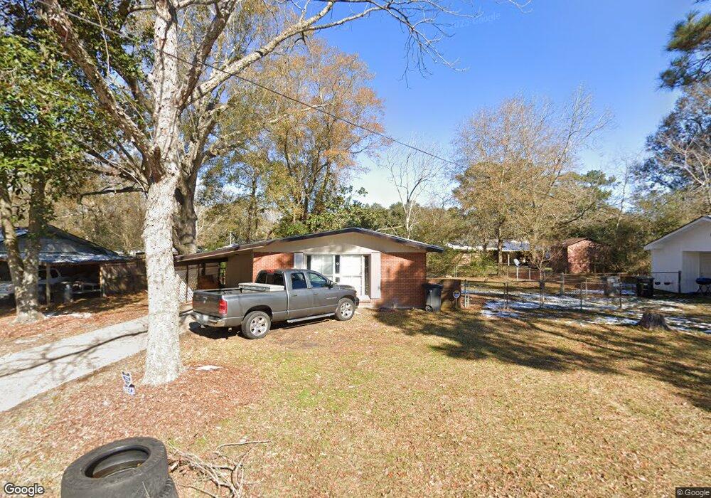
5375 Devore Dr Baton Rouge, LA 70811
Scotlandville NeighborhoodEstimated Value: $72,779 - $187,000
3
Beds
1
Bath
1,048
Sq Ft
$122/Sq Ft
Est. Value
About This Home
This home is located at 5375 Devore Dr, Baton Rouge, LA 70811 and is currently estimated at $127,695, approximately $121 per square foot. 5375 Devore Dr is a home located in East Baton Rouge Parish with nearby schools including Brownfields Elementary School, Scotlandville Magnet High School, and Impact Charter School.
Ownership History
Date
Name
Owned For
Owner Type
Purchase Details
Closed on
Sep 19, 2025
Sold by
Alexander Pamela
Bought by
Alexander Denzel
Current Estimated Value
Purchase Details
Closed on
Sep 15, 2025
Sold by
Pamela Alexander
Bought by
Alexander Denzel
Purchase Details
Closed on
Jul 28, 2011
Sold by
Millender Ronald
Bought by
Alexander Pamela
Purchase Details
Closed on
May 30, 2008
Sold by
Consolidated Holdings
Bought by
Millender Ronald
Purchase Details
Closed on
Aug 15, 2007
Sold by
Smith Fred H
Bought by
Consolidated Holdings
Create a Home Valuation Report for This Property
The Home Valuation Report is an in-depth analysis detailing your home's value as well as a comparison with similar homes in the area
Home Values in the Area
Average Home Value in this Area
Purchase History
| Date | Buyer | Sale Price | Title Company |
|---|---|---|---|
| Alexander Denzel | -- | None Listed On Document | |
| Alexander Denzel | -- | None Listed On Document | |
| Alexander Denzel | -- | None Listed On Document | |
| Alexander Pamela | $33,000 | -- | |
| Millender Ronald | $53,000 | -- | |
| Consolidated Holdings | $47,000 | -- |
Source: Public Records
Tax History
| Year | Tax Paid | Tax Assessment Tax Assessment Total Assessment is a certain percentage of the fair market value that is determined by local assessors to be the total taxable value of land and additions on the property. | Land | Improvement |
|---|---|---|---|---|
| 2024 | $567 | $4,189 | $739 | $3,450 |
| 2023 | $570 | $3,740 | $660 | $3,080 |
| 2022 | $530 | $3,740 | $660 | $3,080 |
| 2021 | $521 | $3,740 | $660 | $3,080 |
| 2020 | $527 | $3,740 | $660 | $3,080 |
| 2019 | $498 | $3,400 | $600 | $2,800 |
| 2018 | $493 | $3,400 | $600 | $2,800 |
| 2017 | $493 | $3,400 | $600 | $2,800 |
| 2016 | $483 | $3,400 | $600 | $2,800 |
| 2015 | $442 | $3,300 | $600 | $2,700 |
| 2014 | $441 | $3,300 | $600 | $2,700 |
| 2013 | -- | $3,300 | $600 | $2,700 |
Source: Public Records
Map
Nearby Homes
- 11747 Troy St
- 11685 Troy St
- 5029 Clark St
- 12265 Plank Rd
- 11225 Plank Rd
- 5715 Guice Dr
- 4534 Clark St
- 11395 Granberry Dr
- 5834 Guice Dr
- 5440 Gallantry Ct
- 12744 Middlewood Dr
- 6525 Brownfields Dr
- 13314 Lilywood Ct
- 5410 Gallantry Ct
- 13326 Lilywood Ct
- 13404 Lilywood Ct
- 5428 Gallantry Ct
- 13320 Lilywood Ct
- 11325 Cypress Dale Ave
- 11130 Cypress Dale Ave
- 5363 Devore Dr
- 5425 Devore Dr
- 5400 Brownfields Dr
- 5380 Devore Dr
- 5376 Brownfields Dr
- 5364 Devore Dr
- 5410 Brownfields Dr
- 5390 Brownfields Dr
- 5345 Devore Dr
- 5445 Devore Dr
- 5420 Devore Dr
- 5344 Devore Dr
- 5418 Brownfields Dr
- 5354 Brownfields Dr
- 5450 Devore Dr
- 5415 Truman St
- 5455 Devore Dr
- 5325 Devore Dr
- 5436 Brownfields Dr
- 5393 Brownfields Dr
Your Personal Tour Guide
Ask me questions while you tour the home.