Estimated Value: $322,626 - $339,000
3
Beds
2
Baths
1,642
Sq Ft
$202/Sq Ft
Est. Value
About This Home
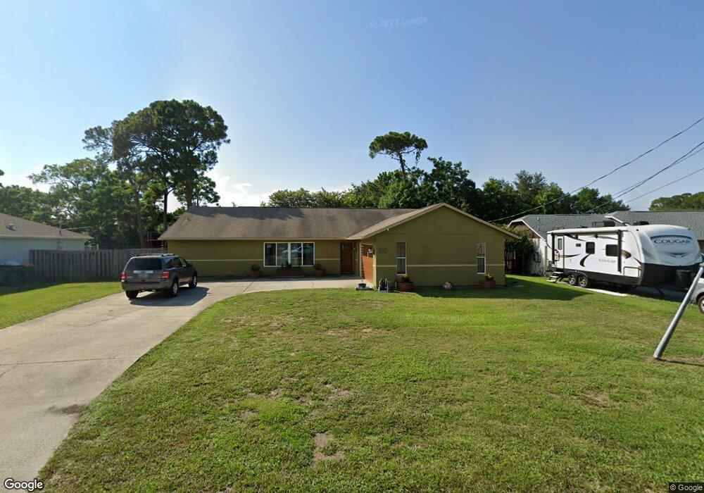
This home is located at 5380 Holden Rd, Cocoa, FL 32927 and is currently estimated at $332,157, approximately $202 per square foot. 5380 Holden Rd is a home located in Brevard County with nearby schools including Challenger 7 Elementary School, Space Coast Junior/Senior High School, and East Atlantic Prep of Brevard County.
Ownership History
Date
Name
Owned For
Owner Type
Purchase Details
Closed on
Nov 2, 2012
Sold by
Revocab Mackoul Carol Cycmanick and Revocab Carol Cycmanick Mckoul
Bought by
Kiss Debbie L
Current Estimated Value
Purchase Details
Closed on
Aug 1, 2001
Sold by
Lynchchavez Carolyn S and Lynch Carolyn S
Bought by
Kiss Debbie L
Home Financials for this Owner
Home Financials are based on the most recent Mortgage that was taken out on this home.
Original Mortgage
$99,000
Interest Rate
7.1%
Purchase Details
Closed on
Oct 14, 1996
Sold by
Lynch Joseph E
Bought by
Lynch Carolyn S
Create a Home Valuation Report for This Property
The Home Valuation Report is an in-depth analysis detailing your home's value as well as a comparison with similar homes in the area
Home Values in the Area
Average Home Value in this Area
Purchase History
| Date | Buyer | Sale Price | Title Company |
|---|---|---|---|
| Kiss Debbie L | -- | Fidelity National Title Of F | |
| Kiss Debbie L | $110,000 | -- | |
| Lynch Carolyn S | $39,500 | -- |
Source: Public Records
Mortgage History
| Date | Status | Borrower | Loan Amount |
|---|---|---|---|
| Previous Owner | Kiss Debbie L | $99,000 |
Source: Public Records
Tax History Compared to Growth
Tax History
| Year | Tax Paid | Tax Assessment Tax Assessment Total Assessment is a certain percentage of the fair market value that is determined by local assessors to be the total taxable value of land and additions on the property. | Land | Improvement |
|---|---|---|---|---|
| 2025 | $1,376 | $99,800 | -- | -- |
| 2024 | $1,339 | $96,990 | -- | -- |
| 2023 | $1,339 | $94,170 | $0 | $0 |
| 2022 | $1,247 | $91,430 | $0 | $0 |
| 2021 | $1,241 | $88,770 | $0 | $0 |
| 2020 | $1,177 | $87,550 | $0 | $0 |
| 2019 | $1,110 | $85,410 | $0 | $0 |
| 2018 | $1,101 | $83,820 | $0 | $0 |
| 2017 | $1,091 | $82,100 | $0 | $0 |
| 2016 | $1,089 | $80,420 | $18,000 | $62,420 |
| 2015 | $1,098 | $79,870 | $15,000 | $64,870 |
| 2014 | $1,098 | $79,240 | $11,000 | $68,240 |
Source: Public Records
Map
Nearby Homes
- 5446 Jamaica Rd
- 5460 Holden Rd
- 5275 Holden Rd
- 5220 Holden Rd
- 5215 Holden Rd
- 5946 Deer Ln
- 6017 Flamingo Ave
- 6061 Banbury Ave
- 5720 Flint Rd
- 00 Unknown
- 4650 N Highway 1 Hwy
- 6094 Cardiff Ave
- 5950 Ackard Ave
- 5049 Jamaica Rd
- 6309 Alleghany Ave
- 5575 Curtis Blvd
- 5715 Fairbridge St
- 6375 Cable Ave
- 6615 Dock Ave
- 6581 Bancroft Ave