Estimated Value: $247,000 - $292,000
3
Beds
2
Baths
1,250
Sq Ft
$217/Sq Ft
Est. Value
About This Home
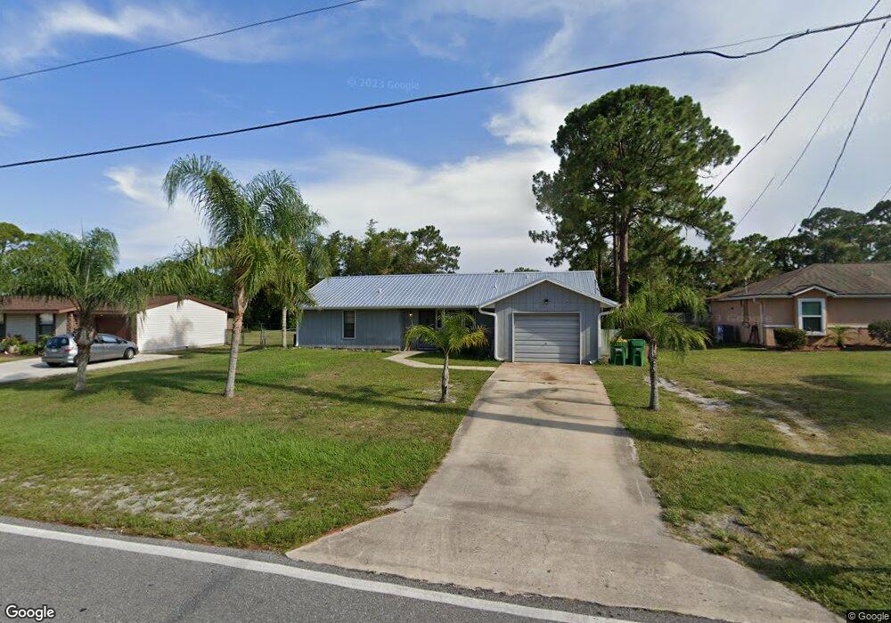
This home is located at 5385 Curtis Blvd, Cocoa, FL 32927 and is currently estimated at $271,850, approximately $217 per square foot. 5385 Curtis Blvd is a home located in Brevard County with nearby schools including Enterprise Elementary School, Space Coast Junior/Senior High School, and Sculptor Charter School.
Ownership History
Date
Name
Owned For
Owner Type
Purchase Details
Closed on
Oct 27, 2010
Sold by
Gerhardt Dorothy L and Faust Charles F
Bought by
Yocom Jason D
Current Estimated Value
Home Financials for this Owner
Home Financials are based on the most recent Mortgage that was taken out on this home.
Original Mortgage
$70,944
Outstanding Balance
$47,939
Interest Rate
4.75%
Mortgage Type
FHA
Estimated Equity
$223,911
Create a Home Valuation Report for This Property
The Home Valuation Report is an in-depth analysis detailing your home's value as well as a comparison with similar homes in the area
Home Values in the Area
Average Home Value in this Area
Purchase History
| Date | Buyer | Sale Price | Title Company |
|---|---|---|---|
| Yocom Jason D | $71,900 | Liberty Title |
Source: Public Records
Mortgage History
| Date | Status | Borrower | Loan Amount |
|---|---|---|---|
| Open | Yocom Jason D | $70,944 |
Source: Public Records
Tax History Compared to Growth
Tax History
| Year | Tax Paid | Tax Assessment Tax Assessment Total Assessment is a certain percentage of the fair market value that is determined by local assessors to be the total taxable value of land and additions on the property. | Land | Improvement |
|---|---|---|---|---|
| 2025 | $979 | $67,320 | -- | -- |
| 2024 | $960 | $65,430 | -- | -- |
| 2023 | $960 | $63,530 | $0 | $0 |
| 2022 | $912 | $61,680 | $0 | $0 |
| 2021 | $912 | $59,890 | $0 | $0 |
| 2020 | $867 | $59,070 | $0 | $0 |
| 2019 | $814 | $57,750 | $0 | $0 |
| 2018 | $815 | $56,680 | $0 | $0 |
| 2017 | $815 | $55,520 | $0 | $0 |
| 2016 | $820 | $54,380 | $18,000 | $36,380 |
| 2015 | $825 | $54,010 | $15,000 | $39,010 |
| 2014 | $829 | $53,590 | $11,000 | $42,590 |
Source: Public Records
Map
Nearby Homes
- 6615 Dock Ave
- 00 Unknown
- 5149 Arlington Rd Unit 104
- 6581 Bancroft Ave
- 5575 Curtis Blvd
- 4650 N Highway 1 Hwy
- 6643 Emil Ave
- 5715 Fairbridge St
- 5275 Holden Rd
- 5220 Holden Rd
- 5145 Fay Blvd
- 6375 Cable Ave
- 5460 Holden Rd
- 0000 Grissom Pkwy
- 5446 Jamaica Rd
- 7065 Hundred Acre Dr
- 6735 Grissom Pkwy
- 5049 Jamaica Rd
- 6240 Grissom Pkwy
- 5090 Market St
- 5395 Curtis Blvd
- 5375 Curtis Blvd
- 5405 Curtis Blvd
- 6510 Ember Ave
- 5320 Fruitport St
- 6555 Elliott Ave
- 5330 Fruitport St
- 6550 Elliot
- 6550 Elliott Ave Unit 7
- 6555 Elliot Ave
- 5310 Fruitport St
- 5340 Fruitport St
- 5415 Curtis Blvd
- 5360 Curtis Blvd
- 6560 Elliott Ave
- 5350 Fruitport St
- 0 Fairchild Ave
- 5300 Fruitport St
- 6565 Elliott Ave
- 5425 Curtis Blvd