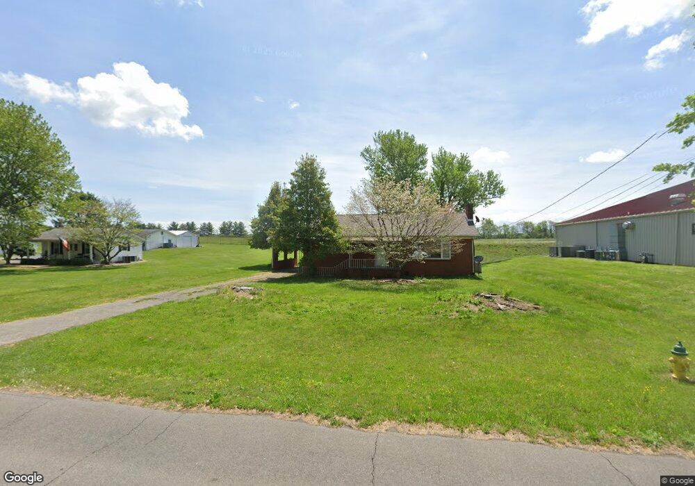
5385 Old Highway 11e Morristown, TN 37814
Estimated Value: $182,947 - $293,000
--
Bed
2
Baths
1,247
Sq Ft
$191/Sq Ft
Est. Value
About This Home
This home is located at 5385 Old Highway 11e, Morristown, TN 37814 and is currently estimated at $238,237, approximately $191 per square foot. 5385 Old Highway 11e is a home located in Hamblen County with nearby schools including Alpha Elementary School, West View Middle School, and Morristown West High School.
Ownership History
Date
Name
Owned For
Owner Type
Purchase Details
Closed on
Mar 13, 2009
Sold by
White Douglas C
Bought by
Mcginnis Timothy J
Current Estimated Value
Home Financials for this Owner
Home Financials are based on the most recent Mortgage that was taken out on this home.
Original Mortgage
$40,000
Interest Rate
5.29%
Purchase Details
Closed on
Mar 6, 2009
Sold by
Butler Clarence A
Bought by
White Douglas C
Home Financials for this Owner
Home Financials are based on the most recent Mortgage that was taken out on this home.
Original Mortgage
$40,000
Interest Rate
5.29%
Purchase Details
Closed on
Sep 16, 1993
Bought by
Butler Clarence A
Purchase Details
Closed on
Sep 18, 1987
Bought by
Butler Clarence A and Butler Delores A
Purchase Details
Closed on
Aug 25, 1987
Bought by
Hite Thomas H and Hite Gemma L
Purchase Details
Closed on
Aug 24, 1987
Bought by
Hite Thomas H and Hite Gemma L
Purchase Details
Closed on
Apr 5, 1979
Bought by
Turner Steve and Turner Glenda
Purchase Details
Closed on
Jan 2, 1979
Create a Home Valuation Report for This Property
The Home Valuation Report is an in-depth analysis detailing your home's value as well as a comparison with similar homes in the area
Home Values in the Area
Average Home Value in this Area
Purchase History
| Date | Buyer | Sale Price | Title Company |
|---|---|---|---|
| Mcginnis Timothy J | $65,000 | -- | |
| White Douglas C | $50,000 | -- | |
| Butler Clarence A | -- | -- | |
| Butler Clarence A | $43,000 | -- | |
| Hite Thomas H | $37,900 | -- | |
| Hite Thomas H | -- | -- | |
| Turner Steve | -- | -- | |
| -- | -- | -- |
Source: Public Records
Mortgage History
| Date | Status | Borrower | Loan Amount |
|---|---|---|---|
| Closed | Not Available | $40,000 |
Source: Public Records
Tax History Compared to Growth
Tax History
| Year | Tax Paid | Tax Assessment Tax Assessment Total Assessment is a certain percentage of the fair market value that is determined by local assessors to be the total taxable value of land and additions on the property. | Land | Improvement |
|---|---|---|---|---|
| 2024 | $477 | $27,100 | $3,400 | $23,700 |
| 2023 | $477 | $27,100 | $0 | $0 |
| 2022 | $856 | $27,100 | $3,400 | $23,700 |
| 2021 | $856 | $27,100 | $3,400 | $23,700 |
| 2020 | $855 | $27,100 | $3,400 | $23,700 |
| 2019 | $591 | $17,375 | $3,400 | $13,975 |
| 2018 | $547 | $17,375 | $3,400 | $13,975 |
| 2017 | $539 | $17,375 | $3,400 | $13,975 |
| 2016 | $515 | $17,375 | $3,400 | $13,975 |
| 2015 | $479 | $17,375 | $3,400 | $13,975 |
| 2014 | -- | $17,375 | $3,400 | $13,975 |
| 2013 | -- | $16,425 | $0 | $0 |
Source: Public Records
Map
Nearby Homes
- 5087 Runnerstone Rd
- 5073 Runnerstone Rd
- 5043 Runnerstone Rd
- 5031 Runnerstone Rd
- 234 Saint Johns Rd
- 5203 Cub Cir
- 412 Furrow Dr
- 413 Furrow Dr
- 420 Furrow Dr
- 419 Furrow Dr
- 428 Furrow Dr
- 434 Furrow Dr
- 429 Furrow Dr
- 5130 Old Highway 11e
- 5044 Lost Creek Dr
- 5048 Lost Creek Dr
- 5052 Lost Creek Dr
- 5056 Lost Creek Dr
- 5076 Lost Creek Dr
- 5353 Old Highway 11e
- 251 Shady Woods Rd
- 5350 Old Highway 11e
- 221 Shady Woods Rd
- 5321 Old Highway 11e
- 5320 Old Highway 11e
- 5310 Old Highway 11e
- 191 Shady Woods Rd
- 246 Panda Dr
- 181 Shady Woods Rd
- 205 Saint Johns Rd
- 182 Shady Woods Rd
- 247 Panda Dr
- 236 Panda Dr
- 241 Panda Dr
- 172 Shady Woods Rd
- 171 Shady Woods Rd
- 237 Panda Dr
- 175 Saint Johns Rd
- 229 Panda Dr