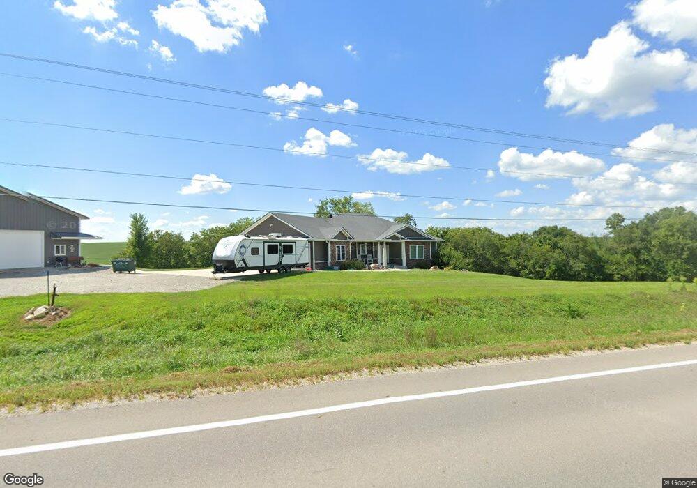
5387 Highway 117 S Colfax, IA 50054
Estimated Value: $326,000 - $563,368
3
Beds
4
Baths
1,861
Sq Ft
$227/Sq Ft
Est. Value
About This Home
This home is located at 5387 Highway 117 S, Colfax, IA 50054 and is currently estimated at $421,842, approximately $226 per square foot. 5387 Highway 117 S is a home located in Jasper County with nearby schools including Colfax-Mingo Elementary School and Colfax-Mingo High School.
Ownership History
Date
Name
Owned For
Owner Type
Purchase Details
Closed on
Mar 19, 2015
Sold by
Ingraham Ryan Mitchell and Ingraham Jill N
Bought by
Ingraham Ryan Mitchell and Ingraham Jill N
Current Estimated Value
Home Financials for this Owner
Home Financials are based on the most recent Mortgage that was taken out on this home.
Original Mortgage
$269,775
Outstanding Balance
$206,544
Interest Rate
3.67%
Mortgage Type
New Conventional
Estimated Equity
$215,298
Create a Home Valuation Report for This Property
The Home Valuation Report is an in-depth analysis detailing your home's value as well as a comparison with similar homes in the area
Home Values in the Area
Average Home Value in this Area
Purchase History
| Date | Buyer | Sale Price | Title Company |
|---|---|---|---|
| Ingraham Ryan Mitchell | -- | None Available |
Source: Public Records
Mortgage History
| Date | Status | Borrower | Loan Amount |
|---|---|---|---|
| Open | Ingraham Ryan Mitchell | $269,775 |
Source: Public Records
Tax History Compared to Growth
Tax History
| Year | Tax Paid | Tax Assessment Tax Assessment Total Assessment is a certain percentage of the fair market value that is determined by local assessors to be the total taxable value of land and additions on the property. | Land | Improvement |
|---|---|---|---|---|
| 2025 | $6,336 | $575,450 | $93,300 | $482,150 |
| 2024 | $6,336 | $470,700 | $57,380 | $413,320 |
| 2023 | $6,136 | $470,550 | $57,380 | $413,170 |
| 2022 | $5,050 | $366,450 | $57,380 | $309,070 |
| 2021 | $4,900 | $338,510 | $57,380 | $281,130 |
| 2020 | $4,900 | $303,860 | $46,930 | $256,930 |
| 2019 | $4,636 | $266,750 | $0 | $0 |
| 2018 | $4,636 | $247,900 | $0 | $0 |
| 2017 | $4,214 | $247,900 | $0 | $0 |
| 2016 | $4,312 | $247,900 | $0 | $0 |
| 2015 | $4,306 | $247,900 | $0 | $0 |
| 2014 | $4,034 | $26,530 | $0 | $0 |
Source: Public Records
Map
Nearby Homes
- 1161 S Goodrich St
- 624 S Goodrich St
- 520 S Oak Park Ave
- 11654 S 60th Ave W
- 400 S Goodrich St
- 226 S Iowa St
- 222 E Broadway St
- 215 W Spring St
- 34 E Broadway St
- 20 S Oak Park Ave
- 655 E Division St
- 108 S Walnut St
- 223 W Broadway St
- 0000 Lincoln St
- 119 W Washington St
- 501 W Broadway St
- 200 Jefferson St
- 108 N West St
- 509 N Claire St
- 300 E Front St