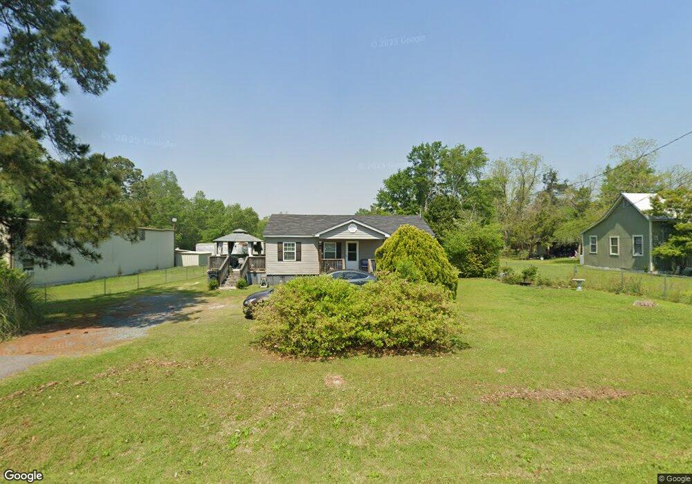
539 Barrow Ave SW Pelham, GA 31779
Estimated Value: $114,255 - $209,000
--
Bed
1
Bath
1,476
Sq Ft
$103/Sq Ft
Est. Value
About This Home
This home is located at 539 Barrow Ave SW, Pelham, GA 31779 and is currently estimated at $151,314, approximately $102 per square foot. 539 Barrow Ave SW is a home located in Mitchell County with nearby schools including Pelham Elementary School, Pelham City Middle School, and Pelham High School.
Ownership History
Date
Name
Owned For
Owner Type
Purchase Details
Closed on
Dec 2, 2019
Sold by
Curleys & Associates Inc
Bought by
Huff Freddie J
Current Estimated Value
Home Financials for this Owner
Home Financials are based on the most recent Mortgage that was taken out on this home.
Original Mortgage
$78,787
Outstanding Balance
$69,598
Interest Rate
3.7%
Mortgage Type
New Conventional
Estimated Equity
$81,716
Purchase Details
Closed on
Oct 2, 2018
Sold by
Crenshaw Shonta
Bought by
Curley & Associates Inc
Create a Home Valuation Report for This Property
The Home Valuation Report is an in-depth analysis detailing your home's value as well as a comparison with similar homes in the area
Home Values in the Area
Average Home Value in this Area
Purchase History
| Date | Buyer | Sale Price | Title Company |
|---|---|---|---|
| Huff Freddie J | $78,000 | -- | |
| Curley & Associates Inc | $16,144 | -- |
Source: Public Records
Mortgage History
| Date | Status | Borrower | Loan Amount |
|---|---|---|---|
| Open | Huff Freddie J | $78,787 |
Source: Public Records
Tax History Compared to Growth
Tax History
| Year | Tax Paid | Tax Assessment Tax Assessment Total Assessment is a certain percentage of the fair market value that is determined by local assessors to be the total taxable value of land and additions on the property. | Land | Improvement |
|---|---|---|---|---|
| 2024 | $1,497 | $35,520 | $1,800 | $33,720 |
| 2023 | $1,558 | $35,520 | $1,800 | $33,720 |
| 2022 | $1,217 | $27,440 | $1,800 | $25,640 |
| 2021 | $1,041 | $24,320 | $1,800 | $22,520 |
| 2020 | $999 | $24,320 | $1,800 | $22,520 |
| 2019 | $768 | $18,520 | $1,800 | $16,720 |
| 2018 | $837 | $18,520 | $1,800 | $16,720 |
| 2017 | $412 | $22,922 | $1,800 | $21,122 |
| 2016 | $428 | $22,922 | $1,800 | $21,122 |
| 2015 | $428 | $22,922 | $1,800 | $21,122 |
| 2014 | $428 | $22,922 | $1,800 | $21,122 |
| 2013 | $428 | $22,922 | $1,800 | $21,122 |
Source: Public Records
Map
Nearby Homes
- 443 Stewart St SW
- 425 Hollis St SW
- 389 Stewart St SW
- 410 Hollis St SW
- 0 Old Ga Highway 3
- 277 Saunders St SW
- 5854 Mount Olive Rd
- 209 McDonald St SW
- 3** Youngs Mill Rd
- 135 Baggs Ave SE
- 212 Hand Ave W
- 354 Bennett St NW
- 183 Baggs Ave SE
- 210 Castleberry St NW
- 233 Cannon St NW
- 199 Carroll St NE
- 375 Baggs Ave SE
- 323 Curry St NE
- 335 Curry St NE
- 438 Dogwood Dr NE
- 533 Barrow Ave SW
- 534 Barrow Ave SW
- 431 Stewart St SW
- 424 Virginia St SW
- 423 Stewart St SW
- 424 Stewart St SW
- 411 Stewart St SW
- 421 Hollis St SW
- 401 Stewart St SW
- 442 Palmer St SW
- 442 Palmer St SW
- 377 Hollis St SW
- 365 Hollis St SW
- 409 Palmer St SW
- 468 Palmer St SW
- 500 Palmer St SW
- 450 Palmer St SW
- 399 Palmer St SW
- 378 Hollis St SW
- 464 Barrow Ave SW