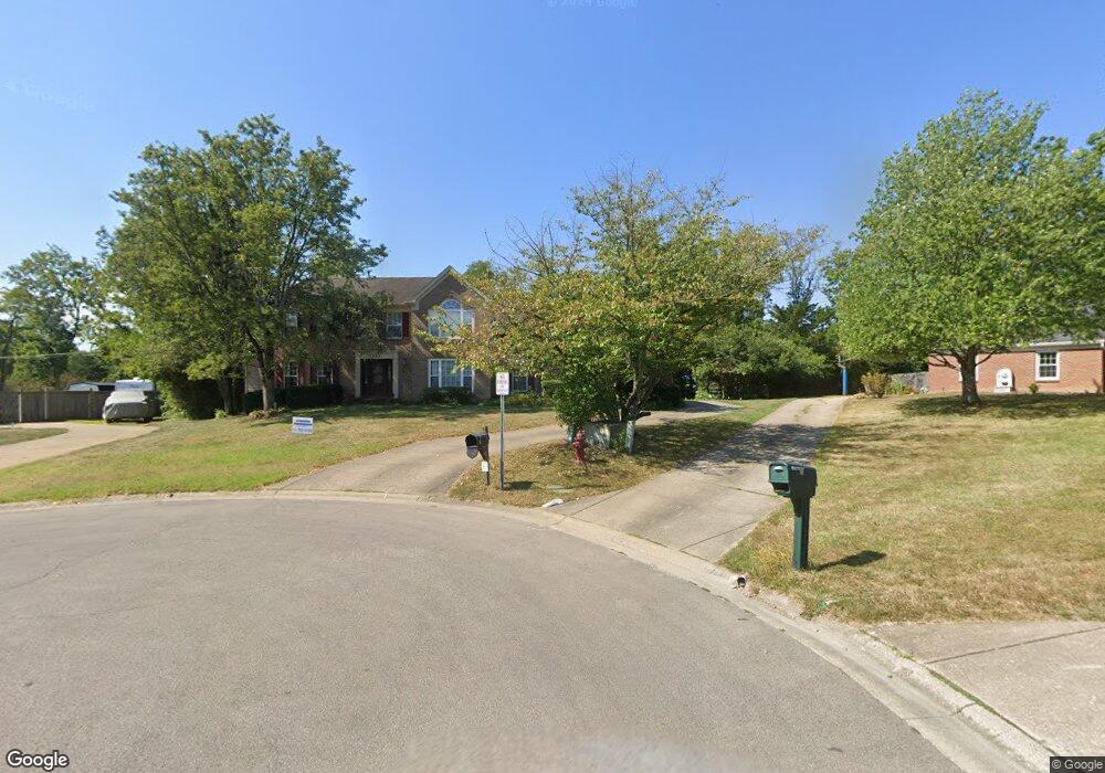
539 Common Wealth Dr Cincinnati, OH 45244
Estimated Value: $475,000 - $561,000
4
Beds
4
Baths
2,942
Sq Ft
$175/Sq Ft
Est. Value
About This Home
This home is located at 539 Common Wealth Dr, Cincinnati, OH 45244 and is currently estimated at $514,307, approximately $174 per square foot. 539 Common Wealth Dr is a home located in Clermont County with nearby schools including St. Veronica Catholic School.
Ownership History
Date
Name
Owned For
Owner Type
Purchase Details
Closed on
Sep 9, 2024
Sold by
Stark Dennis R and Stark Margaret M
Bought by
Dennis And Margaret Stark Family Trust and Stark
Current Estimated Value
Purchase Details
Closed on
May 2, 1994
Purchase Details
Closed on
Dec 4, 1992
Purchase Details
Closed on
Nov 1, 1989
Create a Home Valuation Report for This Property
The Home Valuation Report is an in-depth analysis detailing your home's value as well as a comparison with similar homes in the area
Purchase History
| Date | Buyer | Sale Price | Title Company |
|---|---|---|---|
| Dennis And Margaret Stark Family Trust | -- | None Listed On Document | |
| Dennis And Margaret Stark Family Trust | -- | None Listed On Document | |
| -- | $190,000 | -- | |
| -- | $176,500 | -- | |
| -- | $21,000 | -- |
Source: Public Records
Tax History
| Year | Tax Paid | Tax Assessment Tax Assessment Total Assessment is a certain percentage of the fair market value that is determined by local assessors to be the total taxable value of land and additions on the property. | Land | Improvement |
|---|---|---|---|---|
| 2024 | $6,990 | $153,340 | $18,410 | $134,930 |
| 2023 | $7,060 | $153,340 | $18,410 | $134,930 |
| 2022 | $6,186 | $102,060 | $12,250 | $89,810 |
| 2021 | $6,191 | $102,060 | $12,250 | $89,810 |
| 2020 | $5,934 | $102,060 | $12,250 | $89,810 |
| 2019 | $4,897 | $84,320 | $11,450 | $72,870 |
| 2018 | $4,899 | $84,320 | $11,450 | $72,870 |
| 2017 | $5,011 | $84,320 | $11,450 | $72,870 |
| 2016 | $5,011 | $77,350 | $10,500 | $66,850 |
| 2015 | $4,855 | $77,350 | $10,500 | $66,850 |
| 2014 | $4,855 | $77,350 | $10,500 | $66,850 |
| 2013 | $4,335 | $67,310 | $11,200 | $56,110 |
Source: Public Records
Map
Nearby Homes
- 4885 Beechwood Rd
- 673 Brandy Way
- 4992 Mallet Hill Dr
- 4834 Summerside Rd
- 2 Mount Carmel Rd
- 4806 Forest Meadows Ct
- 689 Bostwick Ct
- 634 Chateau Dr
- 4773 Beechwood Rd
- 551 N View Dr
- 481 Big Moe Dr
- 695 Miami View Trail
- 4775 Timberknoll Dr
- 454 Dartmouth Cir Unit 43
- 0 Pearl St Unit 1225343
- 0 Pearl St Unit 1841806
- 602 Stanton Ave
- 1 Mt Carmel Rd
- 822 Stanton Ave
- 141 Wrenwood Ln
- 543 Common Wealth Dr
- 536 Common Wealth Dr
- 4989 Cinnamon Ct
- 4992 Sesame St
- 540 Common Wealth Dr
- 549 Common Wealth Dr
- 4975 Cinnamon Dr
- 4985 Cinnamon Ct
- 4988 Sesame St
- 555 Common Wealth Dr
- 4979 Cinnamon Dr
- 5005 Sesame St
- 548 Common Wealth Dr
- 4984 Sesame St
- 4981 Cinnamon Ct
- 4983 Cinnamon Dr
- 4970 Cinnamon Dr
- 4974 Cinnamon Dr
- 5001 Sesame St
- 552 Common Wealth Dr
Your Personal Tour Guide
Ask me questions while you tour the home.