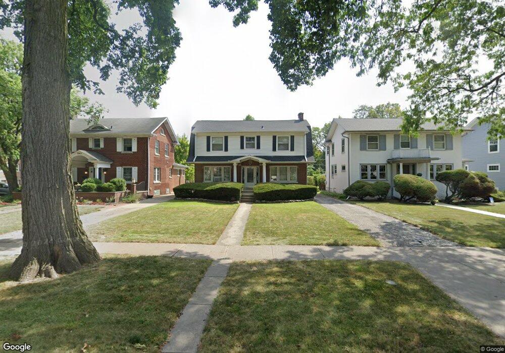
539 Lathrop Ave River Forest, IL 60305
Estimated Value: $712,000 - $793,000
3
Beds
2
Baths
1,976
Sq Ft
$383/Sq Ft
Est. Value
About This Home
This home is located at 539 Lathrop Ave, River Forest, IL 60305 and is currently estimated at $756,506, approximately $382 per square foot. 539 Lathrop Ave is a home located in Cook County with nearby schools including Roosevelt Middle School, Lincoln Elementary School, and Oak Park and River Forest High School.
Ownership History
Date
Name
Owned For
Owner Type
Purchase Details
Closed on
May 24, 1995
Sold by
Tyler Woodrow S and Tyler Maureen
Bought by
Pohlman Daniel J and Pohlman Deborah A
Current Estimated Value
Home Financials for this Owner
Home Financials are based on the most recent Mortgage that was taken out on this home.
Original Mortgage
$220,000
Interest Rate
8.26%
Purchase Details
Closed on
Aug 24, 1993
Sold by
Wholey Richard and Wholey Deborah L
Bought by
Tyler Woodrow S and Tyler Maureen
Home Financials for this Owner
Home Financials are based on the most recent Mortgage that was taken out on this home.
Original Mortgage
$181,100
Interest Rate
7.24%
Create a Home Valuation Report for This Property
The Home Valuation Report is an in-depth analysis detailing your home's value as well as a comparison with similar homes in the area
Home Values in the Area
Average Home Value in this Area
Purchase History
| Date | Buyer | Sale Price | Title Company |
|---|---|---|---|
| Pohlman Daniel J | $253,000 | Intercounty Title | |
| Pohlman Daniel J | $253,000 | Intercounty Title | |
| Tyler Woodrow S | $170,666 | -- |
Source: Public Records
Mortgage History
| Date | Status | Borrower | Loan Amount |
|---|---|---|---|
| Previous Owner | Pohlman Daniel J | $220,000 | |
| Previous Owner | Tyler Woodrow S | $181,100 |
Source: Public Records
Tax History Compared to Growth
Tax History
| Year | Tax Paid | Tax Assessment Tax Assessment Total Assessment is a certain percentage of the fair market value that is determined by local assessors to be the total taxable value of land and additions on the property. | Land | Improvement |
|---|---|---|---|---|
| 2024 | $15,518 | $60,000 | $11,960 | $48,040 |
| 2023 | $15,893 | $60,000 | $11,960 | $48,040 |
| 2022 | $15,893 | $52,636 | $10,350 | $42,286 |
| 2021 | $16,445 | $56,210 | $10,350 | $45,860 |
| 2020 | $16,138 | $56,210 | $10,350 | $45,860 |
| 2019 | $15,976 | $54,892 | $9,430 | $45,462 |
| 2018 | $15,122 | $54,892 | $9,430 | $45,462 |
| 2017 | $15,086 | $54,892 | $9,430 | $45,462 |
| 2016 | $13,974 | $45,937 | $7,820 | $38,117 |
| 2015 | $13,688 | $45,937 | $7,820 | $38,117 |
| 2014 | $13,281 | $48,448 | $7,820 | $40,628 |
| 2013 | $13,501 | $50,479 | $7,820 | $42,659 |
Source: Public Records
Map
Nearby Homes
- 547 Jackson Ave
- 407 Ashland Ave Unit 3G
- 407 Ashland Ave Unit 5F
- 410 Ashland Ave Unit 1A
- 414 Franklin Ave Unit 3A
- 435 William St Unit 205
- 424 Park Ave Unit 206
- 414 Clinton Place Unit 302
- 727 Clinton Place
- 838 William St
- 7415 Dixon St
- 7911 Oak Ave
- 734 Bonnie Brae Place
- 213 Ashland Ave
- 7241 Franklin St Unit B
- 922 Jackson Ave
- 7212 Oak Ave Unit 3NE
- 7240 Franklin St Unit 2A
- 7210 Oak Ave Unit 3SW
- 7200 Oak Ave Unit 3NW
- 543 Lathrop Ave
- 535 Lathrop Ave
- 531 Lathrop Ave
- 527 Lathrop Ave
- 542 Jackson Ave
- 534 Jackson Ave
- 523 Lathrop Ave
- 530 Jackson Ave
- 538 Lathrop Ave
- 542 Lathrop Ave
- 519 Lathrop Ave
- 530 Lathrop Ave
- 546 Lathrop Ave
- 522 Jackson Ave
- 550 Lathrop Ave
- 515 Lathrop Ave
- 554 Lathrop Ave
- 518 Jackson Ave
- 558 Lathrop Ave
- 511 Lathrop Ave