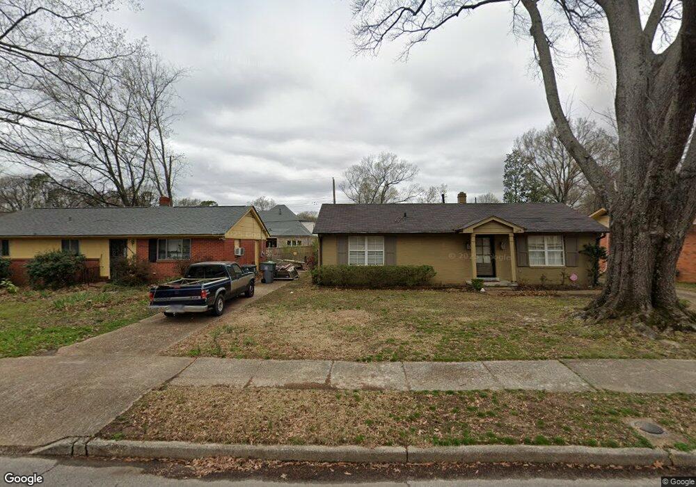
539 Mineral Rd Memphis, TN 38120
Audubon Park NeighborhoodEstimated Value: $223,000 - $291,000
3
Beds
2
Baths
1,391
Sq Ft
$180/Sq Ft
Est. Value
About This Home
This home is located at 539 Mineral Rd, Memphis, TN 38120 and is currently estimated at $250,053, approximately $179 per square foot. 539 Mineral Rd is a home located in Shelby County with nearby schools including Richland Elementary School, White Station Middle, and White Station High.
Ownership History
Date
Name
Owned For
Owner Type
Purchase Details
Closed on
Mar 29, 2019
Sold by
Dixon Richard
Bought by
Dixon Richard and Dixon Anne
Current Estimated Value
Purchase Details
Closed on
Feb 6, 2008
Sold by
Patrick Christopher Hays and Patrick Jennifer
Bought by
Dixon Richard
Home Financials for this Owner
Home Financials are based on the most recent Mortgage that was taken out on this home.
Original Mortgage
$127,300
Outstanding Balance
$80,758
Interest Rate
6.17%
Mortgage Type
Purchase Money Mortgage
Estimated Equity
$169,295
Purchase Details
Closed on
Aug 20, 2007
Sold by
Mcatee William
Bought by
Patrick Christopher Hays and Patrick Jennifer
Purchase Details
Closed on
Dec 4, 2002
Sold by
Mcatee William A
Bought by
Mcatee William
Create a Home Valuation Report for This Property
The Home Valuation Report is an in-depth analysis detailing your home's value as well as a comparison with similar homes in the area
Home Values in the Area
Average Home Value in this Area
Purchase History
| Date | Buyer | Sale Price | Title Company |
|---|---|---|---|
| Dixon Richard | -- | None Available | |
| Dixon Richard | $134,000 | None Available | |
| Patrick Christopher Hays | -- | None Available | |
| Mcatee William | -- | First National Financial Tit |
Source: Public Records
Mortgage History
| Date | Status | Borrower | Loan Amount |
|---|---|---|---|
| Open | Dixon Richard | $127,300 |
Source: Public Records
Tax History Compared to Growth
Tax History
| Year | Tax Paid | Tax Assessment Tax Assessment Total Assessment is a certain percentage of the fair market value that is determined by local assessors to be the total taxable value of land and additions on the property. | Land | Improvement |
|---|---|---|---|---|
| 2025 | $1,460 | $58,350 | $10,000 | $48,350 |
| 2024 | $1,460 | $43,075 | $6,250 | $36,825 |
| 2023 | $2,624 | $43,075 | $6,250 | $36,825 |
| 2022 | $2,624 | $43,075 | $6,250 | $36,825 |
| 2021 | $2,655 | $43,075 | $6,250 | $36,825 |
| 2020 | $2,324 | $32,075 | $5,075 | $27,000 |
| 2019 | $2,324 | $32,075 | $5,075 | $27,000 |
| 2018 | $2,324 | $32,075 | $5,075 | $27,000 |
| 2017 | $1,318 | $32,075 | $5,075 | $27,000 |
| 2016 | $1,218 | $27,875 | $0 | $0 |
| 2014 | $1,218 | $27,875 | $0 | $0 |
Source: Public Records
Map
Nearby Homes
- 536 Wheaton Park Cove N
- 580 N Oak Grove Rd
- 430 Mcelroy Rd
- 422 Mcelroy Rd
- 432 Malboro Rd
- 496 Chalmers Rd
- 424 Malboro Rd
- 446 Rosser Rd
- 379 Mcelroy Rd
- 529 Fleda Rd
- 5468 Mason Rd
- 551 N White Station Rd
- 5362 Wilton Ave
- 448 N White Station Rd
- 5137 Whitehall Ave
- 5176 White Cliff Dr
- 284 Fountain River Dr
- 5238 Peg Ln
- 296 N White Station Rd
- 5119 Tarrytown Dr
- 533 Mineral Rd
- 545 Mineral Rd
- 527 Mineral Rd
- 551 Mineral Rd
- 536 Mineral Rd
- 521 Mineral Rd
- 542 Mineral Rd
- 5405 Mesquite Rd
- 557 Mineral Rd
- 530 Mineral Rd
- 548 Mineral Rd
- 524 Mineral Rd
- 5399 Mesquite Rd
- 515 Mineral Rd
- 558 Mineral Rd
- 518 Mineral Rd
- 5393 Mesquite Rd
- 5435 Mesquite Rd
- 509 Mineral Rd
- 535 Mcdermitt Rd