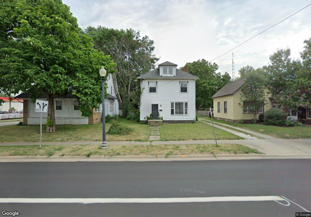
539 N Union Ave Alliance, OH 44601
Estimated Value: $63,000 - $96,398
3
Beds
2
Baths
1,584
Sq Ft
$50/Sq Ft
Est. Value
About This Home
This home is located at 539 N Union Ave, Alliance, OH 44601 and is currently estimated at $79,799, approximately $50 per square foot. 539 N Union Ave is a home located in Stark County with nearby schools including Alliance Early Learning School, Alliance Intermediate School at Northside, and Alliance Middle School.
Ownership History
Date
Name
Owned For
Owner Type
Purchase Details
Closed on
Feb 6, 2009
Sold by
Wells Fargo Bank Na
Bought by
Schroeder Herbert T and Schroeder Hong T
Current Estimated Value
Purchase Details
Closed on
May 14, 2008
Sold by
Ritch Crystal and Ritch Richard
Bought by
Wells Fargo Bank Na and Pooling & Servicing Agreement Asset Back
Purchase Details
Closed on
Sep 29, 2000
Sold by
Hyer Loreen R
Bought by
Ritch Richard and Ritch Crystal
Home Financials for this Owner
Home Financials are based on the most recent Mortgage that was taken out on this home.
Original Mortgage
$47,025
Interest Rate
7.98%
Mortgage Type
Stand Alone First
Create a Home Valuation Report for This Property
The Home Valuation Report is an in-depth analysis detailing your home's value as well as a comparison with similar homes in the area
Home Values in the Area
Average Home Value in this Area
Purchase History
| Date | Buyer | Sale Price | Title Company |
|---|---|---|---|
| Schroeder Herbert T | $13,600 | Sovereign Title Agency Llc | |
| Wells Fargo Bank Na | $37,000 | None Available | |
| Ritch Richard | $49,500 | Americas Choice Title Agency |
Source: Public Records
Mortgage History
| Date | Status | Borrower | Loan Amount |
|---|---|---|---|
| Previous Owner | Ritch Richard | $47,025 |
Source: Public Records
Tax History
| Year | Tax Paid | Tax Assessment Tax Assessment Total Assessment is a certain percentage of the fair market value that is determined by local assessors to be the total taxable value of land and additions on the property. | Land | Improvement |
|---|---|---|---|---|
| 2022 | $609 | $14,710 | $3,120 | $11,590 |
| 2021 | $611 | $14,710 | $3,120 | $11,590 |
| 2020 | $489 | $11,000 | $2,280 | $8,720 |
| 2019 | $483 | $11,000 | $2,280 | $8,720 |
| 2018 | $485 | $11,000 | $2,280 | $8,720 |
| 2017 | $451 | $10,050 | $1,890 | $8,160 |
| 2016 | $455 | $10,050 | $1,890 | $8,160 |
| 2015 | $459 | $10,050 | $1,890 | $8,160 |
| 2014 | $509 | $10,610 | $2,000 | $8,610 |
| 2013 | $254 | $10,610 | $2,000 | $8,610 |
Source: Public Records
Map
Nearby Homes
- 505 N Union Ave
- 710 N Freedom Ave
- 849 Walnut Ave
- 717 Garfield Ave
- 62 E Market St
- 171 1/2 W Main St
- 361 E Main St
- 163 W Market St
- 264 W Market St
- 33 S Lincoln Ave
- 11344 Walnut Ave NE
- 118 S Mckinley Ave
- 343 W Columbia St
- 427 S Union Ave
- 847 E Patterson St
- V/L S Freedom Ave
- 1015 Reed St
- 1025 Reed St
- 15832 Waverly St NE
- 228 W Oxford St
- 553 N Union Ave
- 525 N Union Ave
- 35 E Wayne St
- 35 E Wayne St
- 519 N Union Ave
- 515 N Union Ave
- 45 E Wayne St
- 47 E Wayne St
- 540 N Union Ave
- 26 E Washington St
- 55 E Wayne St
- 512 N Union Ave
- 536 N Park Ave
- 12 W Wayne St
- 534 N Union Ave
- 40 E Washington St
- 546 N Park Ave
- 512 N Park Ave
- 556 N Park Ave
- 451 N Union Ave
Your Personal Tour Guide
Ask me questions while you tour the home.