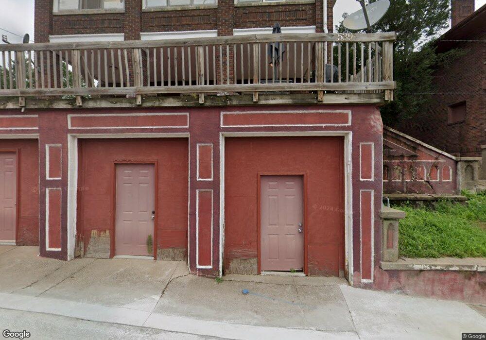
539 Pickett St Dubuque, IA 52001
Estimated Value: $183,000 - $244,532
6
Beds
3
Baths
4,954
Sq Ft
$44/Sq Ft
Est. Value
About This Home
This home is located at 539 Pickett St, Dubuque, IA 52001 and is currently estimated at $217,133, approximately $43 per square foot. 539 Pickett St is a home located in Dubuque County with nearby schools including Lincoln Elementary School, George Washington Middle School, and Dubuque Senior High School.
Ownership History
Date
Name
Owned For
Owner Type
Purchase Details
Closed on
Apr 29, 2013
Sold by
Tri State Property Management Llc
Bought by
Nottingham Properties Llc
Current Estimated Value
Home Financials for this Owner
Home Financials are based on the most recent Mortgage that was taken out on this home.
Original Mortgage
$320,000
Outstanding Balance
$226,285
Interest Rate
3.51%
Mortgage Type
Future Advance Clause Open End Mortgage
Estimated Equity
-$9,152
Create a Home Valuation Report for This Property
The Home Valuation Report is an in-depth analysis detailing your home's value as well as a comparison with similar homes in the area
Home Values in the Area
Average Home Value in this Area
Purchase History
| Date | Buyer | Sale Price | Title Company |
|---|---|---|---|
| Nottingham Properties Llc | $35,000 | None Available |
Source: Public Records
Mortgage History
| Date | Status | Borrower | Loan Amount |
|---|---|---|---|
| Open | Nottingham Properties Llc | $320,000 |
Source: Public Records
Tax History Compared to Growth
Tax History
| Year | Tax Paid | Tax Assessment Tax Assessment Total Assessment is a certain percentage of the fair market value that is determined by local assessors to be the total taxable value of land and additions on the property. | Land | Improvement |
|---|---|---|---|---|
| 2025 | $2,120 | $154,800 | $22,300 | $132,500 |
| 2024 | $2,120 | $147,400 | $21,000 | $126,400 |
| 2023 | $2,358 | $151,800 | $21,000 | $130,800 |
| 2022 | $2,758 | $166,760 | $15,740 | $151,020 |
| 2021 | $2,758 | $166,760 | $15,740 | $151,020 |
| 2020 | $2,825 | $149,750 | $15,740 | $134,010 |
| 2019 | $4,125 | $149,750 | $15,740 | $134,010 |
| 2018 | $8,190 | $142,680 | $13,640 | $129,040 |
| 2017 | $5,107 | $142,680 | $13,640 | $129,040 |
| 2016 | $5,978 | $131,550 | $13,640 | $117,910 |
| 2015 | $2,488 | $131,550 | $13,640 | $117,910 |
| 2014 | $2,420 | $131,550 | $13,640 | $117,910 |
Source: Public Records
Map
Nearby Homes
- 568 Loras Blvd
- 603 Arlington St
- 609 Arlington St
- 623 Arlington St
- 642 Arlington St
- 460 Loras Blvd
- 604 Chestnut St
- 563 W 11th St
- 721 Rose St Unit 721-723 Rose Street
- 1477 Locust St
- 364 W Locust St Unit 366 W Locust Street
- 1255 - 1257 Locust St
- 601 Angella St
- 645 Angella St
- 1337 Main St
- 251 W 17th St Unit 253 West 17th St
- 1374 Main St
- 1906 Ellis St
- 945 Spruce St
- 1735 Madison St Unit 1737 & 1745 Madison
- 529 Pickett St
- 515 Pickett St
- 575 Loras Blvd
- 583 Loras Blvd
- 548 May Place
- 561 Loras Blvd
- 553 Loras Blvd
- 563 Loras Blvd
- 567 Loras Blvd
- 567 Loras Blvd Unit 1
- 1401 Henion St
- 431 1/2 W 16th St
- 575 Loras Blvd
- 533 Loras Blvd
- 1485 Cornell St
- 533 Loras Blvd
- 1493 Cornell St
- 525 Loras Blvd
- 517 Loras Blvd
- 509 Loras Blvd