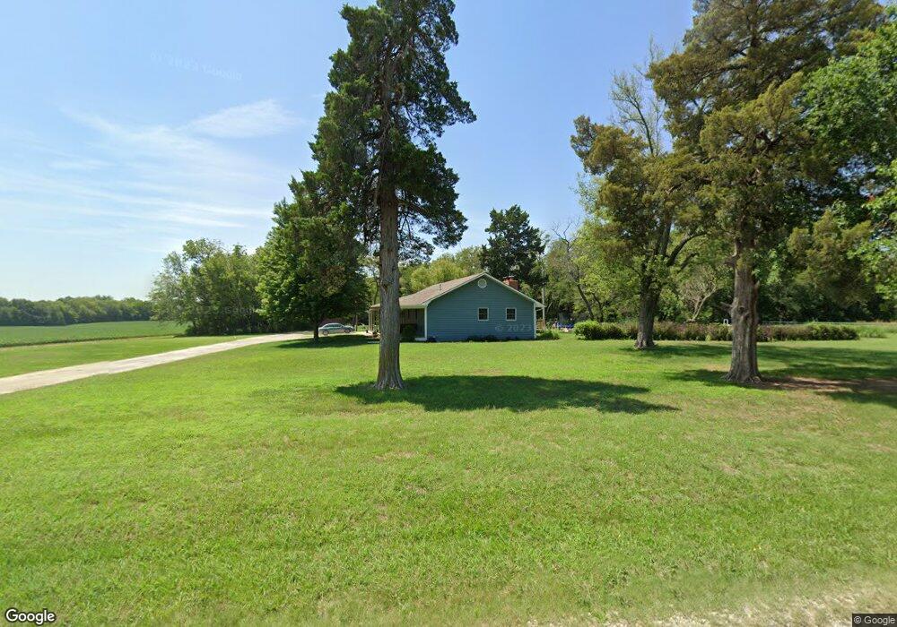
5397 SW 85th St Augusta, KS 67010
Estimated Value: $349,895 - $367,000
3
Beds
2
Baths
1,620
Sq Ft
$223/Sq Ft
Est. Value
About This Home
This home is located at 5397 SW 85th St, Augusta, KS 67010 and is currently estimated at $360,974, approximately $222 per square foot. 5397 SW 85th St is a home located in Butler County with nearby schools including Bluestem Elementary School, Bluestem Junior/Senior High School, and St. James Catholic School.
Ownership History
Date
Name
Owned For
Owner Type
Purchase Details
Closed on
Jun 27, 2018
Sold by
Schneider Roger Alan and Schneider Susan M
Bought by
Brungardt Aloysius S and Brungardt Brenda M
Current Estimated Value
Home Financials for this Owner
Home Financials are based on the most recent Mortgage that was taken out on this home.
Original Mortgage
$227,103
Outstanding Balance
$197,254
Interest Rate
4.6%
Mortgage Type
New Conventional
Estimated Equity
$163,720
Create a Home Valuation Report for This Property
The Home Valuation Report is an in-depth analysis detailing your home's value as well as a comparison with similar homes in the area
Home Values in the Area
Average Home Value in this Area
Purchase History
| Date | Buyer | Sale Price | Title Company |
|---|---|---|---|
| Brungardt Aloysius S | -- | Alpha Title Llc | |
| Brungardt Aloysius S | $283,879 | Alpha Title Company |
Source: Public Records
Mortgage History
| Date | Status | Borrower | Loan Amount |
|---|---|---|---|
| Open | Brungardt Aloysius S | $227,103 | |
| Closed | Brungardt Aloysius S | $227,103 |
Source: Public Records
Tax History Compared to Growth
Tax History
| Year | Tax Paid | Tax Assessment Tax Assessment Total Assessment is a certain percentage of the fair market value that is determined by local assessors to be the total taxable value of land and additions on the property. | Land | Improvement |
|---|---|---|---|---|
| 2025 | $43 | $36,134 | $5,313 | $30,821 |
| 2024 | $43 | $35,459 | $4,878 | $30,581 |
| 2023 | $3,023 | $33,178 | $4,902 | $28,276 |
| 2022 | $4,085 | $29,345 | $3,832 | $25,513 |
| 2021 | $3,023 | $25,377 | $3,216 | $22,161 |
| 2020 | $3,012 | $24,970 | $2,913 | $22,057 |
| 2019 | $3,023 | $24,465 | $2,809 | $21,656 |
| 2018 | $2,948 | $24,426 | $2,666 | $21,760 |
| 2017 | $3,059 | $23,951 | $2,253 | $21,698 |
| 2014 | -- | $190,580 | $15,980 | $174,600 |
Source: Public Records
Map
Nearby Homes
- 2304 Chestnut Ct
- 1034 E Stafford Ct
- 1032 E Stafford Ct
- 2701 N Mainsgate Dr
- 1028 Bedell Rd
- 2823 N Rutland Ln
- 2815 N Rutland Ln
- 2814 N Rutland Ln
- 2809 N Rutland Ln
- 2825 N Rutland Ln
- 2714 Rushwood Dr
- 2712 Rushwood Dr
- 1412 N Kelly Ct
- 2331 Leigh St
- 814 Rushwood Ct
- 2801 Danbury Rd
- 3110 Country Ln
- 3005 Stone Lake Dr
- 2335 Crest St
- 3103 Susan St
- 5243 SW 85th St
- 5495 SW 80th St
- 8422 SW Hopkins Switch Rd
- 8596 SW Hopkins Switch Rd
- 5666 SW 80th St
- 8055 SW Hopkins Switch Rd
- 000 SW Shumway Rd
- 5843 SW 90th St
- 1212 Rolling Hills Dr
- 1210 Rolling Hills Dr
- 1206 Rolling Hills Dr
- 1204 Rolling Hills Dr
- 1202 Rolling Hills Dr
- 1200 Rolling Hills Dr Unit LOT 13 BLOCK 2 WILLO
- 2208 Foxfire Ct
- 2206 Foxfire Ct
- 1108 Rolling Hills Dr
- 2204 Foxfire Ct
- 2205 Foxfire Ct Unit LOTS 17 & 24 BLOCK 1
- 1106 Rolling Hills Dr