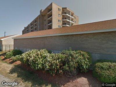
54-64 Broad Reach Unit 603 Weymouth, MA 02191
Estimated Value: $422,000 - $436,615
1
Bed
1
Bath
892
Sq Ft
$483/Sq Ft
Est. Value
About This Home
This home is located at 54-64 Broad Reach Unit 603, Weymouth, MA 02191 and is currently estimated at $430,404, approximately $482 per square foot. 54-64 Broad Reach Unit 603 is a home located in Norfolk County with nearby schools including Wessagusset Elementary School, Abigail Adams Middle School, and Weymouth Middle School Chapman.
Ownership History
Date
Name
Owned For
Owner Type
Purchase Details
Closed on
Mar 31, 2025
Sold by
Remmes Ft and Remmes
Bought by
Sawtelle Sundee A
Current Estimated Value
Home Financials for this Owner
Home Financials are based on the most recent Mortgage that was taken out on this home.
Original Mortgage
$300,000
Outstanding Balance
$300,000
Interest Rate
6.87%
Mortgage Type
Purchase Money Mortgage
Estimated Equity
$130,404
Purchase Details
Closed on
Apr 7, 2022
Sold by
Sullivan Kathleen
Bought by
Remmes Family Irt
Purchase Details
Closed on
Dec 30, 2015
Sold by
Rumble Rodney B
Bought by
Sullivan Kathleen
Create a Home Valuation Report for This Property
The Home Valuation Report is an in-depth analysis detailing your home's value as well as a comparison with similar homes in the area
Home Values in the Area
Average Home Value in this Area
Purchase History
| Date | Buyer | Sale Price | Title Company |
|---|---|---|---|
| Sawtelle Sundee A | $430,000 | None Available | |
| Sawtelle Sundee A | $430,000 | None Available | |
| Remmes Family Irt | $440,000 | None Available | |
| Remmes Family Irt | $440,000 | None Available | |
| Sullivan Kathleen | $280,000 | -- |
Source: Public Records
Mortgage History
| Date | Status | Borrower | Loan Amount |
|---|---|---|---|
| Open | Sawtelle Sundee A | $300,000 | |
| Closed | Sawtelle Sundee A | $300,000 | |
| Previous Owner | Rumble Rodney B | $10,000 | |
| Previous Owner | Rumble Rodney B | $163,000 |
Source: Public Records
Tax History Compared to Growth
Tax History
| Year | Tax Paid | Tax Assessment Tax Assessment Total Assessment is a certain percentage of the fair market value that is determined by local assessors to be the total taxable value of land and additions on the property. | Land | Improvement |
|---|---|---|---|---|
| 2025 | $4,145 | $410,400 | $0 | $410,400 |
| 2024 | $4,027 | $392,100 | $0 | $392,100 |
| 2023 | $3,762 | $360,000 | $0 | $360,000 |
| 2022 | $3,535 | $308,500 | $0 | $308,500 |
| 2021 | $3,400 | $289,600 | $0 | $289,600 |
| 2020 | $3,375 | $283,100 | $0 | $283,100 |
| 2019 | $3,367 | $277,800 | $0 | $277,800 |
| 2018 | $3,259 | $260,700 | $0 | $260,700 |
| 2017 | $3,445 | $268,900 | $0 | $268,900 |
| 2016 | $3,192 | $249,400 | $0 | $249,400 |
| 2015 | $3,077 | $238,500 | $0 | $238,500 |
| 2014 | $2,874 | $216,100 | $0 | $216,100 |
Source: Public Records
Map
Nearby Homes
- 51 Broad Reach Unit T62A
- 51 Broad Reach Unit T23A
- 61 Broad Reach Unit T143B
- 73 Broad Reach Unit t56,c
- 130 Broad Reach Unit 409
- 130 Broad Reach Unit 305
- 130 Broad Reach Unit 206
- 23 Shipyard Dr Unit 303
- 10 Shipyard Dr Unit 402
- 10 Shipyard Dr Unit 104
- 121 Hms Halsted Dr Unit 121
- 20 Harlem Rd
- 119 Fort Point Rd
- 2 Beach Ln
- 34 Kimball Beach Rd
- 9 Regatta Rd
- 34 Highview Dr
- 34 Fottler Rd
- 303 Tuckers Ln
- 26 Wompatuck Rd
- 54-64 Broad Reach Unit 404
- 54-64 Broad Reach Unit 309
- 54-64 Broad Reach Unit 106A
- 54-64 Broad Reach Unit 502
- 54-64 Broad Reach Unit 108
- 54-64 Broad Reach Unit 308
- 54-64 Broad Reach Unit 306
- 54-64 Broad Reach Unit 305
- 54-64 Broad Reach Unit 304
- 54-64 Broad Reach Unit 202
- 54-64 Broad Reach Unit 105
- 54-64 Broad Reach Unit 406
- 54-64 Broad Reach Unit 301
- 54-64 Broad Reach Unit 603
- 54-64 Broad Reach Unit 303
- 54-64 Broad Reach Unit 104
- 54-64 Broad Reach Unit 607
- 54-64 Broad Reach Unit 212
- 54-64 Broad Reach Unit 403
- 54-64 Broad Reach Unit 405