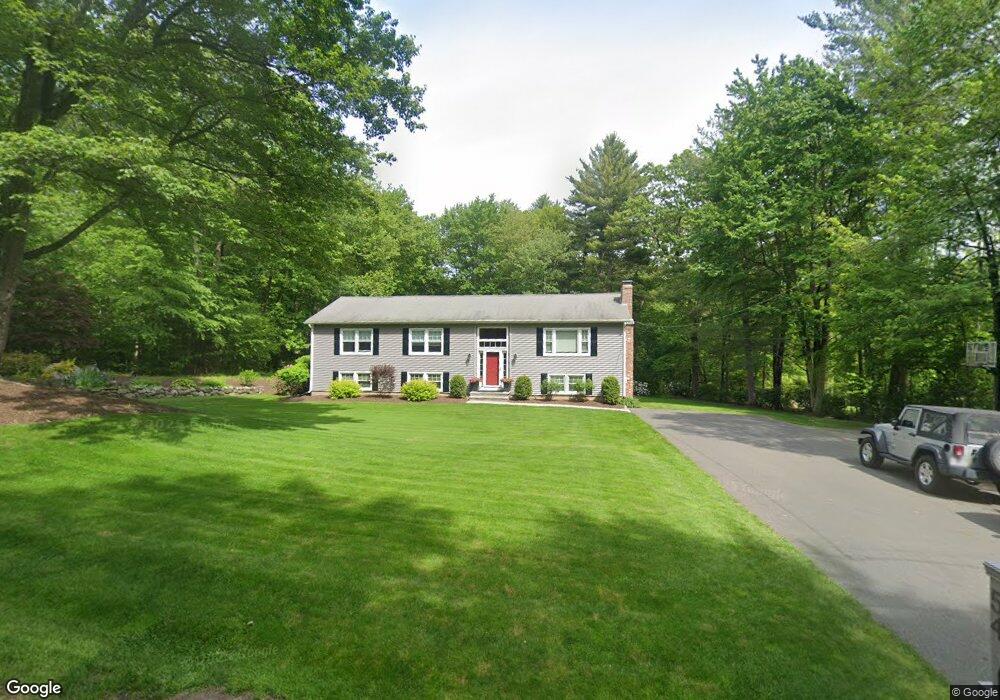
54 Bayberry Ln Westfield, MA 01085
Estimated Value: $458,000 - $524,059
3
Beds
2
Baths
1,618
Sq Ft
$301/Sq Ft
Est. Value
About This Home
This home is located at 54 Bayberry Ln, Westfield, MA 01085 and is currently estimated at $487,515, approximately $301 per square foot. 54 Bayberry Ln is a home located in Hampden County with nearby schools including Westfield High School.
Ownership History
Date
Name
Owned For
Owner Type
Purchase Details
Closed on
May 9, 1997
Sold by
Scholpp Karl L and Scholpp Lizabeth A
Bought by
Glenzel Michael E and Glenzel Patricia A
Current Estimated Value
Home Financials for this Owner
Home Financials are based on the most recent Mortgage that was taken out on this home.
Original Mortgage
$137,000
Outstanding Balance
$18,570
Interest Rate
7.88%
Mortgage Type
Purchase Money Mortgage
Estimated Equity
$468,945
Purchase Details
Closed on
Sep 28, 1990
Sold by
Rider Robert P
Bought by
Scholpp Karl L
Create a Home Valuation Report for This Property
The Home Valuation Report is an in-depth analysis detailing your home's value as well as a comparison with similar homes in the area
Home Values in the Area
Average Home Value in this Area
Purchase History
| Date | Buyer | Sale Price | Title Company |
|---|---|---|---|
| Glenzel Michael E | $147,000 | -- | |
| Scholpp Karl L | $145,000 | -- |
Source: Public Records
Mortgage History
| Date | Status | Borrower | Loan Amount |
|---|---|---|---|
| Open | Scholpp Karl L | $137,000 | |
| Previous Owner | Scholpp Karl L | $95,700 |
Source: Public Records
Tax History Compared to Growth
Tax History
| Year | Tax Paid | Tax Assessment Tax Assessment Total Assessment is a certain percentage of the fair market value that is determined by local assessors to be the total taxable value of land and additions on the property. | Land | Improvement |
|---|---|---|---|---|
| 2025 | $6,816 | $449,000 | $149,500 | $299,500 |
| 2024 | $6,846 | $428,700 | $137,300 | $291,400 |
| 2023 | $6,518 | $396,800 | $130,700 | $266,100 |
| 2022 | $6,518 | $352,500 | $117,200 | $235,300 |
| 2021 | $6,329 | $335,200 | $111,100 | $224,100 |
| 2020 | $6,279 | $326,200 | $111,100 | $215,100 |
| 2019 | $6,151 | $312,700 | $106,300 | $206,400 |
| 2018 | $6,054 | $312,700 | $106,300 | $206,400 |
| 2017 | $5,929 | $305,300 | $107,600 | $197,700 |
| 2016 | $5,935 | $305,300 | $107,600 | $197,700 |
| 2015 | $5,838 | $314,900 | $107,600 | $207,300 |
| 2014 | $4,370 | $314,900 | $107,600 | $207,300 |
Source: Public Records
Map
Nearby Homes
- 745 West Rd
- 50 Russellville Rd
- 10 Day Lily Ln
- 19 3rd Ave
- 28 1st Ave
- 6 Johns Dr
- 232 Russellville Rd
- 22 Root Rd
- 0 Cabot Rd
- 1430 Russell Rd Unit 9
- 1430 Russell Rd Unit 35
- 1020 Russell Rd
- 549 Russell Rd Unit 6B
- 555 Russell Rd Unit D18
- 291 Pochassic Rd
- 148 Prospect Street Extension
- 336 Russellville Rd
- 14 Pinewood Ln
- 70 Yeoman Ave
- 66 Stoney Ln
- 48 Bayberry Ln
- 62 Bayberry Ln
- 45 Bayberry Ln
- 44 Bayberry Ln
- 29 Bayberry Ln
- 25 Bayberry Lane Extension
- 87 Bayberry Ln
- 24 Bayberry Lane Extension
- 99 Bayberry Ln
- 58 Bayberry Ln
- L 50,51,52 Bayberry Ln
- 129 Skyline Dr
- 91 Skyline Dr
- 85 Skyline Dr
- 120 Skyline Dr
- 88 Skyline Dr
- 110 Skyline Dr
- 55 Skyline Dr
- 96 Skyline Dr
- 45 Skyline Dr