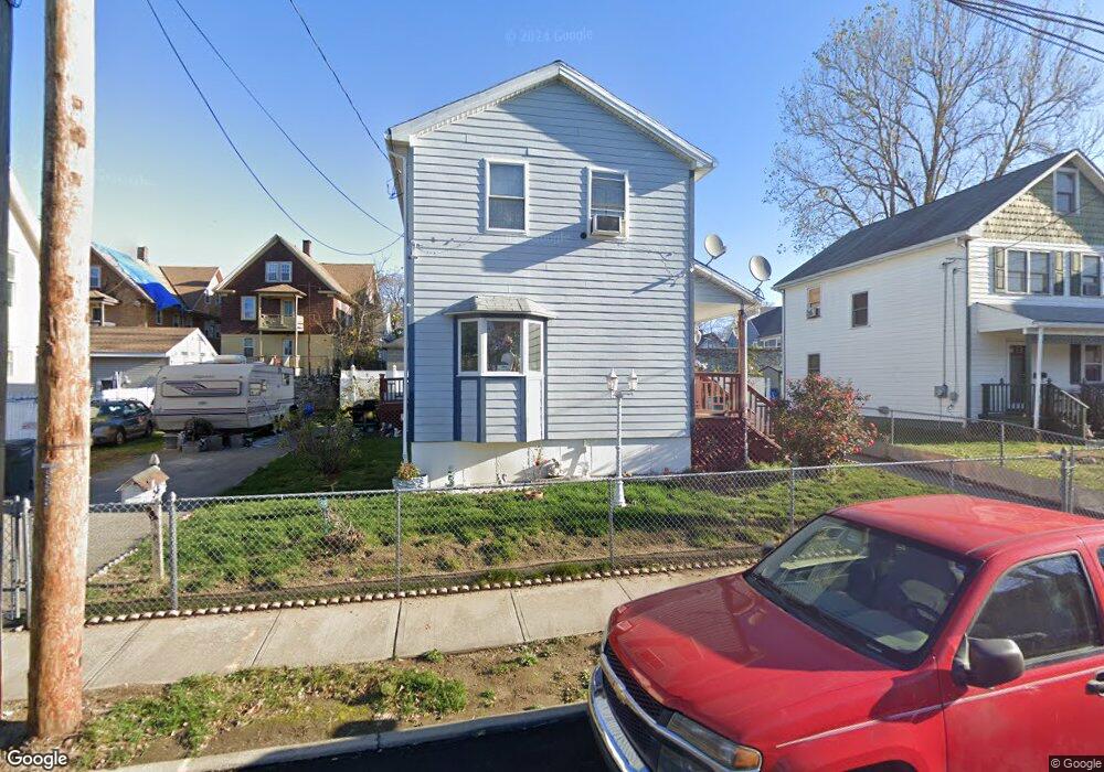
54 Brothwell St Unit 56 Bridgeport, CT 06605
West End-West Side NeighborhoodEstimated Value: $338,000 - $368,000
3
Beds
2
Baths
1,440
Sq Ft
$244/Sq Ft
Est. Value
About This Home
This home is located at 54 Brothwell St Unit 56, Bridgeport, CT 06605 and is currently estimated at $351,340, approximately $243 per square foot. 54 Brothwell St Unit 56 is a home located in Fairfield County with nearby schools including James J. Curiale School, Bassick High School, and Catholic Academy of Bridgeport-St. Raphael Academy.
Ownership History
Date
Name
Owned For
Owner Type
Purchase Details
Closed on
Aug 3, 2000
Sold by
Habitat For Humanity
Bought by
Ramos Myriam
Current Estimated Value
Home Financials for this Owner
Home Financials are based on the most recent Mortgage that was taken out on this home.
Original Mortgage
$80,915
Outstanding Balance
$29,090
Interest Rate
8.1%
Estimated Equity
$322,250
Purchase Details
Closed on
Sep 3, 1999
Sold by
Medina Frank
Bought by
Habitat For Humanity
Create a Home Valuation Report for This Property
The Home Valuation Report is an in-depth analysis detailing your home's value as well as a comparison with similar homes in the area
Home Values in the Area
Average Home Value in this Area
Purchase History
| Date | Buyer | Sale Price | Title Company |
|---|---|---|---|
| Ramos Myriam | $80,915 | -- | |
| Ramos Myriam | $80,915 | -- | |
| Habitat For Humanity | $6,000 | -- | |
| Habitat For Humanity | $6,000 | -- |
Source: Public Records
Mortgage History
| Date | Status | Borrower | Loan Amount |
|---|---|---|---|
| Open | Habitat For Humanity | $80,915 | |
| Closed | Habitat For Humanity | $80,915 |
Source: Public Records
Tax History Compared to Growth
Tax History
| Year | Tax Paid | Tax Assessment Tax Assessment Total Assessment is a certain percentage of the fair market value that is determined by local assessors to be the total taxable value of land and additions on the property. | Land | Improvement |
|---|---|---|---|---|
| 2025 | $6,304 | $145,080 | $44,930 | $100,150 |
| 2024 | $6,304 | $145,080 | $44,930 | $100,150 |
| 2023 | $6,304 | $145,080 | $44,930 | $100,150 |
| 2022 | $6,304 | $145,080 | $44,930 | $100,150 |
| 2021 | $6,304 | $145,080 | $44,930 | $100,150 |
| 2020 | $6,539 | $121,110 | $27,240 | $93,870 |
| 2019 | $6,539 | $121,110 | $27,240 | $93,870 |
| 2018 | $6,585 | $121,110 | $27,240 | $93,870 |
| 2017 | $6,585 | $121,110 | $27,240 | $93,870 |
| 2016 | $6,585 | $121,110 | $27,240 | $93,870 |
| 2015 | $6,720 | $159,250 | $41,200 | $118,050 |
| 2014 | $6,720 | $159,250 | $41,200 | $118,050 |
Source: Public Records
Map
Nearby Homes
- 826 Norman St
- 1373 Iranistan Ave
- 414 Wood Ave
- 592 Norman St Unit 594
- 566 Wood Ave
- 309 Pequonnock St
- 1199 Iranistan Ave Unit 1201
- 1872 North Ave Unit 1874
- 213 Harral Ave Unit 215
- 700 Laurel Ave
- 200 Harral Ave
- 697 Laurel Ave
- 393 Laurel Ave Unit 203
- 393 Laurel Ave Unit 415
- 687 Wood Ave
- 100 Lorraine St
- 670 Clinton Ave
- 184 Pacific St
- 183 Calhoun Ave
- 113 Milne St Unit 115
- 66 Brothwell St
- 1451 Iranistan Ave
- 802 Norman St
- 46 Brothwell St
- 794 Norman St
- 808 Norman St
- 94 Brothwell St
- 788 Norman St
- 816 Norman St
- 1485-1487 Iranistan Ave
- 1467 Iranistan Ave Unit 1469
- 1485 Iranistan Ave Unit 1487
- 1485 Iranistan Ave Unit 1
- 1485 Iranistan Ave Unit 2
- 1485 Iranistan Ave Unit 3
- 1477 Iranistan Ave Unit 1479
- 1459 Iranistan Ave
- 782 Norman St
- 782 Norman St
- 782 Norman St Unit 1227 Iranistan Av