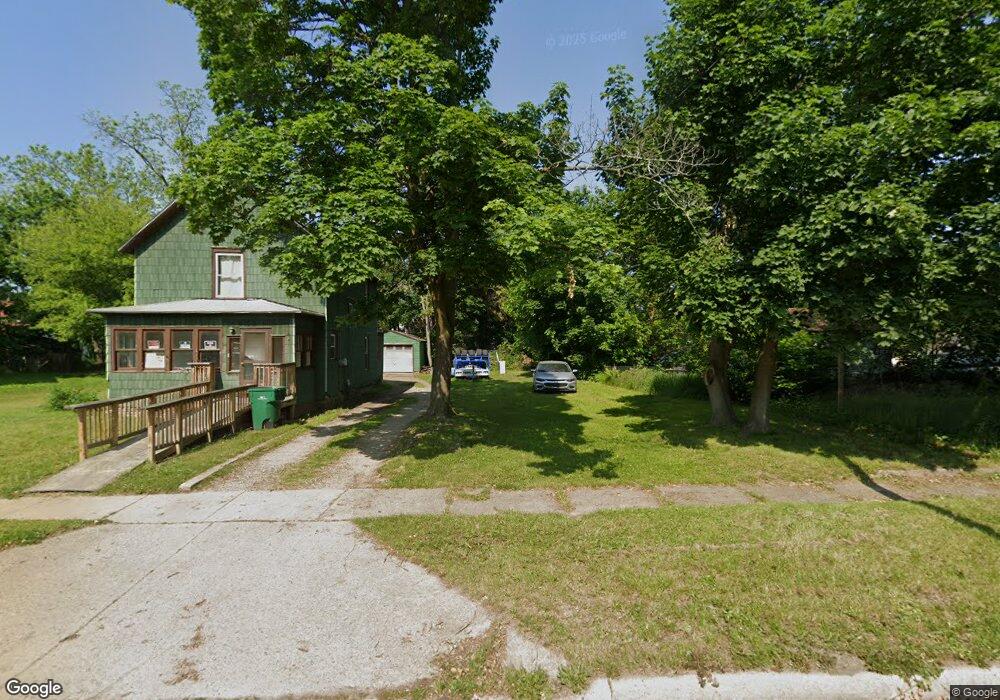
54 Euclid St Battle Creek, MI 49014
Post Franklin NeighborhoodEstimated Value: $18,000 - $112,000
3
Beds
1
Bath
1,368
Sq Ft
$48/Sq Ft
Est. Value
About This Home
This home is located at 54 Euclid St, Battle Creek, MI 49014 and is currently estimated at $65,000, approximately $47 per square foot. 54 Euclid St is a home located in Calhoun County with nearby schools including Post-Franklin Elementary School, Springfield Middle School, and Battle Creek Central High School.
Ownership History
Date
Name
Owned For
Owner Type
Purchase Details
Closed on
May 26, 2016
Sold by
Calhoun County Land Bank Authority
Bought by
St Mark Christian Methodist Episcopal Ch
Current Estimated Value
Purchase Details
Closed on
Dec 22, 2009
Sold by
Rosenbaum Ann
Bought by
The Calhoun County Land Bank Authority
Purchase Details
Closed on
Feb 8, 2006
Sold by
Mortgage Electronic Registration Systems
Bought by
Lasalle Bank Na
Purchase Details
Closed on
Feb 3, 2006
Sold by
Graham Freddie L and Graham Clarissa
Bought by
Mortgage Electronic Registration Systems
Purchase Details
Closed on
Mar 25, 2003
Sold by
Firstar Bank
Bought by
Graham Freddie L
Purchase Details
Closed on
May 17, 2002
Sold by
Ruffin Lee
Bought by
Firstar Bank
Purchase Details
Closed on
Jul 1, 1998
Bought by
Ruffin
Purchase Details
Closed on
Jun 18, 1998
Bought by
Hueckel
Create a Home Valuation Report for This Property
The Home Valuation Report is an in-depth analysis detailing your home's value as well as a comparison with similar homes in the area
Home Values in the Area
Average Home Value in this Area
Purchase History
| Date | Buyer | Sale Price | Title Company |
|---|---|---|---|
| St Mark Christian Methodist Episcopal Ch | -- | Attorney | |
| The Calhoun County Land Bank Authority | -- | None Available | |
| Lasalle Bank Na | -- | None Available | |
| Mortgage Electronic Registration Systems | $35,726 | None Available | |
| Graham Freddie L | $7,000 | -- | |
| Firstar Bank | $23,700 | -- | |
| Ruffin | $15,500 | -- | |
| Hueckel | $6,000 | -- |
Source: Public Records
Tax History Compared to Growth
Tax History
| Year | Tax Paid | Tax Assessment Tax Assessment Total Assessment is a certain percentage of the fair market value that is determined by local assessors to be the total taxable value of land and additions on the property. | Land | Improvement |
|---|---|---|---|---|
| 2025 | -- | $1,700 | $0 | $0 |
| 2024 | $14 | $1,238 | $0 | $0 |
| 2023 | $18 | $825 | $0 | $0 |
| 2022 | $13 | $578 | $0 | $0 |
| 2021 | $17 | $495 | $0 | $0 |
| 2020 | $16 | $413 | $0 | $0 |
| 2019 | $16 | $330 | $0 | $0 |
| 2018 | $16 | $330 | $330 | $0 |
| 2017 | $0 | $248 | $0 | $0 |
| 2016 | $0 | $1,638 | $0 | $0 |
| 2015 | -- | $1,638 | $1,638 | $0 |
| 2014 | -- | $1,638 | $1,638 | $0 |
Source: Public Records
Map
Nearby Homes
- 57 Euclid St
- 100 Illinois St
- 130 Cliff St
- 118 Nelson St
- 232 Cliff St
- 180 Grenville St
- 50 Douglas St
- 418 Main St
- 501 Michigan Ave E
- 136 Jericho Rd
- 507 Michigan Ave E
- 117 Inn Rd
- 390 E Michigan Ave
- 76 Taft St
- 47 Alden Ave W
- 802 Michigan Ave E
- 519 S Shore Dr
- 51 Pauline Ave
- 503 S Shore Dr
- 156 Woodway Ave