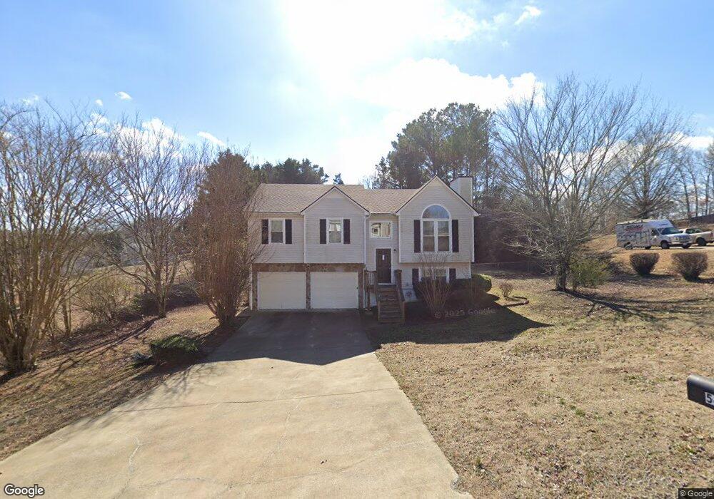
54 Ginnity Dr Douglasville, GA 30134
Estimated Value: $244,000 - $316,756
3
Beds
2
Baths
1,240
Sq Ft
$228/Sq Ft
Est. Value
About This Home
This home is located at 54 Ginnity Dr, Douglasville, GA 30134 and is currently estimated at $282,919, approximately $228 per square foot. 54 Ginnity Dr is a home located in Paulding County with nearby schools including Connie Dugan Elementary School, Irma C. Austin Middle School, and South Paulding High School.
Ownership History
Date
Name
Owned For
Owner Type
Purchase Details
Closed on
May 28, 2025
Sold by
Alto Asset Co 1 Llc
Bought by
Rh Alto Asset Co Llc
Current Estimated Value
Purchase Details
Closed on
Oct 4, 2016
Sold by
Denise Natalkka
Bought by
American Homes 4 Rent
Purchase Details
Closed on
Jan 25, 2008
Sold by
Wilkerson Natalkka D
Bought by
Franks Nathaniel L and Franks Natalkka D
Home Financials for this Owner
Home Financials are based on the most recent Mortgage that was taken out on this home.
Original Mortgage
$142,709
Interest Rate
6.12%
Mortgage Type
FHA
Purchase Details
Closed on
Dec 19, 1997
Sold by
Dobbins Inc
Bought by
Wilkerson Isaac M
Home Financials for this Owner
Home Financials are based on the most recent Mortgage that was taken out on this home.
Original Mortgage
$82,669
Interest Rate
7.18%
Mortgage Type
FHA
Create a Home Valuation Report for This Property
The Home Valuation Report is an in-depth analysis detailing your home's value as well as a comparison with similar homes in the area
Home Values in the Area
Average Home Value in this Area
Purchase History
| Date | Buyer | Sale Price | Title Company |
|---|---|---|---|
| Rh Alto Asset Co Llc | $1,505,709 | -- | |
| American Homes 4 Rent | $106,000 | -- | |
| Franks Nathaniel L | -- | -- | |
| Wilkerson Natalkka D | -- | -- | |
| Wilkerson Isaac M | $84,600 | -- |
Source: Public Records
Mortgage History
| Date | Status | Borrower | Loan Amount |
|---|---|---|---|
| Previous Owner | Wilkerson Natalkka D | $142,709 | |
| Previous Owner | Wilkerson Isaac M | $82,669 |
Source: Public Records
Tax History Compared to Growth
Tax History
| Year | Tax Paid | Tax Assessment Tax Assessment Total Assessment is a certain percentage of the fair market value that is determined by local assessors to be the total taxable value of land and additions on the property. | Land | Improvement |
|---|---|---|---|---|
| 2024 | $2,611 | $104,984 | $12,000 | $92,984 |
| 2023 | $1,680 | $64,428 | $8,000 | $56,428 |
| 2022 | $1,680 | $64,428 | $8,000 | $56,428 |
| 2021 | $1,872 | $64,428 | $8,000 | $56,428 |
| 2020 | $1,549 | $52,160 | $8,000 | $44,160 |
| 2019 | $1,683 | $55,844 | $8,000 | $47,844 |
| 2018 | $1,303 | $43,252 | $8,000 | $35,252 |
Source: Public Records
Map
Nearby Homes
- 23 Bomar Ln
- 42 Crystal Springs Dr
- 239 Clear Brook Trail
- 269 Shelby Ln
- 976 Bakers Bridge Rd
- 1150 Denton Rd Unit 371
- 1150 Denton Rd
- 1050 Denton Rd
- 1305 Denton Rd
- 1462 Senator Rd
- 263 Chandler Ridge Dr
- 554 Oak Landing Cir
- 43 Oak Landing Cir
- 289 Ridge Run Dr
- 1267 Austin Bridge Rd
- 624 Silverthorne Cir
- 3061 Dallas Nebo Rd