Estimated Value: $653,000 - $724,000
3
Beds
3
Baths
2,491
Sq Ft
$277/Sq Ft
Est. Value
About This Home
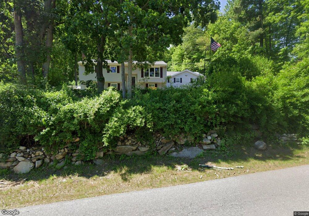
This home is located at 54 Lawrence Rd, Derry, NH 03038 and is currently estimated at $689,990, approximately $276 per square foot. 54 Lawrence Rd is a home located in Rockingham County with nearby schools including Derry Village School, West Running Brook Middle School, and Pinkerton Academy.
Ownership History
Date
Name
Owned For
Owner Type
Purchase Details
Closed on
Sep 28, 2016
Sold by
Joan M Iazzazzo Ret
Bought by
Salem Mob 1 Llc
Current Estimated Value
Home Financials for this Owner
Home Financials are based on the most recent Mortgage that was taken out on this home.
Original Mortgage
$488,700
Outstanding Balance
$385,026
Interest Rate
3.43%
Mortgage Type
Purchase Money Mortgage
Estimated Equity
$304,964
Purchase Details
Closed on
Feb 19, 2015
Sold by
Iannazzo Joan M
Bought by
Joan Marie Iannazzo Re
Purchase Details
Closed on
Jun 21, 2007
Sold by
Salem Mobi Llc
Bought by
Iannazzo Joan M
Purchase Details
Closed on
Feb 1, 1996
Sold by
Optima Health Inc
Bought by
Umali Edgardo A and Umali Rosemarie P
Create a Home Valuation Report for This Property
The Home Valuation Report is an in-depth analysis detailing your home's value as well as a comparison with similar homes in the area
Home Values in the Area
Average Home Value in this Area
Purchase History
| Date | Buyer | Sale Price | Title Company |
|---|---|---|---|
| Salem Mob 1 Llc | $278,000 | -- | |
| Joan Marie Iannazzo Re | -- | -- | |
| Iannazzo Joan M | $240,000 | -- | |
| Umali Edgardo A | $122,000 | -- |
Source: Public Records
Mortgage History
| Date | Status | Borrower | Loan Amount |
|---|---|---|---|
| Open | Salem Mob 1 Llc | $488,700 | |
| Previous Owner | Umali Edgardo A | $220,000 | |
| Previous Owner | Umali Edgardo A | $159,700 | |
| Previous Owner | Umali Edgardo A | $254,685 |
Source: Public Records
Tax History
| Year | Tax Paid | Tax Assessment Tax Assessment Total Assessment is a certain percentage of the fair market value that is determined by local assessors to be the total taxable value of land and additions on the property. | Land | Improvement |
|---|---|---|---|---|
| 2025 | $12,792 | $673,600 | $199,900 | $473,700 |
| 2024 | $12,590 | $673,600 | $199,900 | $473,700 |
| 2023 | $11,380 | $550,300 | $169,900 | $380,400 |
| 2022 | $10,426 | $547,600 | $169,900 | $377,700 |
| 2021 | $10,382 | $419,300 | $129,800 | $289,500 |
| 2020 | $10,206 | $419,300 | $129,800 | $289,500 |
| 2019 | $9,223 | $353,100 | $100,200 | $252,900 |
| 2018 | $9,821 | $359,800 | $100,200 | $259,600 |
| 2017 | $8,958 | $333,000 | $95,200 | $237,800 |
| 2016 | $8,735 | $322,800 | $95,200 | $227,600 |
| 2015 | $8,743 | $299,100 | $95,200 | $203,900 |
| 2014 | $8,800 | $299,100 | $95,200 | $203,900 |
| 2013 | $8,748 | $277,800 | $87,200 | $190,600 |
Source: Public Records
Map
Nearby Homes
- 43 Lampton Dr
- 5 Stone Fence Dr
- 89 Lane Rd
- 139 Rockingham Rd Unit 21
- 144 Rockingham Rd
- 21 Berry Rd
- 51 Bedard Ave
- 6 Homestead Dr
- 4 Westview Dr
- 13 Kilrea Rd Unit L
- 17 Tyler Rd
- 13 Sunnyside Ln Unit L
- 15 Bonnie Ln Unit R
- 3 Bonnie Ln
- 8 Blueberry Rd Unit U: R
- 242 Rockingham Rd
- 12R Brian Ave Unit R
- 52 Windham Depot Rd
- 4 Norman Dr Unit L
- 7 Chester Rd Unit 212
- 52 Lawrence Rd
- 56 Lawrence Rd
- 119 Lawrence Rd
- 50 Lawrence Rd
- 57 Lawrence Rd
- 61 Lawrence Rd
- 48 Lawrence Rd
- 75 Island Pond Rd
- 55 Lawrence Rd
- 63 Lawrence Rd
- 46 Lawrence Rd
- 51 Lawrence Rd
- 77 Island Pond Rd
- 45 Lampton Dr
- 79 Island Pond Rd
- 44 Lawrence Rd
- 28 Lampton Dr
- 42 Lawrence Rd
- 49 Lawrence Rd
- 2 Duck Pond Rd
Your Personal Tour Guide
Ask me questions while you tour the home.