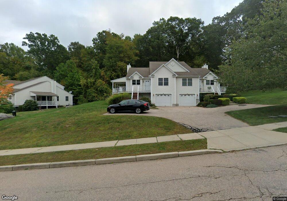
54 Murphys Dr Groton, CT 06340
Estimated Value: $391,946 - $420,000
3
Beds
2
Baths
1,786
Sq Ft
$225/Sq Ft
Est. Value
About This Home
This home is located at 54 Murphys Dr, Groton, CT 06340 and is currently estimated at $401,987, approximately $225 per square foot. 54 Murphys Dr is a home located in New London County with nearby schools including Charles Barnum Discovery Magnet School, Groton Middle School, and Robert E. Fitch High School.
Ownership History
Date
Name
Owned For
Owner Type
Purchase Details
Closed on
Jan 16, 2023
Sold by
Mikovic Sara E
Bought by
Mikovic Sara E and Stankewicz Timothy J
Current Estimated Value
Purchase Details
Closed on
Jan 7, 2022
Sold by
Yang Xin and Qian Demin
Bought by
Mikovic Sara E
Home Financials for this Owner
Home Financials are based on the most recent Mortgage that was taken out on this home.
Original Mortgage
$274,500
Interest Rate
3.12%
Mortgage Type
Purchase Money Mortgage
Purchase Details
Closed on
Aug 7, 2013
Sold by
Rich Marcus S and Rich Debbie L
Bought by
Yang Xin and Qian Demin
Create a Home Valuation Report for This Property
The Home Valuation Report is an in-depth analysis detailing your home's value as well as a comparison with similar homes in the area
Home Values in the Area
Average Home Value in this Area
Purchase History
| Date | Buyer | Sale Price | Title Company |
|---|---|---|---|
| Mikovic Sara E | -- | None Available | |
| Mikovic Sara E | $305,000 | None Available | |
| Mikovic Sara E | $305,000 | None Available | |
| Yang Xin | $195,000 | -- | |
| Yang Xin | $195,000 | -- |
Source: Public Records
Mortgage History
| Date | Status | Borrower | Loan Amount |
|---|---|---|---|
| Previous Owner | Mikovic Sara E | $274,500 |
Source: Public Records
Tax History
| Year | Tax Paid | Tax Assessment Tax Assessment Total Assessment is a certain percentage of the fair market value that is determined by local assessors to be the total taxable value of land and additions on the property. | Land | Improvement |
|---|---|---|---|---|
| 2025 | $4,686 | $168,490 | $50,547 | $117,943 |
| 2024 | $4,394 | $168,490 | $50,547 | $117,943 |
| 2023 | $4,234 | $168,490 | $0 | $168,490 |
| 2022 | $4,153 | $168,490 | $0 | $168,490 |
| 2021 | $4,350 | $147,560 | $0 | $147,560 |
| 2020 | $4,304 | $147,560 | $0 | $147,560 |
| 2019 | $4,124 | $147,560 | $0 | $147,560 |
| 2018 | $4,083 | $147,560 | $0 | $147,560 |
| 2017 | $4,003 | $147,560 | $0 | $147,560 |
| 2016 | $4,078 | $161,630 | $0 | $161,630 |
| 2015 | $3,952 | $161,630 | $0 | $161,630 |
| 2014 | $3,860 | $161,630 | $0 | $161,630 |
Source: Public Records
Map
Nearby Homes
- 1260 Route 12
- 0 Briar Hill Rd Unit 24148389
- 1010 Long Cove Rd Unit LOT 23
- 1010 Long Cove Rd Unit LOT 17
- 435 Military Hwy Unit 449
- 1513 Connecticut 12
- 39 Inchcliffe Dr
- 2 John Ave
- 17 Patricia Ct
- 310 Lestertown Rd
- 141 Starr Hill Rd
- 944 Long Cove Rd Unit 1
- 22 Toll Gate Rd
- 1581 Route 12
- 153 Old Norwich Rd
- 41 Riverview Ave
- 517-571 Gold Star Hwy
- 593 Mohegan Avenue Pkwy
- 82 Christy Hill Rd
- 90 Crown Knoll Ct Unit 136
- 54 Murphys Dr Unit 54
- 56 Murphys Dr
- 56 Murphys Dr Unit 56
- 34 Murphys Dr
- 88 Murphys Dr
- 88 Murphys Dr Unit 88
- 88 Murphys Dr Unit 4A
- 32 Murphys Dr
- 32 Murphys Dr Unit 32
- 90 Murphys Dr
- 90 Murphys Dr Unit 90
- 1065 Pleasant Valley Rd N
- 1065 Pleasant Valley Rd N Unit 1065
- 1065 Pleasant Valley Rd N Unit 16A
- 71 Murphys Dr
- 71 Murphys Dr Unit 71
- 1063 Pleasant Valley Rd N
- 73 Murphys Dr
- 73 Murphys Dr Unit 14 A
- 1077 Pleasant Valley Rd N
Your Personal Tour Guide
Ask me questions while you tour the home.