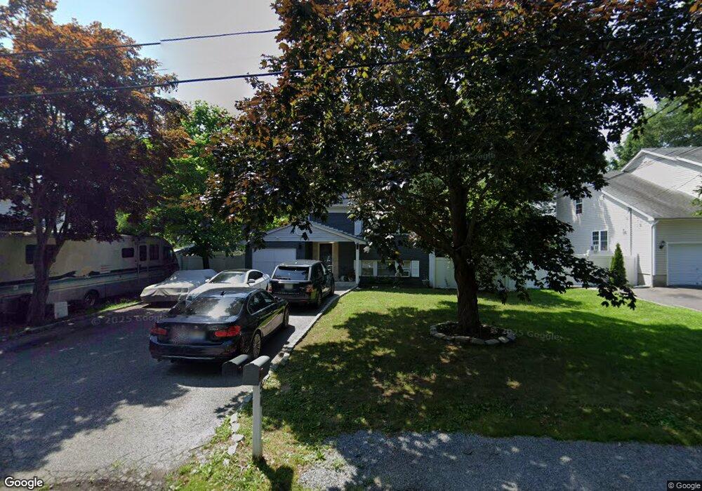
54 Probst Dr Shirley, NY 11967
Estimated Value: $532,418 - $630,000
5
Beds
2
Baths
2,236
Sq Ft
$261/Sq Ft
Est. Value
About This Home
This home is located at 54 Probst Dr, Shirley, NY 11967 and is currently estimated at $583,605, approximately $261 per square foot. 54 Probst Dr is a home located in Suffolk County with nearby schools including Nathaniel Woodhull Elementary School, William Paca Middle School, and William Floyd High School.
Ownership History
Date
Name
Owned For
Owner Type
Purchase Details
Closed on
Mar 21, 2005
Sold by
Kasdan Gary Patricia A
Bought by
Olcek Mustafa
Current Estimated Value
Purchase Details
Closed on
Jun 17, 1999
Sold by
Fuhs William Henry and Fuhs Luann
Bought by
Kasdan Gary and Kasdan Patricia A
Home Financials for this Owner
Home Financials are based on the most recent Mortgage that was taken out on this home.
Original Mortgage
$82,600
Interest Rate
7.09%
Create a Home Valuation Report for This Property
The Home Valuation Report is an in-depth analysis detailing your home's value as well as a comparison with similar homes in the area
Home Values in the Area
Average Home Value in this Area
Purchase History
| Date | Buyer | Sale Price | Title Company |
|---|---|---|---|
| Olcek Mustafa | $328,600 | Douglas J Mollo | |
| Kasdan Gary | $118,000 | Commonwealth Land Title Ins |
Source: Public Records
Mortgage History
| Date | Status | Borrower | Loan Amount |
|---|---|---|---|
| Previous Owner | Kasdan Gary | $82,600 |
Source: Public Records
Tax History Compared to Growth
Tax History
| Year | Tax Paid | Tax Assessment Tax Assessment Total Assessment is a certain percentage of the fair market value that is determined by local assessors to be the total taxable value of land and additions on the property. | Land | Improvement |
|---|---|---|---|---|
| 2024 | $7,710 | $2,050 | $150 | $1,900 |
| 2023 | $7,710 | $2,050 | $150 | $1,900 |
| 2022 | $8,150 | $2,050 | $150 | $1,900 |
| 2021 | $8,150 | $2,050 | $150 | $1,900 |
| 2020 | $8,345 | $2,050 | $150 | $1,900 |
| 2019 | $8,345 | $0 | $0 | $0 |
| 2018 | $8,006 | $2,050 | $150 | $1,900 |
| 2017 | $8,006 | $2,050 | $150 | $1,900 |
| 2016 | $8,019 | $2,050 | $150 | $1,900 |
| 2015 | -- | $2,050 | $150 | $1,900 |
| 2014 | -- | $2,200 | $150 | $2,050 |
Source: Public Records
Map
Nearby Homes
- 43 Adobe Dr
- 36 Happy Acres Dr
- 4 Windus Dr
- 43 Ranch Dr
- 21 Lama Dr
- 36 Flintlock Dr
- 33 Ranch Dr
- 0 Amarr Dr Unit KEYL3493702
- 10 Amarr Dr
- 18 Happy Acres Dr
- 32 Flintlock Dr
- Vacant Lot The Green
- VL - (Sec 937 Lot 14 The Green
- 33 Breston Dr W
- 12 Beacon St
- 11 The Green
- 16 Flintlock Dr
- 32 Rockledge Dr
- 45 Arrowhead Dr
- 17 Appel Dr E