Estimated Value: $302,372 - $418,000
--
Bed
--
Bath
1,316
Sq Ft
$290/Sq Ft
Est. Value
About This Home
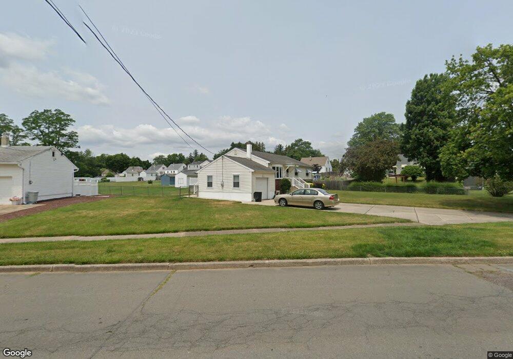
This home is located at 54 Railroad Ave, Ewing, NJ 08628 and is currently estimated at $382,093, approximately $290 per square foot. 54 Railroad Ave is a home located in Mercer County with nearby schools including Ewing High School, Paul Robeson Charter School For The Humanities, and Trenton Stem-To-Civics Charter School.
Ownership History
Date
Name
Owned For
Owner Type
Purchase Details
Closed on
Aug 19, 1993
Sold by
Petito Dorothy A
Bought by
Petersack Ronald
Current Estimated Value
Purchase Details
Closed on
May 31, 1990
Sold by
Kmiec Joseph and Kmiec Alice
Bought by
Petito Dorothy A
Create a Home Valuation Report for This Property
The Home Valuation Report is an in-depth analysis detailing your home's value as well as a comparison with similar homes in the area
Home Values in the Area
Average Home Value in this Area
Purchase History
| Date | Buyer | Sale Price | Title Company |
|---|---|---|---|
| Petersack Ronald | -- | -- | |
| Petersack Ronald | -- | -- | |
| Petito Dorothy A | $137,500 | -- |
Source: Public Records
Tax History Compared to Growth
Tax History
| Year | Tax Paid | Tax Assessment Tax Assessment Total Assessment is a certain percentage of the fair market value that is determined by local assessors to be the total taxable value of land and additions on the property. | Land | Improvement |
|---|---|---|---|---|
| 2025 | $7,901 | $200,900 | $75,700 | $125,200 |
| 2024 | $7,427 | $200,900 | $75,700 | $125,200 |
| 2023 | $7,427 | $200,900 | $75,700 | $125,200 |
| 2022 | $7,226 | $200,900 | $75,700 | $125,200 |
| 2021 | $7,050 | $200,900 | $75,700 | $125,200 |
| 2020 | $6,949 | $200,900 | $75,700 | $125,200 |
| 2019 | $6,768 | $200,900 | $75,700 | $125,200 |
| 2018 | $6,919 | $131,000 | $57,000 | $74,000 |
| 2017 | $7,081 | $131,000 | $57,000 | $74,000 |
| 2016 | $6,985 | $131,000 | $57,000 | $74,000 |
| 2015 | $6,892 | $131,000 | $57,000 | $74,000 |
| 2014 | $6,874 | $131,000 | $57,000 | $74,000 |
Source: Public Records
Map
Nearby Homes
- 21 Decou Ave
- 15 Decou Ave
- 6 Michelle Ct
- 1200 Silvia St
- 288 Clamer Rd
- 409 Silvia St
- 335 Silvia St
- 325 Silvia St
- 322 Wynnewood Rd
- 161 Franklyn Rd
- 152 Franklyn Rd
- 21 Dixmont Ave
- 107 Kyle Way
- 97 Kyle Way
- 121 Kyle Way
- 182 W Upper Ferry Rd
- 860 Lower Ferry Rd Unit 2K
- 860 Lower Ferry Rd Unit 1K
- 30 Chelmsford Ct
- 202 W Upper Ferry Rd
- 56 Railroad Ave
- 2 Carrigg Ave
- 111 Central Ave
- 109 Central Ave
- 113 Central Ave
- 107 Central Ave
- 105 Central Ave
- 103 Central Ave
- 115 Central Ave
- 0 Agnes Ave Unit 1007115380
- 0 Agnes Ave Unit 5797846
- 0 Agnes Ave Unit 5998929
- 0 Agnes Ave Unit 1008919556
- 101 Central Ave
- 117 Central Ave
- 4 Carrigg Ave
- 6 Carrigg Ave
- 119 Central Ave
- 104 Central Ave
- 112 Central Ave