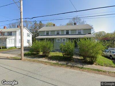
54 Roosevelt St Unit 56 Maynard, MA 01754
Presidential NeighborhoodEstimated Value: $471,380 - $513,000
6
Beds
2
Baths
2,094
Sq Ft
$233/Sq Ft
Est. Value
About This Home
This home is located at 54 Roosevelt St Unit 56, Maynard, MA 01754 and is currently estimated at $487,095, approximately $232 per square foot. 54 Roosevelt St Unit 56 is a home located in Middlesex County with nearby schools including Green Meadow School, Fowler School, and Maynard High School.
Ownership History
Date
Name
Owned For
Owner Type
Purchase Details
Closed on
May 9, 2024
Sold by
Marchese Development Llc
Bought by
Bouck Kevin J and Mahoney Jacqueline
Current Estimated Value
Purchase Details
Closed on
Apr 20, 2005
Sold by
Oates Margaret L
Bought by
Margaret L Oates Ret and Oates
Create a Home Valuation Report for This Property
The Home Valuation Report is an in-depth analysis detailing your home's value as well as a comparison with similar homes in the area
Home Values in the Area
Average Home Value in this Area
Purchase History
| Date | Buyer | Sale Price | Title Company |
|---|---|---|---|
| Bouck Kevin J | $475,000 | None Available | |
| Bouck Kevin J | $475,000 | None Available | |
| Margaret L Oates Ret | -- | -- | |
| Margaret L Oates Ret | -- | -- |
Source: Public Records
Mortgage History
| Date | Status | Borrower | Loan Amount |
|---|---|---|---|
| Previous Owner | Marchese Re Group Llc | $420,000 | |
| Previous Owner | Marchese Re Group Llc | $432,000 |
Source: Public Records
Tax History Compared to Growth
Tax History
| Year | Tax Paid | Tax Assessment Tax Assessment Total Assessment is a certain percentage of the fair market value that is determined by local assessors to be the total taxable value of land and additions on the property. | Land | Improvement |
|---|---|---|---|---|
| 2025 | $8,491 | $476,200 | $271,900 | $204,300 |
| 2024 | $8,103 | $453,200 | $258,900 | $194,300 |
| 2023 | $7,651 | $403,300 | $246,600 | $156,700 |
| 2022 | $7,465 | $363,800 | $207,100 | $156,700 |
| 2021 | $7,177 | $356,200 | $207,100 | $149,100 |
| 2020 | $6,822 | $330,500 | $187,400 | $143,100 |
| 2019 | $6,297 | $299,300 | $179,000 | $120,300 |
| 2018 | $8,937 | $261,300 | $162,800 | $98,500 |
| 2017 | $5,751 | $261,300 | $162,800 | $98,500 |
| 2016 | $5,553 | $261,300 | $162,800 | $98,500 |
| 2015 | $5,763 | $258,300 | $155,400 | $102,900 |
| 2014 | $5,815 | $260,900 | $150,400 | $110,500 |
Source: Public Records
Map
Nearby Homes
- 79 Waltham St
- 50 Mckinley St Unit 52
- 17 Wood Ln
- 16 Waltham St
- 1 Oak Ridge Dr Unit 3
- 2 East St
- 36 Parker St
- 12 Oak Ridge Dr Unit 4
- 10 Oak Ridge Dr Unit 6
- 5 Summer St
- 9-A&B Summer St
- 20 Deer Path Unit 5
- 16 Deer Path Unit 1
- 7 Deer Path Unit 2
- 21 Deer Path Unit 6
- 66 Powder Mill Rd
- 39 Acton St
- 11 Fox Hill Dr
- 1 Prospect St
- 2 Brooks St
- 54 Roosevelt St Unit 56
- 56 Roosevelt St Unit 56
- 54-56 Roosevelt St
- 58-60 Roosevelt St
- 58 Roosevelt St Unit 60
- 50 Roosevelt St Unit 52
- 52 Roosevelt St
- 48 Roosevelt St Unit 48
- 51 - 53 Roosevelt St
- 51-53 Roosevelt St
- 45 Roosevelt St
- 11 Demars St Unit 13
- 11 Demars St Unit 11
- 9 Demars St
- 46 Roosevelt St Unit 48
- 15 Demars St Unit 17
- 7 Demars St
- 7 Demars St Unit 7
- 7 Demars St Unit 2
- 51 Roosevelt St Unit 53