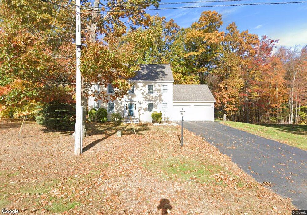
54 Viola Cir Seabrook, NH 03874
Estimated Value: $662,441 - $757,000
3
Beds
3
Baths
2,080
Sq Ft
$346/Sq Ft
Est. Value
About This Home
This home is located at 54 Viola Cir, Seabrook, NH 03874 and is currently estimated at $720,110, approximately $346 per square foot. 54 Viola Cir is a home located in Rockingham County with nearby schools including Seabrook Elementary School, Seabrook Middle School, and Winnacunnet High School.
Ownership History
Date
Name
Owned For
Owner Type
Purchase Details
Closed on
Apr 11, 2003
Sold by
54 Viola Cir Rt
Bought by
Hill Jo Ann
Current Estimated Value
Purchase Details
Closed on
Nov 30, 2000
Sold by
Brn Real Est Corp Seab
Bought by
54 Viola Cir Rlty T
Create a Home Valuation Report for This Property
The Home Valuation Report is an in-depth analysis detailing your home's value as well as a comparison with similar homes in the area
Home Values in the Area
Average Home Value in this Area
Purchase History
| Date | Buyer | Sale Price | Title Company |
|---|---|---|---|
| Hill Jo Ann | $339,700 | -- | |
| 54 Viola Cir Rlty T | $270,000 | -- |
Source: Public Records
Mortgage History
| Date | Status | Borrower | Loan Amount |
|---|---|---|---|
| Open | 54 Viola Cir Rlty T | $185,000 | |
| Closed | 54 Viola Cir Rlty T | $190,000 | |
| Closed | 54 Viola Cir Rlty T | $187,000 |
Source: Public Records
Tax History Compared to Growth
Tax History
| Year | Tax Paid | Tax Assessment Tax Assessment Total Assessment is a certain percentage of the fair market value that is determined by local assessors to be the total taxable value of land and additions on the property. | Land | Improvement |
|---|---|---|---|---|
| 2024 | $6,914 | $589,900 | $264,300 | $325,600 |
| 2023 | $7,098 | $470,400 | $220,200 | $250,200 |
| 2022 | $6,233 | $470,400 | $220,200 | $250,200 |
| 2021 | $6,459 | $470,400 | $220,200 | $250,200 |
| 2020 | $5,918 | $370,600 | $167,500 | $203,100 |
| 2019 | $6,904 | $370,600 | $167,500 | $203,100 |
| 2018 | $6,022 | $370,600 | $167,500 | $203,100 |
| 2017 | $6,869 | $342,700 | $139,600 | $203,100 |
| 2016 | $5,069 | $342,700 | $139,600 | $203,100 |
| 2015 | $4,422 | $299,000 | $112,400 | $186,600 |
| 2014 | $4,566 | $299,000 | $112,400 | $186,600 |
| 2013 | $4,567 | $299,100 | $112,400 | $186,700 |
Source: Public Records
Map
Nearby Homes
- 176 Lower Collins St
- 35 Norman Rd
- 1 Old Salt Dr
- 57 Washington St
- 14 Coleman Ct
- 8 Kimberly Dr
- 22 Farm Ln
- 312 S Main St
- 28 Brooks Rd
- 308 Route 286 Unit 77
- 308 Route 286 Unit Lot 58
- 1 Lakeshore Dr
- 2 Collins St
- 241 & 245 Lafayette Rd
- 64 Seabrook Rd
- 27 Cross Beach Rd
- 20 Railroad Ave
- 308 State Route 286 Unit Lot 73
- 308 State Route 286 Unit Lot 108
- 308 State Route 286 Unit Lot 23