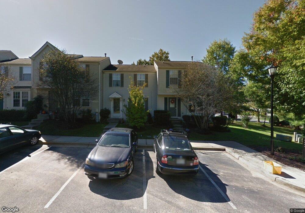
540 Doral Ct Arnold, MD 21012
Estimated Value: $343,000 - $415,000
--
Bed
2
Baths
1,166
Sq Ft
$329/Sq Ft
Est. Value
About This Home
This home is located at 540 Doral Ct, Arnold, MD 21012 and is currently estimated at $383,860, approximately $329 per square foot. 540 Doral Ct is a home located in Anne Arundel County with nearby schools including Broadneck Elementary School, Magothy River Middle School, and Broadneck High School.
Ownership History
Date
Name
Owned For
Owner Type
Purchase Details
Closed on
Dec 28, 2001
Sold by
Burton Richard L
Bought by
Burton Jeanne E
Current Estimated Value
Purchase Details
Closed on
Sep 30, 1992
Sold by
Ryland Group Inc
Bought by
Burton Richard L
Home Financials for this Owner
Home Financials are based on the most recent Mortgage that was taken out on this home.
Original Mortgage
$115,600
Interest Rate
8.02%
Create a Home Valuation Report for This Property
The Home Valuation Report is an in-depth analysis detailing your home's value as well as a comparison with similar homes in the area
Home Values in the Area
Average Home Value in this Area
Purchase History
| Date | Buyer | Sale Price | Title Company |
|---|---|---|---|
| Burton Jeanne E | -- | -- | |
| Burton Richard L | $119,400 | -- |
Source: Public Records
Mortgage History
| Date | Status | Borrower | Loan Amount |
|---|---|---|---|
| Previous Owner | Burton Richard L | $115,600 |
Source: Public Records
Tax History Compared to Growth
Tax History
| Year | Tax Paid | Tax Assessment Tax Assessment Total Assessment is a certain percentage of the fair market value that is determined by local assessors to be the total taxable value of land and additions on the property. | Land | Improvement |
|---|---|---|---|---|
| 2025 | $2,630 | $300,100 | -- | -- |
| 2024 | $2,630 | $277,900 | $150,000 | $127,900 |
| 2023 | $2,560 | $275,900 | $0 | $0 |
| 2022 | $2,862 | $273,900 | $0 | $0 |
| 2021 | $4,717 | $271,900 | $150,000 | $121,900 |
| 2020 | $2,271 | $260,533 | $0 | $0 |
| 2019 | $4,362 | $249,167 | $0 | $0 |
| 2018 | $2,411 | $237,800 | $100,000 | $137,800 |
| 2017 | $2,094 | $235,833 | $0 | $0 |
| 2016 | -- | $233,867 | $0 | $0 |
| 2015 | -- | $231,900 | $0 | $0 |
| 2014 | -- | $231,900 | $0 | $0 |
Source: Public Records
Map
Nearby Homes
- 686 Southern Hills Dr Unit D-4H
- 628 Southern Hills Dr Unit B
- 624 Southern Hills Dr Unit B-2A
- 1447 Falcon Nest Ct Unit 45
- 1455 Falcon Nest Ct
- 1216 Seminole Dr
- 633 Baystone Ct
- 543 Bay Green Dr
- 537 Bay Green Dr
- 599 Oakland Hills Dr Unit 1A
- 599 Oakland Hills Dr Unit 3A
- 1208 Darlow Place
- 1405 Colonial Manor Ct
- 633 Andrew Hill Rd
- 618 Andrew Hill Rd
- 478 Bay Green Dr
- 975 Phillips Dr
- 1214 Ramblewood Dr
- 1247 Ramblewood Dr
- 1138 Ramblewood Dr
- 544 Doral Ct
- 542 Doral Ct
- 548 Doral Ct
- 546 Doral Ct
- 550 Doral Ct
- 552 Doral Ct
- 554 Doral Ct
- 1248 Quaker Ridge Dr
- 1250 Quaker Ridge Dr
- 1254 Quaker Ridge Dr
- 1256 Quaker Ridge Dr Unit 84
- 1256 Quaker Ridge Dr
- 1252 Quaker Ridge Dr
- 1266 Quaker Ridge Dr Unit 79
- 1268 Quaker Ridge Dr
- 1270 Quaker Ridge Dr
- 1272 Quaker Ridge Dr
- 1266 Quaker Ridge Dr
- 1274 Quaker Ridge Dr
- 1258 Quaker Ridge Dr