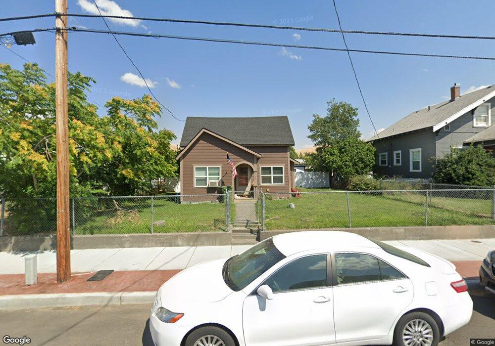
540 N Gale St Heppner, OR 97836
Estimated Value: $176,221 - $218,000
2
Beds
2
Baths
1,318
Sq Ft
$150/Sq Ft
Est. Value
About This Home
This home is located at 540 N Gale St, Heppner, OR 97836 and is currently estimated at $197,111, approximately $149 per square foot. 540 N Gale St is a home located in Morrow County with nearby schools including Heppner Elementary School and Heppner Junior/Senior High School.
Ownership History
Date
Name
Owned For
Owner Type
Purchase Details
Closed on
May 18, 2021
Sold by
Nance Jerry and Nance Patricia
Bought by
Paullus Rick A and Paullus Jacki L
Current Estimated Value
Home Financials for this Owner
Home Financials are based on the most recent Mortgage that was taken out on this home.
Original Mortgage
$130,494
Outstanding Balance
$118,008
Interest Rate
3.1%
Mortgage Type
FHA
Estimated Equity
$79,103
Purchase Details
Closed on
Jun 14, 2011
Sold by
Felker James A
Bought by
Nance Jerry and Nance Patty
Create a Home Valuation Report for This Property
The Home Valuation Report is an in-depth analysis detailing your home's value as well as a comparison with similar homes in the area
Home Values in the Area
Average Home Value in this Area
Purchase History
| Date | Buyer | Sale Price | Title Company |
|---|---|---|---|
| Paullus Rick A | $135,000 | Amerititle | |
| Nance Jerry | $32,000 | -- |
Source: Public Records
Mortgage History
| Date | Status | Borrower | Loan Amount |
|---|---|---|---|
| Open | Paullus Rick A | $130,494 |
Source: Public Records
Tax History Compared to Growth
Tax History
| Year | Tax Paid | Tax Assessment Tax Assessment Total Assessment is a certain percentage of the fair market value that is determined by local assessors to be the total taxable value of land and additions on the property. | Land | Improvement |
|---|---|---|---|---|
| 2025 | $2,555 | $94,960 | -- | -- |
| 2024 | $2,248 | $93,530 | -- | -- |
| 2023 | $1,934 | $90,810 | $0 | $0 |
| 2022 | $1,871 | $88,170 | $0 | $0 |
| 2021 | $1,514 | $85,610 | $0 | $0 |
| 2020 | $1,543 | $85,610 | $0 | $0 |
| 2019 | $1,471 | $83,120 | $0 | $0 |
| 2018 | $1,362 | $78,350 | $0 | $0 |
| 2017 | $1,410 | $76,070 | $0 | $0 |
| 2016 | $1,248 | $73,860 | $0 | $0 |
| 2015 | $1,236 | $71,710 | $0 | $0 |
| 2013 | $556 | $67,610 | $0 | $0 |
Source: Public Records
Map
Nearby Homes
- 175 W Baltimore St
- 315 N Gale St
- 300 N Chase St
- 310 N Chase St
- 240 N Court St
- 440 W Riverside St
- 387 E Linden Way
- 235 Rock St
- 220 E Cannon St
- 615 Hager St
- 680 S Alfalfa St
- 61476 Dee Cox Rd
- 64209 Meadow Brook Rd
- Hwy 74
- 3300 Blake Ranch Rd
- 000 Chickadee St
- 54901 Willow St
- 80982 Cougar Ln
- 80269 Park Ln
- 0 Mountain Property Unit 357954927