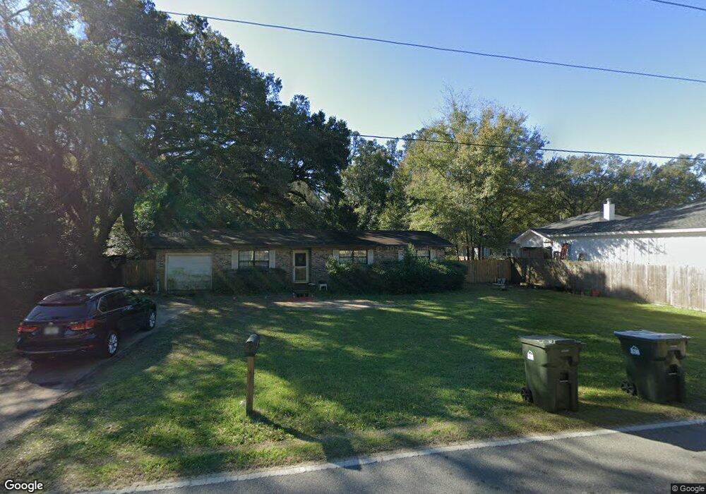
5401 Cerny Rd Pensacola, FL 32526
Estimated Value: $194,000 - $278,000
--
Bed
2
Baths
1,774
Sq Ft
$125/Sq Ft
Est. Value
About This Home
This home is located at 5401 Cerny Rd, Pensacola, FL 32526 and is currently estimated at $221,169, approximately $124 per square foot. 5401 Cerny Rd is a home located in Escambia County with nearby schools including Bellview Elementary School, Bellview Middle School, and Pine Forest High School.
Ownership History
Date
Name
Owned For
Owner Type
Purchase Details
Closed on
Jun 1, 2014
Sold by
Dunn Thomas E
Bought by
Smk Investments Properties Llc
Current Estimated Value
Purchase Details
Closed on
Jul 28, 2004
Sold by
Mousaw Gary R and Mousaw Deborah Ann
Bought by
Dunn Thomas E and Dunn Brenda C
Home Financials for this Owner
Home Financials are based on the most recent Mortgage that was taken out on this home.
Original Mortgage
$117,530
Interest Rate
6.22%
Mortgage Type
VA
Create a Home Valuation Report for This Property
The Home Valuation Report is an in-depth analysis detailing your home's value as well as a comparison with similar homes in the area
Home Values in the Area
Average Home Value in this Area
Purchase History
| Date | Buyer | Sale Price | Title Company |
|---|---|---|---|
| Smk Investments Properties Llc | $55,700 | Attorney | |
| Dunn Thomas E | $115,000 | Southland Title Of Pensacola |
Source: Public Records
Mortgage History
| Date | Status | Borrower | Loan Amount |
|---|---|---|---|
| Previous Owner | Dunn Thomas E | $117,530 |
Source: Public Records
Tax History Compared to Growth
Tax History
| Year | Tax Paid | Tax Assessment Tax Assessment Total Assessment is a certain percentage of the fair market value that is determined by local assessors to be the total taxable value of land and additions on the property. | Land | Improvement |
|---|---|---|---|---|
| 2024 | $2,099 | $166,566 | $12,250 | $154,316 |
| 2023 | $2,099 | $142,784 | $0 | $0 |
| 2022 | $1,942 | $144,540 | $12,250 | $132,290 |
| 2021 | $1,764 | $118,860 | $0 | $0 |
| 2020 | $1,586 | $107,277 | $0 | $0 |
| 2019 | $1,514 | $101,104 | $0 | $0 |
| 2018 | $757 | $83,776 | $0 | $0 |
| 2017 | $910 | $93,191 | $0 | $0 |
| 2016 | $899 | $91,275 | $0 | $0 |
| 2015 | $880 | $90,641 | $0 | $0 |
| 2014 | $868 | $89,922 | $0 | $0 |
Source: Public Records
Map
Nearby Homes
- 5224 Westwind Cir
- 3237 Tallship Ln
- 3710 N Blue Angel Pkwy
- 3216 Tallship Ln
- 5689 Nicholas Ln
- 5346 & 5336 N Blue Angel Pkwy
- 3191 Muldoon Rd Unit A & B
- 5721 Perkins St
- 3084 Creole Way
- 3394 N Blue Angel Pkwy
- 7909 Red Bean Dr
- 5820 Perkins St
- 3104 Fayal Dr
- 3001 Christine St
- 5635 Turkey Rd
- 7315 Hayward Ave
- 3097 Fayal Dr
- 4712 Clara St
- 5750 Turkey Rd
- 7311 Hayward Ave
- 5331 Cerny Rd
- 3536 Nandina Dr
- 3516 Nandina Dr
- 0 Oak Lavista Dr
- 3521 Oak Lavista Dr
- 5400 Cerny Rd
- 5400 Cerny Rd Unit Vacant Lot 5400 BLK
- 5400 Cerny Rd Unit BLK
- 5330 Cerny Rd
- 5412 Cerny Rd
- 5321 Cerny Rd
- 3514 Nandina Dr
- 5320 Cerny Rd
- 5520 Ormond Dr
- 5408 Cerny Rd
- 5307 Cerny Rd
- 3511 Nandina Dr
- 5519 Ormond Dr
- 5510 Cerny Rd
- 0 Ormond Dr