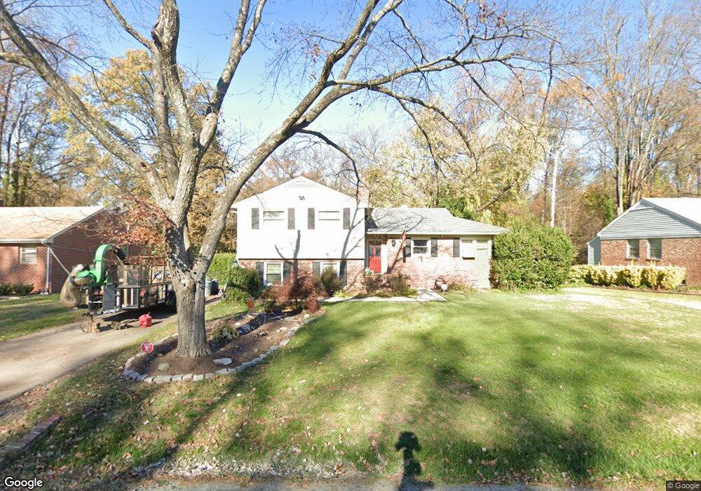
5404 Forest Brook Dr Richmond, VA 23230
Dumbarton NeighborhoodEstimated Value: $345,000 - $404,000
3
Beds
3
Baths
1,906
Sq Ft
$195/Sq Ft
Est. Value
About This Home
This home is located at 5404 Forest Brook Dr, Richmond, VA 23230 and is currently estimated at $371,486, approximately $194 per square foot. 5404 Forest Brook Dr is a home located in Henrico County with nearby schools including Johnson Elementary School, Brookland Middle School, and Tucker High School.
Ownership History
Date
Name
Owned For
Owner Type
Purchase Details
Closed on
May 13, 2015
Sold by
Foster Robert A
Bought by
Brooks Llc
Current Estimated Value
Purchase Details
Closed on
Jul 27, 2007
Sold by
Casey Dale A
Bought by
Foster Robert
Home Financials for this Owner
Home Financials are based on the most recent Mortgage that was taken out on this home.
Original Mortgage
$175,950
Interest Rate
6.73%
Mortgage Type
New Conventional
Create a Home Valuation Report for This Property
The Home Valuation Report is an in-depth analysis detailing your home's value as well as a comparison with similar homes in the area
Home Values in the Area
Average Home Value in this Area
Purchase History
| Date | Buyer | Sale Price | Title Company |
|---|---|---|---|
| Brooks Llc | -- | -- | |
| Foster Robert | $219,950 | -- |
Source: Public Records
Mortgage History
| Date | Status | Borrower | Loan Amount |
|---|---|---|---|
| Previous Owner | Foster Robert | $175,950 |
Source: Public Records
Tax History Compared to Growth
Tax History
| Year | Tax Paid | Tax Assessment Tax Assessment Total Assessment is a certain percentage of the fair market value that is determined by local assessors to be the total taxable value of land and additions on the property. | Land | Improvement |
|---|---|---|---|---|
| 2025 | $2,449 | $277,900 | $75,000 | $202,900 |
| 2024 | $2,449 | $261,900 | $63,000 | $198,900 |
| 2023 | $2,226 | $261,900 | $63,000 | $198,900 |
| 2022 | $2,058 | $242,100 | $53,000 | $189,100 |
| 2021 | $977 | $224,600 | $43,000 | $181,600 |
| 2020 | $1,954 | $224,600 | $43,000 | $181,600 |
| 2019 | $1,784 | $205,000 | $43,000 | $162,000 |
| 2018 | $1,775 | $204,000 | $43,000 | $161,000 |
| 2017 | $1,695 | $194,800 | $43,000 | $151,800 |
| 2016 | $1,536 | $176,600 | $43,000 | $133,600 |
| 2015 | $1,536 | $176,600 | $43,000 | $133,600 |
| 2014 | $1,536 | $176,600 | $43,000 | $133,600 |
Source: Public Records
Map
Nearby Homes
- 5605 Hard Rock Place
- 3004 Dunwick Rd
- Lot 11 Bethlehem Rd
- TBD Bethlehem Rd
- Lot 9 Bethlehem Rd
- 6711 Fernwood St
- 4910 Regent Rd
- 2929 Battery Ave
- 4801 Penick Rd
- 4901 Rodney Rd
- 5423 Falmouth St
- 4927 Dollard Dr
- 4914 Dollard Dr
- 4818 Coleman Rd
- Lot 13 Fernwood St
- 6700 Kirkwood St
- 2248 Libbie Lake St W Unit B
- 2901 Oakland Ave
- 4807 Rodney Rd
- 2904 Pinehurst Rd
- 5402 Forest Brook Dr
- 5406 Forest Brook Dr
- 5400 Forest Brook Dr
- 5408 Forest Brook Dr
- 5407 Forest Brook Dr
- 5405 Forest Brook Dr
- 5409 Forest Brook Dr
- 5410 Forest Brook Dr
- 5411 Forest Brook Dr
- 3211 Wendover Ln
- 5412 Forest Brook Dr
- 5408 Windingbrook Rd
- 5406 Windingbrook Rd
- 5413 Forest Brook Dr
- 5404 Windingbrook Rd
- 5410 Windingbrook Rd
- 3209 Wendover Ln
- 5408 Flower Ave
- 5402 Windingbrook Rd
- 5414 Forest Brook Dr