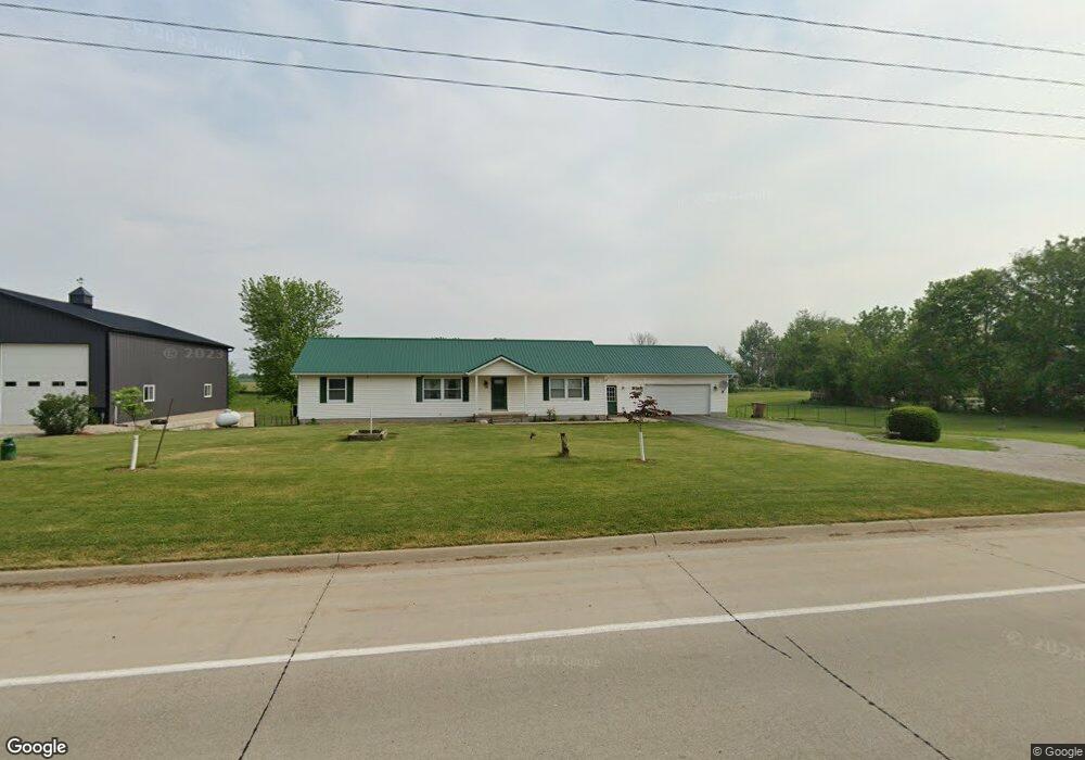
541 290th St West Branch, IA 52358
Estimated Value: $348,000 - $423,000
3
Beds
1
Bath
1,680
Sq Ft
$225/Sq Ft
Est. Value
About This Home
This home is located at 541 290th St, West Branch, IA 52358 and is currently estimated at $378,006, approximately $225 per square foot. 541 290th St is a home located in Cedar County with nearby schools including Hoover Elementary School, West Branch Middle School, and West Branch High School.
Create a Home Valuation Report for This Property
The Home Valuation Report is an in-depth analysis detailing your home's value as well as a comparison with similar homes in the area
Home Values in the Area
Average Home Value in this Area
Tax History Compared to Growth
Tax History
| Year | Tax Paid | Tax Assessment Tax Assessment Total Assessment is a certain percentage of the fair market value that is determined by local assessors to be the total taxable value of land and additions on the property. | Land | Improvement |
|---|---|---|---|---|
| 2025 | $3,772 | $320,640 | $71,950 | $248,690 |
| 2024 | $3,772 | $325,090 | $82,400 | $242,690 |
| 2023 | $3,642 | $314,080 | $82,400 | $231,680 |
| 2022 | $3,556 | $264,850 | $58,280 | $206,570 |
| 2021 | $3,396 | $264,850 | $58,280 | $206,570 |
| 2020 | $3,304 | $235,420 | $51,800 | $183,620 |
| 2019 | $2,898 | $230,750 | $51,800 | $183,620 |
| 2018 | $2,836 | $230,750 | $0 | $0 |
| 2017 | $2,836 | $205,530 | $0 | $0 |
| 2016 | $2,776 | $205,530 | $0 | $0 |
| 2015 | $2,806 | $205,530 | $0 | $0 |
| 2014 | $2,806 | $207,700 | $0 | $0 |
Source: Public Records
Map
Nearby Homes
- 325 Elm St
- 1908 Charles Ave Lot 2
- 1928 Charles Ave Lot 7
- 1912 Charles Ave Lot 3
- 1924 Charles Ave Lot 6
- 1932 Charles Ave Lot 8
- 1904 Charles Ave
- T.B.D. 275th St
- 168 290th St
- 2263 Eureka Ave
- 557 N 4th St
- 521 N 4th St Unit Louise Court Condos
- 314 Sycamore Dr
- 312 Sycamore Dr
- 316 Sycamore Dr
- 121 Northridge Dr Unit 121-139
- 360 Cookson Dr
- 316 S Maple St
- 3 Grant St Unit GR3
- 63 Eisenhower St Unit GB63