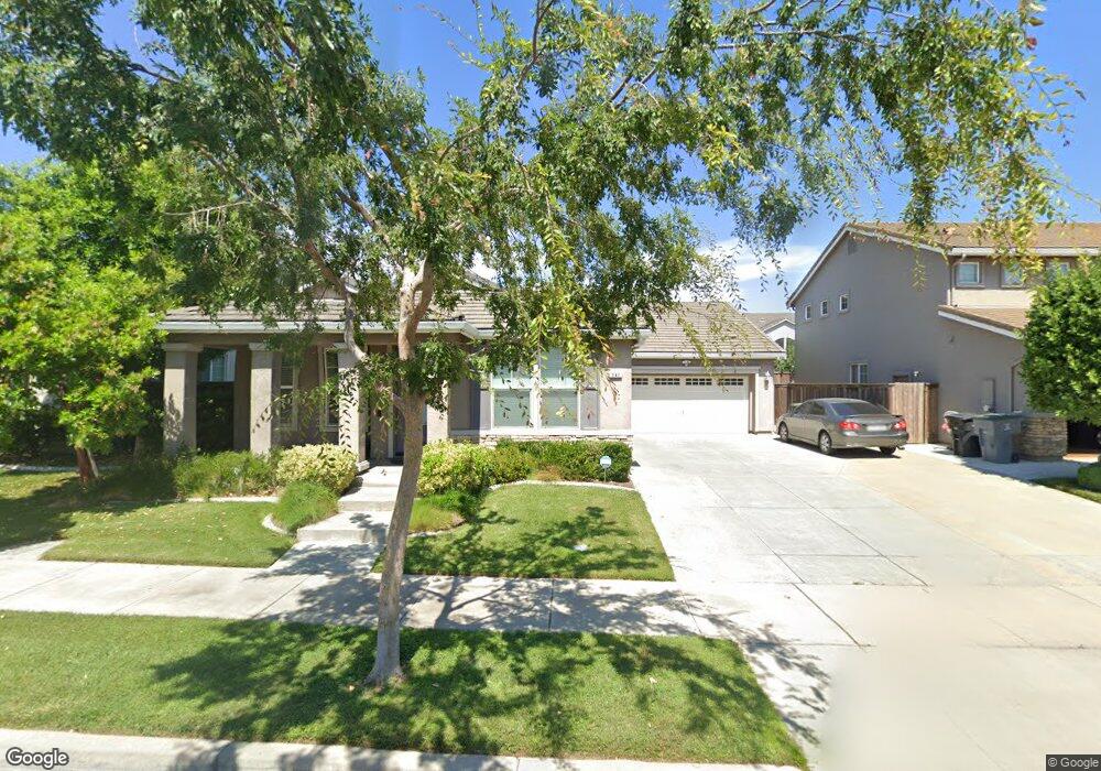
541 Buckaroo Ct Oakdale, CA 95361
Estimated Value: $251,000 - $575,000
3
Beds
2
Baths
2,100
Sq Ft
$228/Sq Ft
Est. Value
About This Home
This home is located at 541 Buckaroo Ct, Oakdale, CA 95361 and is currently estimated at $477,930, approximately $227 per square foot. 541 Buckaroo Ct is a home located in Stanislaus County with nearby schools including Fair Oaks Elementary School, Oakdale Junior High School, and East Stanislaus High School.
Ownership History
Date
Name
Owned For
Owner Type
Purchase Details
Closed on
Mar 15, 2018
Sold by
Schenck Gary A and Schenck Julianne E
Bought by
North Oaks Holdings Llc
Current Estimated Value
Purchase Details
Closed on
Mar 31, 2010
Sold by
Jamke
Bought by
Schenck Gary A and Schenck Julianne E
Purchase Details
Closed on
Jan 15, 2010
Sold by
Knox Angelina N
Bought by
Jamke
Purchase Details
Closed on
Oct 18, 2005
Sold by
Bridle Ridge Lp
Bought by
Knox Jason A and Knox Angelina N
Home Financials for this Owner
Home Financials are based on the most recent Mortgage that was taken out on this home.
Original Mortgage
$399,990
Interest Rate
9.3%
Mortgage Type
Purchase Money Mortgage
Create a Home Valuation Report for This Property
The Home Valuation Report is an in-depth analysis detailing your home's value as well as a comparison with similar homes in the area
Home Values in the Area
Average Home Value in this Area
Purchase History
| Date | Buyer | Sale Price | Title Company |
|---|---|---|---|
| North Oaks Holdings Llc | -- | None Available | |
| Schenck Gary A | $237,000 | Old Republic Title Company | |
| Jamke | $172,000 | None Available | |
| Knox Jason A | $399,990 | Chicago Title Co |
Source: Public Records
Mortgage History
| Date | Status | Borrower | Loan Amount |
|---|---|---|---|
| Previous Owner | Knox Jason A | $399,990 |
Source: Public Records
Tax History
| Year | Tax Paid | Tax Assessment Tax Assessment Total Assessment is a certain percentage of the fair market value that is determined by local assessors to be the total taxable value of land and additions on the property. | Land | Improvement |
|---|---|---|---|---|
| 2025 | $5,053 | $305,907 | $77,441 | $228,466 |
| 2024 | $4,855 | $299,910 | $75,923 | $223,987 |
| 2023 | $4,753 | $294,031 | $74,435 | $219,596 |
| 2022 | $4,653 | $288,267 | $72,976 | $215,291 |
| 2021 | $4,568 | $282,616 | $71,546 | $211,070 |
| 2020 | $4,523 | $279,719 | $70,813 | $208,906 |
| 2019 | $4,448 | $274,235 | $69,425 | $204,810 |
| 2018 | $4,382 | $268,859 | $68,064 | $200,795 |
| 2017 | $4,330 | $263,588 | $66,730 | $196,858 |
| 2016 | $4,267 | $258,421 | $65,422 | $192,999 |
| 2015 | $4,272 | $254,540 | $64,440 | $190,100 |
| 2014 | $4,215 | $249,555 | $63,178 | $186,377 |
Source: Public Records
Map
Nearby Homes
- 2153 Saddlebrook Way
- 1766 Churchill Downs Cir
- 0 Odessa Way Unit 226014449
- 366 Romano Way
- 1810 Silvio Way
- 225 Ash Ave
- 1957 Blue Spruce Dr
- 2532 Laurel Ridge Ct
- 562 Ranger St
- 2134 Navajo Ct
- 2848 Westport Cir
- 2337 Rainwood Ln
- 561 Branding Iron St
- 332 Hinkley Ave
- 2588 Foxwood Ct
- 575 Wild Stallion Dr Unit 15
- 656 Chestnut St
- 1039 Longview Dr
- 1030 Meadowlands Dr
- 1018 Meadowlands Dr
- 553 Buckaroo Ct
- 529 Buckaroo Ct
- 536 Wrangler St
- 548 Wrangler St
- 565 Buckaroo Ct
- 524 Wrangler St
- 517 Buckaroo Ct
- 560 Wrangler St
- 544 Buckaroo Ct
- 512 Wrangler St
- 556 Buckaroo Ct
- 532 Buckaroo Ct
- 577 Buckaroo Ct
- 568 Buckaroo Ct
- 520 Buckaroo Ct
- 572 Wrangler St
- 580 Buckaroo Ct
- 589 Buckaroo Ct
- 508 Buckaroo Ct
- 1883 Pack Saddle St
Your Personal Tour Guide
Ask me questions while you tour the home.